Tuesday, September 5. Jackson, MT to Conner, MT.
Our original plan for today was to end in Darby, but with Tom and Char's generous offer of sleeping at their ranch, we would stop about 8 miles short of Darby. Even so, we rode over 70 miles.
The road from Jackson to Wisdom was a fast 18-miles. Of course, in my head I'm doing the math and thinking that at this rate, we'll be in Conner before lunch. Right before arriving in Wisdom, I noticed some short cone-shaped objects and then realized that I was looking at an airport runway. The flight control "tower" appeared to be a small building with a half-moon on the door . . .
At Wisdom, we turned off Hwy. 278 and began a 27-mile climb to Chief Joseph Pass. Like the climbs from yesterday, this one started out very gradually. At about 10 miles into the climb, we pulled off for a visit to the Big Hole Battlefield National Monument. The monument commemorates the slaughter of Nez Perce Indians by US forces under the command of General Gibbon. The Visitor Center shows a 25-minute historical video, and there is also a small museum with original artifacts from the battle, including Chief Joseph's red jacket. It is a sad place, though, and the Nez Perce return every year in early August to remember the battle.
We left the battlefield around 2pm, and got to the top of Chief Joseph Pass right before 4pm. It is a very cool thing to be riding in a valley, then foothills, and then be surrounded by the forested mountains. At the top of the pass we were once again at the Continental Divide, at an elevation of 7,241 feet. We could see Idaho and the Lost Trail Pass, named by Lewis and Clark because it was an Indian trail which was notoriously difficult to follow.
We turned onto Hwy 93, and began a really long--9 miles--downhill. And not just a descent, but a screaming descent, accompanied by twisting, turning switchbacks. There were a number of places where I had to apply my brakes to keep under the posted speed limit. Through the tears in my eyes, I strained to watch for any bumps or irregularities in the road--now would not be a good time to lose control of my bike. Every now and again, I could smell something and wondered if it was my burning brakes. Turns out that ahead fo me, Matthew was wondering the same thing. He finally realized that the car in front of him was riding its brakes the whole way, and that's what we smelled.
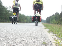
After about 3 miles into the downhill, we saw two cyclists coming up the pass. My brakes squealed as I slowed and then finally stopped. Sarah and David are traveling from Essex, England, riding from Alaska to Denver. They do a lot of cycle-touring, and enjoy traveling in the US. This year they only have 3 weeks vacation, but last year they had 6 months and were able to ride the Pacific Coast and then both the north and south islands of New Zealand. They had started the day from Hamilton, and would end their day at May Creek Campground--about 5 miles from the top of Chief Joseph Pass. Hope they have a chance to check in on the blog--pictures will be uploaded in the next few days.
Our steep descent continued for another 6 miles, through the Bitterroot Mountains, putting this downhill at the top of my list of favorite downhills. Even after the sharp decline ended, we rode generally downhill for another 14 miles to the Conner Cut-off. At the cut-off, we stopped to call Tom and Char, letting them know we were near their ranch.
Tom met us at the next turn, and we followed him back to the house. He showed us their guest house over one of their outbuildings, and invited us to take showers and then come over to the house.
The guest house was a beautifully-appointed apartment, including a fireplace, kitchen, bedroom and full bath, all decorated with a western flair. Really, really nice. I wanted to dive onto the bed as soon as I saw it--an extra-tall bedframe, lovely quilt, fluffy pillows were calling my name. But hunger won out, and we were soon showered and headed to Tom and Char's house.
From their back porch, binoculars in hand, I saw my first live moose. He's a bull, and according to Tom is about 5 years old. He's been in and around their property for the last few years, so they've kind of watched him grow up. He was on the other side of the river that runs through their ranch, the West Fork Bitterroot River. The moose was calmly munching on leafy tree branches, and I was surprised to see that he was nearly all black, not black and brown as I had supposed. It was fun to watch him for a little while--until Char arrived with a plate of cheese, crackers and fruit.
Tom has a fully furnished tepee down by the river, too. Carpeted, with a fireplace and furnished with a futon for sleeping. Tom offered to let us sleep there, and I was tempted. Close to the river and the moose, but I knew that Matthew would be happier with four solid walls and a roof over his head.
Tom and Char drove us to dinner at a local place--the West Fork Lodge--where we met the owners, Heidi and Tex. After a great meal, and beer from the Hamilton Brewery, we were very ready to crawl into--onto--that comfy bed. I was asleep within a few minutes, and didn't move until the next morning.
1 comment:
Thanks so much for loaning us your parents for the day! We had a wonderful time with incredibly gracious and generous people. And we're all cleaned up for the next leg. Well, as clean as we get :-)
-Randy and Nancy (and Stuart)
hobobiker.com
Post a Comment