Saturday, September 16. Biggs, OR, to Hood River, OR.
After yesterday's adventure, virtually any change in the weather was certain to be an improvement; and so, when we got ready to go and there wasn't a hint of rain in sight, we counted ourselves fortunate, pointing our tires into the wind and rolling away.
Of course, it was still windy. And with the temperature just 53F, it felt like northern Minnesota in January to me, so I had on my arm warmers, my thermal jacket AND my wind/rain jacket, along with my windproof pants. We hadn't even gone five miles before I put my gloves on, too. Nancy, too, was bundled up, just not three LAYERS bundled up like me. But we were riding in sunlight, which was a nice change.
As we crossed the Deschutes River, we entered the Columbia River Gorge Scenic Area. There, along the bridge, were several fishermen; many more, too many to count, were aboard boats down on the water or wading from shore. We theorized that the wind had blown all the fish up here and that these were the wise fishermen who knew that (although, to look at them, perhaps "wise" would not be the first word that would spring to mind). Although the vegetation looked the same once we passed the sign as it did before, we noticed that soon, different trees were waving in the wind and that huge, exposed, upthrust layers of rock were clearly visible on both sides of the river.
Oh, the Columbia River. We had crossed it once back in Umatilla to get to the Washington side, and then again yesterday to reach Biggs. We had resolved not to cross that bridge at Biggs again, and had instead selected a route that would take us to The Dalles, where we would cross back into Washington on the bridge there. The idea was this: the Washington option is much flatter than the Oregon side, and there was a nice destination available there in White Salmon - namely, the Inn at White Salmon, and although we didn't have a reservation, I had called from Walla Walla and been assured that they would "probably not" be full this weekend. So we would ride to The Dalles first on the Oregon side, avoiding the treacherous bridge at Biggs and the long ascent to the route there.
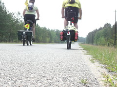
The road from Biggs is a frontage road for about 8 miles, but then the route directs cyclists to ride on Interstate 84 for about 10 miles. This would be our second foray onto an interstate (the first being back in Wyoming where there just wasn't any other road); the shoulder was plenty big and separated from the lanes of travel by rumble strips, so we felt reasonably safe. But do this: next time you are on an interstate, look over at the shoulder and take in just how much crap there is over there. Then try to imagine some poor possessed soul trying to ride their bicycle over there. Ever see the bristly fringe on the bottom of some mudflaps on some of the big rigs? I saw a few of those on the side of the freeway today; I really was struggling to think of a way to attach one or two of those to the front of my bike to operate as a kind of "sweeper" to clear away some of the debris before I rolled over it. Neither of us got a flat, though, which must be some kind of small miracle. Alert the pope.
We saw no trains on the Oregon side for a long time, but eventually we DID see a HazMat cleanup crew doing their thing near the tracks. Although we don't know the nature of the incident there, we don't need to know very much to figure out why we hadn't seen any trains to that point.
As we neared The Dalles, the first thing we saw was the dam. We stopped for a picture, maybe a little dicey on the side of the freeway, but we had to document it somehow. Nancy has already posted that one; scroll down to see it if you want.
The bridge at The Dalles was not as bad as the one at Biggs, but it was pretty close. The east side of the bridge has a walkway that is about three feet wide, but the west side is little more than a curb. It is also two lanes, one in each direction, although there are no impediments in the centerline like on the bridge at Biggs. We stopped for a picture near mid-span (Welcome to Washington), and alternately rode and walked our bikes along the walkway (the wind played havoc with our balance, and it became too risky to ride in the crossing gusts). And, once we reached the other side, and followed US 197, we continued to feel the crosswinds until we reached the route on SR 14. It was there that we saw the road sign that said it was only 18 miles to White Salmon - woo hoo! I had WAY overestimated the distance, so we would be done sooner than 6PM! That was a huge boost to our psyches, even as we continued to slog through the deafening wind (our average speed today would end up at 7.9 mph).
It was also near this point that we encountered Googleville, which appears to be three buildings (two of which are, apparently, occupied). One building has two vending machines out front, and the other appears to be a house (fenced in). No people were in evidence. How did this place get the name Googleville? Does anyone know? We could not find any explanation there.
I should also note that the Maryhill Winery was 15 miles in the other direction - and that we could have been there in half an hour, even with the climb, if we had wanted to go there. But, choosing the promise of a safe place to sleep over the temptation of a few free samples of wine, we skipped it.
Cresting the first climb past Murdock, we could see substantial greenery on the Oregon side of the gorge, and several kiteboarders and even a few windsurfers down on the river. Nancy said they looked like confetti decorating the water. It looked like they were having a good time, darn them. If they could teach us how to rig a sail to the bikes, we'd be in business.
We decided not to stop in Lyle, just after the two tunnels with the "bicycles in tunnel" warning system (we had to push a button, similar to the one you press to activate the "walk" signal, to activate the warning); one van passed us in the tunnel, and then a truck slowed behind us until we emerged safely on the other side. We waved our thanks, and he waved back, smiling - that felt nice. The tunnels also gave us momentary shelter from the wind, which also felt nice. Really nice. I will enjoy the next windless day we have, enjoy it a lot, based on how good it felt just to be in those tunnels for a few measly seconds.
The road to Bingen, just before White Salmon, consists of a series of low rolling hills, exactly what I had expected based on the profile the map shows (it is depicted as dead flat). At one juncture, where old Highway 8 rejoins the route, the road we were on was bordered on both sides by water; beyond the water to our left, the railroad tracks ran straight, and then the river was beyond that. The backdrop was the beautiful cliffs of the gorge on the Oregon side, with the prominent layers of rock exposed but shrouded with vegetation. Mount Hood, it's peak enveloped by clouds and sporting fresh snow, loomed in the distance.
At Bingen, we turned onto 141 and began the long climb (!) up to the White Salmon Inn. Early on, we passed a group of people who were having a "Free Bake Sale" - anyone want to hazard a guess what the heck THAT means? I managed to pant "Not now" as I maintained my climbing rhythm, and Nancy passed up on their confusing offers as well. It took a while, but we eventually reached the White Salmon Inn.
You guessed it: the White Salmon Inn was full. But we didn't panic; I already knew that the nearest place with rooms on the Washington side was another 12 miles, and was trying to figure out how to break it to Nancy when the innkeeper, Janet, got on the phone to find us a place closer by. She found us a spot at the Hood River Inn, across the Columbia on a bridge that prohibits pedestrians and bicyclists, and suggested that her husband, Roger, give us a ride over to Hood River in their van. It took two trips, but that's how we ended up back in Oregon on a night we were supposed to be in Washington.
Roger and Janet, both 70, have been running the Inn at White Salmon for 16 years (although the Inn has been there since 1937); Roger was also the Mayor of White Salmon for 9 years. Janet ran a psych-med ward before becoming an innkeeper (which was apparently excellent experience for the job of innkeeper - taking notes, Becky?). They are a delightful couple and I really regretted not being able to stay there and talk more with them, especially because they are selling the Inn in March and will, like us, be temporarily jobless and homeless (but not hippie bums like us, because they won't be on bikes).
Roger said that the name White Salmon has two possible origins: one, the inevitable Lewis and Clark connection wherein the Corps of Discovery finds salmon here that wash ashore after spawning, dead and white, and two, that salmon caught here are white because they have not been to sea where they could have eaten tiny crusteaceans that turn other salmon's flesh its characteristic pink. We found explanation two much more plausible, but if anyone can find verification, we'd appreciate it.
Speaking of salmon, we had a yummy, yummy dinner here in Hood River - I had smoked salmon and wild mushroom ravioli, which was utterly delicious, and Nancy had the rigatoni with vegetables in surprising roasted-tomato marinara sauce. After weeks of grilled cheese sandwiches, patty melts, fries, and other such fare, this sumptuous dinner was a true and rare luxury. We even went so far as to order the big fat chocolate cake for dessert; we couldn't finish it, but it was not for lack of trying. We tried valiantly.
Tomorrow we hope to make it to the vicinity of PDX, where we can find an inexpensive room near the MAX station and ride in to Portland for dinner. We talked with my sister Kim, who lives out in Beaverton, but for clearly understandable reasons she can't meet us for dinner. We will, however, try to get in touch with my cousin Dan and his wife Geri, and maybe meet them instead,which would be an unexpected pleasure. We'll see if we can get up before the crack of 8 tomorrow, and if the wind has abated any. Will tomorrow be the long awaited non-headwind day?
3 comments:
Hey Guys! I can't believe your trip is winding down. It doesn't seem like 5 months to me...although your backsides might beg to differ!
When my friend, Katie, and her Mom lived in Hood River, I stayed with her Mom for a weekend while Katie was in California with her Girl Scout Troop. Anyways, Hood River as you know is across the river from White Salmon. Well, one morning I was bumped off the couch by a large rumbling. Turned out as I looked through the bathroom window across the river, (why do bathrooms always get the nicest views, as long as you're on your tippy toes?) there had been a train wreck in White Salmon...and that, we deduced is what knocked me off the couch. I'm still skeptical though. I think Katie's Mom helped with the removal of my rear from her couch!
Sorry, I just felt the need to tell you that story!
So, how long before you reach Chez Stovall's? Can you believe you're almost there? You're so close I want to jump in the car and drive down to Portland! Everytime I see two bikers I'm checking to see if they are you two...just in case you read the map wrong! Yeah, I can only hope! HA!
Take care and we can't wait to hear how this book ends. I wonder where your sequel will take us!
Hood River! What a great place. Which inn are you staying at there? Did you get a chance to stop at Mike's Ice Cream Shop? Try the Mandarin Chocolate.
http://2-wheeler.blogspot.com/2006/07/ice-cream-on-historic-rte-30-oregon.html
I ate dinner in Hood River at a place called "Brian's Pourhouse." It was great and I'd recommend it too.
If you're going through Mosier, you can stop at the Porche Museum/Ice Cream Shop.. if you miss Mike's.
Oops, I was confused. Mosier is east of Hood River. I guess you missed that one.
Post a Comment