Wednesday, September 27, 2006

Stats, Part 1

From Lincoln City, OR.
 
We thought some of you might be interested in some of the statistics of the journey -- miles, days, and so on. So, here is a start:
Total miles ridden: 6607.7
Number of days ridden: 134
Rest days: 22
Average miles/day: 49.3
Longest day, in miles: 96.45 (Powell Junction, ID, to Kamiah, ID)
Longest Day, in time: 7 hours, 42 minutes, 37 seconds (Lander, WY, to Dubois, WY)
 
Fastest Average Speed, one day: 14 mph (Powell Junction to Kamiah)
Slowest Average Speed, one day: 6 mph (Canon City, CO, to Guffey, CO)
Highest Plausible Speed achieved: 51.1 mph (Matthew, on the descent from Hoosier Pass)
Highest Speed recorded (not plausible): 86 mph
 
Milestone Points:
1000 miles: near a field in Virginia
2000 miles: at the entrance to the Lake Champlain Islands, Vermont
3000 miles: on a country road outside Bowling Green, OH
4000 miles: on the ONE stretch of road we had a tailwind in Kansas, north of El Dorado
5000 miles: nearing Lander, WY, with the Fab Four
6000 miles: entering Lewiston, ID
 
More soon!

Warm Showers Visitors


Warm Showers Visitors
Originally uploaded by nstovall8.
These three cyclists--Chris, Matthias and Tobias--are riding the Coast route

from Germany. Chris and Tobias are touring for just a few weeks; Matthias

is on a 3-year tour from Patagonia to Alaska. They found Suzi & Jim's house

on the cyclists' warm showers website, and we enjoyed talking with them and

seeing Matthias' pictures from Bolivia. More cyclists are due at the house

tonight!

Roads End


Roads End
Originally uploaded by nstovall8.
From the top of this rise, it's all downhill to the literal Roads End for

us.

The End is Near


The End is Near
Originally uploaded by nstovall8.
At an overlook by the ocean, a friendly tourist snapped this shot of us on

our last day of the Scenic DeTour.

Princess Of Wales


Princess Of Wales
Originally uploaded by nstovall8.
Megan was dubbed "The Princess of Wales" by her fellow cyclists. We met her

on one of the last days of her trip as well as ours. She'd ridden from

Yorktown, VA to Florence, OR, and was heading up the coast to Astoria.

Cape Mears


Cape Mears
Originally uploaded by nstovall8.
The lighthouse on Cape Mears sits at about sea level, though the road to the

park is uphill . . . both ways.

The Saga of Bay Ocean


The Saga of Bay Ocean
Originally uploaded by nstovall8.
This marker tells the sad tale of Bay Ocean. No amount of engineering could

save the doomed development.

Dolly


Dolly
Originally uploaded by nstovall8.
At our stop in Tillamook at the Blue Heron Cheese Company, Matthew visits

with Dolly the Llama.

Hug Point


Hug Point
Originally uploaded by nstovall8.
This spot was named Hug Point not for its' romantic scenery, but because it

was so narrow that cars were forced to hug the road to keep from falling of

the cliff and into the ocean.

The Ocean


The Ocean
Originally uploaded by nstovall8.
Another beautiful day, riding along the oceanfront.

Fort Clatsop


Fort Clatsop
Originally uploaded by nstovall8.
Heading down the coast, we stopped in at Fort Clatsop, the site where the

Discovery Corps spent the winter. It rained on them 112 days out of 116; we

had beautiful weather. A beautiful spot for a park---or a fort

My New Favorite Store


My New Favorite Store
Originally uploaded by nstovall8.
The Rain Store in Astoria has everything for a rainy day. They also have a

website: www.umbrellastand.com

Family Dinner


Family Dinner
Originally uploaded by nstovall8.
While in Portland, we had dinner with Matthew's parents, Suzi & Jim, and

Matthew's twin sister Kim, her husband Ron, and their sons Garrett (who's 16

now) and Tanner. Our waitress was some kind of alien; she never wrote down

a thing, remembered every minute aspect of our orders, and didn't feel the

need to number us.

Tuesday, September 26, 2006

Road's End

Monday, September 25.  Pacific City, OR to Lincoln City (Road's End), OR.
 
Due to the dog days of summer, and the Inn's policy about not installing a/c units, we spent a fairly uncomfortable final night on the road.  It wasn't too hard to get up early, get breakfast, and get on the road one last time.
 
We had about 20 miles to ride before reaching Otis, where we planned to meet Jim & Suzi for lunch at the Otis Cafe.  We continued on the Scenic Cape Route via Hwy 101 through the small burg of Pacific City, the bump in the road known as Oretown, and then into Neskowin,  where we turned onto Slab Creek Road and the Old Scenic Highway 101.  This route avoids the massive climb at Cascade Head, but is also a stunningly gorgeous meander into a primordial rain forest setting.  Towering trees surround the road, scenting the air with cedar.  Beneath them, glorious ferns carpet the ground.  Everything is so lush and fertile here, that even cracks in the road surface are filled with bright green moss.  We begin our ascent in the shade, but soon the effort of climbing warms us up and we stop to take off our jackets. 
 
The climb continues for a long time, but the grade is fairly gentle.  The road twists and turns; we pass the Neskowin Valley School and hear the happy shrieks of children out for recess in the schoolyard.  We pass mile markers, but have no good idea how many miles we'll climb before reaching the 600+ feet to the summit.  Finally, I call for a break, and we decide to stop just at the next turn.  We haven't seen more than 3 or four cars since we turned onto Slab Creek Road, but as we're stopped we can hear a car approaching from the curve just beyond.  Matthew says "I wonder if that's my dad", and as the car comes around the bend we can see that it is, indeed, both his mom and dad.
 
Hugs all around, then a few pictures (I think I know now how Lewis and Clark felt when the Indian tribes welcomed them into their villages).  We had made it to the crest of the mountain, Jim assures us, and it's a downhill ride from here to the Otis Cafe.  Jim & Suzi agree to follow us, so we can take the lane and not have to worry about cars passing us on the descent.  My odometer reads 6597.9 as I start the descent, and I don't turn my pedals for the next 3 miles.  It's about 5 miles total to the Otis Cafe, and we cover that distance in no time.
 
For anyone who's never been, the Otis Cafe is worth the stop in Otis.  It's one of maybe 4 businesses in the entire town, which was sidelined when Hwy 101 was "straightened".  It's one of our favorite places in the area, famous for their homemade breads and pies as well as for their German hashbrowns.  We had to wait a while for a table--there are only 6 tables in the entire cafe--and that gave us a chance to come to terms with the fact that we were about 5 miles from Jim & Suzi's home on the beach in Roads' End.  We left the cafe with a loaf of bread and a berry pie.
 
And then came the last 5 miles.  We rode along the wide shoulder of SR 18 for a short while, and then were back on Hwy 101 for another mile or two.  We took a right turn onto Logan Road, and made the short climb to the turn onto Roads' End.  From the top of that hill, we had a clear view of the ocean and knew that it was, literally, all downhill from here.  The Stovall B&B was about a half-mile away; the ocean just beyond their hot tub.  We flew down the hill and were met in the driveway by our gracious hosts and Honey, their Malamut mix.  We unloaded our trailers, and rolled down to the beach for the ceremonial wheel-dipping ceremony, which marked the official end of our trip.  Within 30 minutes, we were lounging in the hot tub, a glass of Merriweather Champagne in hand, toasting six thousand, six hundred miles.
 
The journey ended the way it began--among family.  No press, no fireworks.  We talked last night about some trip highlights--the Columbia Gorge, the high deserts in Wyoming, the descent from Lolo Pass, Cedar Point Amusement Park, the Great Dismal Swamp are just a few of the fabulous sights we've seen on this trek.  And seeing them from the seat of a bicycle is an experience totally different from touring any other way.  Neither of us feel like Superman (or Wonder Woman), but we also don't feel like we couldn't have gone one more mile.  I was intimidated by the Rockies, but now I see that they're just one more day of riding.  As the saying goes, "Adversity becomes adventure after a shower and a couple of beers".  
 
We'll be hanging out here at the beach for a few weeks while we collect ourselves and our things, then begin to make ourselves at home in our new home in Portland.  Hockey season starts soon, and while Portland doesn't have an NHL team, but we hope that friends and family will visit us here anyway.  Happy Trails!
 

Monday, September 25, 2006

I Looooove Capes!

Sunday, September 24. Tillamook, OR to Pacific City, OR.

We didn't even put our wheels to the road until 11am this morning, since our ride today would be less than 40 miles. Sunday morning breakfast at the Pancake House was just too inviting; we lingered over coffee and the Sunday Oregonian until the breakfast crowds were long gone.

We chose to take the Three Capes Scenic Route today, and almost immediately found ourselves in the middle of Tillamook's dairyland. These cows are famous--they're the backbone of the Tillamook Dairy cheeses, milk and ice cream. Jersey cows are the overwhelming favorite here, with good reason. Their milk has a much higher buttterfat content than their higher-profile cousins, the Holsteins, and produces better flavored cheese and ice cream.

Just before the Cape Mears State Park is a marker for the lost city of Bay Ocean. In the early 1900's, a Kansas developer came to the Bayocean Peninsula with dreams of creating another Atlantic City (Pacific City, presumably). Several town buildings were erected, residents moved into town, but when a winter storm eroded the foundation of the town's swimming pool, confidence in the foundation of the town itself began to erode. By the 1960's the entire town was washed away.

Even though we're within spitting distance of the ocean, the route begins to climb away from the shore and up into the Coast Range. The peaks of this range are considerably smaller than the Cascades or the Rockies, but the roads here are graded more steeply. As we climbed, I found myself peddaling along in my granny gear, wishing for an even grannier gear. Once we got to the top of the climb at Cape Mears, we descended into the Cape Mears Park to have a look at the Mears Lighthouse and the Octopus Tree (a really old, really huge Sitka Spruce). We'd both been here on a previous trip to the coast, but it seemed like a worthwhile side trip. Just as we were about halfway up the lighthouse staircase, Matthew remembered that he'd left his Camelback at the top of the hill, near the park entrance. We cut short our visit to the park, and were about to make the climb back up the hill when a woman approached Matthew and asked if he'd lost his Camelback. They had seen us come in, and on their way out of the park had noticed the pack. They picked it up and brought it down to the parking area to search for us. "See, there are nice people in the world" was their comment as they handed the pack back to Matthew. If they only knew!

Back on the road, we descended out of the Coast Range and headed to Oceanside and Netarts. Riding along Netarts Bay is beautiful. A picturesque body of water on one side of the road, a rocky mountain on the other. The route along the bay turned back toward the mountains, and we climbed back up over 800 feet to the Cape Lookout State Park. For anyone who's considering this route, I offer the following information. The roads along this part of the route have no shoulders to speak of, although there is a bike lane on the southbound side of the climb up to Cape Lookout State Park. We are riding in the off season, so traffic was generally light and well-behaved. The road surface itself is patchy, and the dappled, shaded sunlight made it difficult to tell where the rough spots were. If you were to add either bad weather or heavy traffic to this mix, I'm not sure you'd have a very enjoyable ride.

Anyway, the climb to Cape Lookout is about 2 miles of climbing, and fortunately for us, we had the bike lane on our side. As we came down the descent, I was surprised to see that the landscape changed from majestic forests to open sand dunes. It was as though we'd been plucked out of Narnia and spit out into the sands of Arabia. And that's when we met the Princess of Wales.

Megan, who is actually from Wales, was making her way up toward Cape Lookout as we descended. I crossed over to her side of the road, astonished that we'd run into at least one more cross-country cyclist. Megan began her journey from Yorktown, VA about the same time that we left Lawrenceville, and she'd made it to Florence, OR, just a few days ago. Her plan is to finish riding in Astoria, then ship her bike back to the UK before heading down to LA for a "proper holiday". She'd thought about touring the US with an RV, but decided she didn't want to spend months watching the road. So she put up her house for rent, quit her job, and found her way to Virginia. She'd only ridden about 200 miles with her bike "Jimmy" before deciding that this was something that she could do. I asked her what she was returning to in October and she replied, "the house is let until June, and of course it's winter in England but summer in New Zealand". That's the spirit! We wished her good luck and continued down the mountain to Pacific City.

The last few miles of the day's trip was on Whiskey Creek Road, a road which is more of the same shoulderless patch job that we'd ridden earlier in the day. Because the road also has a lot of twists and turns, the posted speed limits are 25-35mph. And even though we were having to hunt and peck our way around potholes and patches, the majority of the traffic was patient with us and waited for oncoming traffic to pass them before they passed us. Except for one. There's always one. And this one was a big RV, who honked at me (since I was riding sweep) before angrily passing. Matthew stopped short and turned back around to see what the commotion was all about, and when the RV passed us and we could see a cluster of bicycles clamped on to the back of the vehicle, he lost it. A blue streak came spewing from his mouth as he churned his pedals to catch up with the behemouth. The RV hanked at us again and lumbered out of my view, although Matthew did chase him for a little while longer.

It was just a few more miles to Pacific City, where our accommodations at Cape Kiwandah are a good prep for staying in the Princess room at the Stovall B&B in Lincoln City.

Down pillows? Check. Feathertop bed? Check DVD player? Check. Ocean view? Yes, but only from the balcony. At the B&B, even the bathroom has spectacular ocean views. And here at Cape Kiwanda, the rock feature just off shore is known as "Haystack Rock". Funny, that's what the rock feature at Cannon Beach was called, too. But that one has little rocks all around it called "The Needles". Cape Kiwanda's rock doesn't have any needles. Cape Kiwanda's rock needs a new marketing director.

We crossed the street and headed to the Pelican Pub for dinner. The Pub also houses a microbrewery, apparently good enough to win medals at several beer contests. Matthew sample the Doryman's Dark Ale and pronounced it "pretty good". Also "pretty good" was tonight's sunset, dipping into the ocean and painting the sky with a thin orange line at the horizon.

Tomorrow is our final day of riding, and we'll end our trip (appropriately enough) at Road's End, where the Stovall B&B is located. I guess tomorrow's blog will be coming to you from the hot tub. Check. On the beach. Check.

Sunday, September 24, 2006

We Brake for Ice Cream

Saturday, September 23. Cannon Beach, OR, to Tillamook, OR.

We left the window open all night; we could just barely hear the surf, which was nice. Maybe too nice - we almost overslept, and finally got on the road around 10, after going over to Mo's for breakfast (who knew?). It was warm enough that tights were not necessary, which hasn't been true for many, many days now; and we even shed our jackets soon after the first descent.

As might be expected, todays route was replete with incredible views at the several overlooks along the way. And, as might be expected, getting to those overlooks involves climbing a good bit - and the profile shows some utterly dramatic climbs. Of course, that meant that those climbs were not as bad as they were depicted. True.

We arrived at Hug Point State Park, and had to get a picture in front of the sign there (yes, we were hugging); but we didn't venture down to the parking area. Too steep.

We passed through one more tunnel equipped with a button-activated light warning system, just past Arch Cape. Even with the lights flashing (I presume they were still flashing), cars entered the tunnel at speeds that made me worry. Of course, we made it, but being passed by a semi and then an RV INSIDE A TUNNEL is a harrowing experience.

We are ocean-side of the Coast Range mountains here; the slopes are lush, green, and subject to slides. We came across several places along the roadway that showed evidence of those slides - new asphalt in half-moon shapes abutting the downslope side. It's not hard to imagine that driving on this road would require more attention than usual after heavy rain. Fortunately, it's been dry a day or two now, so we didn't have much to worry about in that respect.

Oh, and we had a TAILWIND all day. And clear skies, too; and it was warm without being just BAKING. We struggled to recall a day so perfect for riding in the direction we were going (we've had days that would otherwise have been perfect but for the heat, the ferocious head- or crosswind, or the rain). We fairly sailed through the towns of Manzanita, Nehalem & Mohler before entering the lush Foley Creek valley. A more direct route to Bay City than 101, and probably safer, by all accounts, the road followed along Foley Creek (a tributary to the Nehalem River) up to a shallow pass before descending the other side along the Miami River. We kept waiting for the awful climb depicted on the profile, but never reached anything so bad.

Bay City has places to eat, and we expected to have lunch there; but we rode through without finding a suitable lunch spot, and before we knew it, we were just 5 miles from Tillamook. So, because we needed a break, we stopped roadside and had a snack on the southern outskirts of Bay City, not quite within sight of Tillamook Bay.

Lunch, we decided, would be at the Blue Heron in Tillamook. It was one place where we could get sandwiches made with Tillamook cheddar and finish with a scoop of Tillamook ice cream. It is also at the Blue Heron that you can can meet Dolly the Llama, and when you have that brush with greatness, you can feed her an apparently yummy mix of oats and stuff. The goats will also clamor for some, but they aren't nearly as enlightened.

After lunch, we stopped for an extra tube for my trailer at a sporting goods store. I have found my trailer tire flat twice in recent weeks but have yet to find a leak; so we picked up a replacement tube for the next time it happens, if it happens, in the next two days.

The Marclair Inn, our stop for the night, is centrally located in downtown Tillamook (I just like saying Tillamook). We were able to take a quick walking tour of about 6 downtown blocks, scoping out a spot for breakfast tomorrow, before heading back for dinner at McClaskey's, the restaurant attached to the motel; it was the best available option from among a surprising number of them.

Tomorrow we will embark on the Three Capes Scenic Route, visiting Cape Meares, Cape Lookout, and Cape Kiwanda, before stopping at Pacific City for the night. From there, it will be a 20-mile ride on Monday to the Otis Cafe for lunch, and then a 6-mile, all-smiles ride to the finish. The weather is supposed to hold like it has been, which we could not have even hoped for.

Sure, we could probably make it all the way to Lincoln City tomorrow, but we want to arrive on Monday so my Dad can be there to have lunch with us and help us celebrate reaching the Roads End, both figuratively and literally. Since he will be working late Sunday, we'll wait for Monday when he will be home. Just two days left!

Saturday, September 23, 2006

The Pacific Ocean, at last

Friday, September 22. Astoria, OR, to Cannon Beach, OR.

Let's get this straight: we are not really slacking here, even though we only covered about 31 miles today. We stopped at Fort Clatsop on our way out of Astoria to get one last, surreal taste of the Lewis and Clark story. That took time.

We almost made a special trip yesterday to Fort Clatsop, but didn't because it was on the route we would take today; in retrospect, we made a good decision. Fort Clatsop, for those unfamiliar with the story, was the winter camp for the Corps of Discovery in 1805 before they headed back to St. Louis. It was also one of the rainiest winters on record, with just 4 rain-free days in the 116 they were there.

This Fort Clatsop is a relatively new addition to the array of Lewis and Clark-related spots along their route; in fact, the fort itself is still under construction. Furthermore, the location of the fort itself is not really known, and the fort under construction seems located more for its proximity to the visitor's center than for any relation to historical accuracy.

There's more: the visitor's center is filled with exhibits and some good information about the expedition, but not very much about the role of the winter camp itself. There is a short film, about 20 minutes, which we thought might portray some more details about the expeditions' winter; but it did not. In a surreal kind of retelling, it instead portrayed a native american woman telling the story of the expeditions' arrival at the coast to a group of children as they all sat around a campfire on the beach - in 1841. It's hard to understand the choice of 1841 as the setting for the film, since that year doesn't represent any particular turning point or even significant event. But even more confusing was the fact that the story she told was only SORT OF about the expeditions time at the coast; mostly it was about the little conflicts they had with the native population there, and there were some sequences that seemed like modern ideas were anachronistically placed in her descriptions. Overall, it was less elucidating and more confusing than I hoped.

The fort, still under construction, is not open for close inspection; instead, you can only get close to the outside, looking in to the courtyard. It will be a nice fort when it is done, probably pretty close to the original.

We decided to move on, considering the unfinished state of the whole exhibit; perhaps we will return another time, now that we will be living relatively close by.

The day brightened, literally; the morning's cloud cover dissipated and left clear skies for the remainder of the days' ride. The road to Seaside is actually called Lewis and Clark Road; it follows (what else?) the Lewis and Clark River before climbing a small (600-foot) rise just a few miles outside of town. On the descent, we caught our first real glimpse of the Pacific Ocean; and, riding down 12th Avenue straight towards the ocean, we finally heard the surf about a block from the pedestrian walkway known as the Prom. And then, there we were, within sight of the surf. We stopped and got a picture, and of course we laughed as we both said "Ocean in View! O the Joy!".

After lunch, we got dessert at the Portland Fudge store on Broadway; Tsunami Bark, which is milk chocolate with rice crispies, marshmallows, peanut butter and chocolate chips. Mmmm.

By the way, who else is surprised by the fact that the entire town of Seaside is in a Tsunami Hazard Zone? The view from the oceanfront homes is not exactly great; from ground level all you can see is the vegetation on the dunes and a little of the sea beyond. Nothing dramatic. And, if -- no, WHEN that tsunami comes, Seaside will be under water. I was a little relieved as we climed the hill out of town and passed the sign announcing that we were leaving the tsunami hazard zone.

I thought it would be about 10 miles to Cannon Beach, but it turned out to be just 7. We rolled past, heading to Tolovana Park, a southern suburb of Cannon Beach, where we checked in to the Tolovana Inn. Our room is one of the few that do NOT have an ocean view; instead, it has what they call a "mountain view", a nice way of saying it faces the opposite direction from the ocean.

We passed the afternoon talking with Nancy's sister Emily (on the phone), who was supposed to undergo surgery today; so imagine our surprise when she answered her phone. Long story short: other, emergency surgeries (on other people, of course) pushed her scheduled procedure back far enough that it had to be canceled. We just wanted her to know we support her; it took us more than two hours to say that, and a whole lot more.

We had dinner at Mo's, just in time to watch a nice, ordinary sunset (which I'll take, if it means more nice weather). This Mo's is apparently the original one; there is a Mo's down in Lincoln City, too, just north of Siletz Bay (I think - you locals can correct me Monday when we get there). As a bonus, we got a tiara after dinner - picture soon. Nancy says it is a general purpose tiara, for any occasion, like when your regular tiara is out at the cleaners.

Tomorrow, we head to Tillamook, and more importantly to the Tillamook Dairy, where we will be able to get Tillamook Ice Cream. The Blue Heron Cheese Factory is also there (in Tillamook County there are more cows than people). Perhaps not surprisingly, one other notable institution there is the Tillamook Beef Smoker, producers of some of the best beef jerky available. One thing is certain: we won't starve in Tillamook. Three days left!

Friday, September 22, 2006

Discovering Astoria

Thursday, September 21. Rest day in Astoria.

Even though we'd just had a rest day in Portland, we had planned to take a day off in Astoria to explore this coast city. Besides, the weather hadn't quite cleared up this morning, but the forecast for the weekend looks great.

So after a continental breakfast at the hotel, we unhitched our trailers, jumped on our bikes, and headed off toward downtown Astoria. We found the trolley tracks right beyond the hotel, and followed them down to the waterfront. Astoria is a city that began as a trading post for beaver pelts, but once fashions changed, lumber and salmon became the town's key industries. Immigrants from around the world came to be part of this boomtown, and their influences can still be seen throughout the city. In particular, there is a strong Finn influence here, celebrated every year with a Suomi Festival (held in July; we missed that one, too).

Our first stop on the waterfront was the Maritime Museum. This building is dedicated to all things nautical when it comes to the Columbia River, so everything from a map of lost ships (The Graveyard of the Pacific) to duck decoys are on display here. The river has a wild and woolly history, and still "makes waves" as ships hoist their sails and attempt to cross the sand bar at the mouth of the river.

After the museum we headed to the library, hoping to be able to upload some pictures. But their internet access was down today, as was the case with most of Astoria, so pix will have to wait.

We made a quick stop at Columbia Travel to get lodging info for the next few days, and then dropped into the Hotel Elliott just across the street. A $4 million restoration has turned this former flophouse into a luxury hotel. Maybe on our next visit we'll stay here.

Lunch at the Urban Cafe' was next on the list, including the chocolate hunk cake. These people know how to serve chocolate cake--whipped cream, ice cream (Tillamook Vanilla Bean), and a pitcher of warm chocolate sauce for you to drizzle on as needed. mmmmmmm.

After lunch we spent the rest of the afternoon at a local coffee and book shop, watching the sun poke through as the wind blew the clouds eastward. I'm hoping that trend continues through the rest of the night, and we awake to clear, sunny skies. The dream continues . . .

Thursday, September 21, 2006

Ocean in Sight . . . I Think

Wednesday, September 20. Rainier, OR to Astoria, OR

We made it to the Oregon Coast in true Lewis & Clark style--in the rain.

The skies were misting while we had breakfast, but it seemed as though we would have dry weather when we started out from Rainier this morning. It was a little cold--thank goodness for the 1.5-mile, 600 ft. climb out of Rainier. By the time we got to the viewpoint near the top I was sweating under my layers, and stopped to take off my gloves and rain jacket. Big mistake. As soon as we started the descent, I wanted my gloves back on again. Not to worry--the descent was more of a false flat and we had another hill to climb.

Now that my body temperature had equalized, I was able to enjoy the ride through Alston, Clatskanie (pronounced clat-scan-EYE) and on into Westport, where we planned to stop for lunch. We were still riding on Hwy 30, which has a decent shoulder, but it also has a fair amount of traffic. Each time we passed a "Passing Lane Ahead" sign, we knew we were in for a climb.

As we pulled into Westport we came upon the Oregon Berry Patch, which looked like a nice lunch spot. Turns out that it's much more than that. 30-some years ago, a local man started making berry jams as Christmas gifts, and when demand outstripped production, he and a partner opened the Berry Patch. You can purchase jams, jellies, catsup, mustard and syrups made from huckleberries, blueberries, blackberries, raspberries, choke-cherries and Oregon's own Marionberries. As we sat inside having lunch, the rain started. It would continue for the rest of the day.

Our waitress warned us of a "big hill" outside of town, but we assured her we'd already done the big hill out of Rainier. "This one is just soooo looong" she said, using her face and hands to make the point for us. As we left Westport, (now toting a bottle of blackberry syrup), we did encounter that hill. She wasn't kidding. While the slope of the hill wasn't steep, it was verrrry, verrry long. And now it was raining in earnest. The rain was cold, and when the big drops hit my face, it stung.

We rolled along through the countryside, getting closer and closer to the ocean. The route bent away from the Columbia, and took us past fish hatcheries, logging operations, and a National Forest. It occurred to me that this is just what we saw at the beginning of our trip in South Carolina. Back then, in late April, the summer was just beginning and temps were in the 90's. We wouldn't see rain for a few more weeks. Today, though, the rain didn't bother us. We had jackets and helmet covers that actually repel water, for one thing. But maybe the fact that we are so close to the end made a difference in our demeanor. Or maybe the last 140 days on the road has helped us know that we'd make it to the day's end. The weather is what it is. We were both singing Astoria riding songs in our heads as we rolled along, up one hill after another.

We stopped at John Day Park for a bio-break, and Matthew was able to squeeze water out of his gloves just by making a fist. (Note to self: investigate water-proof gloves for life in the Pacific Northwest) No point in hanging around--we weren't getting any drier.

As we got nearer to Astoria, the road came back parallel to the Columbia River. At one break in the trees, Matthew called out that the ocean was just beyond the river, but the river's edge melted into the grayness of the sky, and the ocean view was obscured by the day's rain.

Just when I had stopped counting miles, minutes and hills, we rounded a corner and entered Astoria. It seemed that the rain intensified and the wind gusts increased just as we arrived. At the "Welcome to Astoria" sign we stopped for our souvenir picture, then continued on through town to our hotel, battling 30+ mile-per-hour winds for the last few miles. We'd made it!

After a celebratory (and complimentary) cookie and glass of OJ in the hotel lobby, we sloshed upstairs to our room and took long, hot showers, then put on warm, dry layers. Now feeling clean and cozy, we hung around the hotel waiting for a break in the weather to allow us to dash out for dinner. We finally called a taxi for the trip into town and had dinner at the Golden Luck restaurant. The weather finally did break during dinner, so we could walk back to the hotel. The winds were still pretty strong, but the cool night air and the short walk felt good.

We'll stay an extra day in Astoria to be able to visit some of the Discovery Corps historic sites such as Fort Clatsop. The Corps spent 116 days in Astoria in 1805, and it rained 112 of those days. We're hoping the weather will clear up by Friday. The coast route can be very hilly, so we plan to take 4 days to cover the distance between Astoria and Lincoln City. I'm even hoping that we'll have a tail wind for one day while we're riding down the coast. It could happen.

Tuesday, September 19, 2006

Rainy Ride to Rainier

Monday, September 18. Portland, OR. Tuesday, September 19, Portland to Rainier, OR.

After spending a rest day on Monday in Portland, we were nearly ready to get on the road again. Matthew's parents, Suzi and Jim, drove up from the coast on Monday to spend the day with us, and we enjoyed a preview of our new home-city. Lunch at the 99-year-old Oyster Bar, a walk through the city's Rose Garden, a quick trip to both REI and Trader Joe's, then dinner with Matthew's twin sister and her family in Beaverton filled the day. It will be another adventure for me to figure out how to get around the city.

After a leisurely breakfast on Tuesday morning, we headed out. While we ate, the rain seemed to clear out, but minor showers misted over us for most of the morning. We rode on Willamette Blvd., taking a cycle-tour of Portland's northwest neighborhood around Ainsworth & Vancouver streets. Crossing the Willamette River via the historic St. Johns Bridge put us on the outskirts of Portland, and soon we were in Linnton. At a c-store stop, we met Scott Kelly, a local cyclist from nearby St. Helens. He recommended Ichabods Restaurant as a good lunch stop in Scappoose, about 12 miles from Linnton. We did stop and have lunch there, and as we were leaving we ran into Scott again. He wanted to give us a contact e-mail so we can hook up and go cycling together once we get settled in town.

From Scappoose it's only about 8 miles to St. Helens,and then another 18 miles to Rainier, where we'll stop for the day. We're still on the Lewis and Clark Trail, which means that the Columbia River is our constant companion. As we rode out of Portland, the river was close, calm and decidedly urban. Houseboats lined the docks and piers that are just a stone's throw from the bicycle path.

Once we get out of Portland, the route puts us on Hwy 30. The river here is pretty much the way the Discover Corps woudl have seen it (minus the highway). The towns of Linnton, Burlington and Scappoose are all port towns, but the hills are increasingly encroaching on the river. These towns are small and mostly support only the needs of their residents. Further on, the landscape changes again, and we're riding in thickly forested groves of firs. The scent of the trees is wonderful.

Hwy 30 is not so wonderful. There's a big shoulder, so I feel pretty comfortable riding it. Matthew feels more comfortable riding on Hwy 30 than on the interstate, though I'm hard-pressed to tell the difference. Sure,there are fewer lanes of traffic, but they're just as close and just as loud.

The skies cleared up after lunch, but temps remained in the mid-60's. After cooling down during lunch, I had to put ear warmers and gloves on for a few miles. It was a beautiful day to ride, and I guess that eventually I'll get the hang of calling temps in the 60's a warm fall day instead of the dead of winter.

We pulled into Rainier around 5pm, checking into Rainier's only hotel. We had dinner at Tapatio's, an Oregon-based, Jalisco-inspired Mexican food chain. We had a table with a view by the river--and a great view of the wood processing plant across the river at Longview, WA. As we ate, we watched the night's river traffic roll by--a tug boat wending its way back to its home port, and a huge barge stacked with railroad cars. Our new home will have a view of the Willamette River, so we may see more of the same river traffic (sure beats looking at traffic on I-85).

Tomorrow we'll head for Astoria, which is where we'll first see the Pacific Ocean. I'm sure it will be as exciting for us as it was for Lewis & Clark. We plan to take an extra day in Astoria, just to take in some of the historic sights (and to find the bakery in the pink Victorian house). From there, we'll have another 3 days on the Pacific Coast route before we pull into Lincoln City and put the kickstand down for the last time on this journey. As we roll along these last few days, both Matthew and I are thinking about all of the other days on this trip. We're savoring these last few days, because our cross-country journey is finally coming to an end. Even after all of these weeks and miles, it's hard to realize that we're really doing it. I watch the miles tick off on the odometer, and I'm amazed. We passed the 6,400-mile mark, and that means there's only 200 miles left. But the miles are just the way we know the beginning from the end. The really important things are the trip stats. And here's a couple more: number of jars of peanutt butter eaten on the trip: 3 1/3. Number of times I cried over our hotel accomodations: 0 (but it was a close call in Moran Junction). More later.

Monday, September 18, 2006

Minor Obstacle

Fwd: Minor Obstacle Originally uploaded by nstovall8.

Chain Troubles


Chain Troubles
Originally uploaded by nstovall8.
After hauling the bikes up the staircase, Matthew's bike developed a "chain

issue". What a gorgeous spot to be stuck, right? We gave up all this for

the INTERSTATE?

Next, Trailers


Next, Trailers
Originally uploaded by nstovall8.
and then we have to haul the trailers and trunks up the stairs. You can see

the groove in the concrete for the wheel.

Portage


Portage
Originally uploaded by nstovall8.
This staircase is steep, but the engineers have thoughtfully included

grooves for our wheels on the edges of the stairs. The incline is such that

we still have to unload the trailers and take our trunks off the bikes in

order to haul them to the top--did I mention that there's five flights?

Minor Obstacle


Minor Obstacle
Originally uploaded by nstovall8.
I can't say that the sign didn't warn us of a staircase on the bike path.

Actually, the word staircase on the sign was obliterated, but I never would

have guessed that Oregon DOT had such a sense of humor.

Wrong Way?


Wrong Way?
Originally uploaded by nstovall8.
. . . but we ultimately decided to follow the bike lane.

Ruckel Creek


Ruckel Creek
Originally uploaded by nstovall8.
A marker near the creek chronicles the Columbia River Highway. This path

claims to be part of that forgotten highway.

Columbia River Trail


Columbia River Trail
Originally uploaded by nstovall8.
Isn't this fabulous? We started onto this bike path and found a mossy,

overgrown, damp, wonderful road ahead. Little did we know.

Cascade Locks


Cascade Locks
Originally uploaded by nstovall8.
At an overlook near the remaining Lock at Cascade Locks, you can see in the

background the mountain that gave way, and gave the river and the mountain

range its' name. A beautiful day for cycling this day--mid 60's, no wind,

no rain, sleet or hail.

Interstate 84 and the Stairwell From Hell

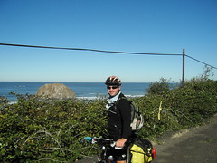
Sunday, September 17. Hood River, OR, to Portland, OR.

Well, we made it to Portland - at least, to near the Portland airport, just short of five full months from the day we left Lawrenceville. The trek will continue, for now, until we get to Lincoln City out on the coast, but in the grand scheme of things, this city was always our true destination. To be here, now, after the long journey, is what you might expect: exciting, amazing, and just a little sad, sad that the trip will soon be over and we'll have to rejoin the real world.

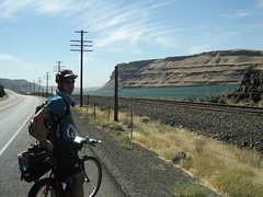
But of course, I'm getting ahead of myself. The question everyone wants to know the answer to is, was it windy today? And, happily, the answer is NO, it was NOT windy today, and we rejoiced. We did have a long way to go, though; we expected to have to go over 65 miles to get to a stopping point near Portland, and much of that on the Columbia River Gorge Historic Highway. On a Sunday, that might be slow going.

Sitting at breakfast, we could see that the river, unlike previous mornings, was not coated with wind-whipped whitecaps; and as we set out, we both smiled that the wind had finally abated. We were looking forward to a scenic day in the Gorge, and it would be nice not to have that to deal with.

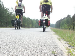
Traveling through Hood River on Oak Street, the traffic was light and we were anticipating our next few miles out on Interstate 84. Nancy and I have distinctly different experiences when we have to get on the freeway like this, and so what we did today requires a little back-story so you may completely understand our respective frames of mind.

Nancy, for all intents and purposes, has no problem riding on the freeway. Totally fearless, happy that there are no hills and that we make really, REALLY good time there, she would ride on the freeway all the way to Portland if the darn map I have wouldn't keep sending us onto "safer" roads.

I, on the other hand, have a little history of being, well, let's say PHOBIC about being on a freeway outside the confines of a car. This goes back many, many years, and although I have made a lot of progress, I still have some trepidation about it.

It's hard to explain what it feels like. Years ago, confronted with the prospect of having to get out of the car on the shoulder of an interstate, my heart would race, I would begin to sweat profusely (even for me), and I found it hard to breathe. While there are perfectly rational reasons for being afraid to get out of a car on a freeway, my panic went beyond mere reason.

For me, standing on a freeway felt like standing on the boundary between the living world and the murky beyond, a kind of DMZ of mortality. The sounds of the tires against the road were like the shrieks of the doomed, zipping around me, too loud to ignore, too fast to see, ethereal and only quasi-corporeal - like they could pass through me and take something of me without my knowing it. So naturally I was petrified.

But I've made progress; I've HEALED, to the point where now, I can ride up the onramp and get on the freeway like I do it all the time. In my head, of course, all I can think is BREATHE IN AND BREATHE OUT AND BREATHE IN AND ... You get the point. Under the conditions, you'd imagine I'd take pretty much any opportunity to avoid the freeway, and you'd be right. Even if it involves a horrific climb of over 600 feet in less than a mile and a half, if it means I can get off the freeway, I'll take it.

So I can't explain why I missed our exit. I mean, I can, sort of - I misread the map; I thought we had to go 13 miles but it was really just 10. But misreading the map in such a critical way, in a way that meant we would ride another 5 miles on the freeway, well, I can't explain that. Maybe I am finally getting free of the phobia.

Good thing, too; we would end up riding on the interstate most of the way to Troutdale. More on that in a moment.

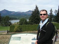
We got off the freeway a little before Cascade Locks, and took the opportunity for a little rest there at a plaza behind the post office. It overlooks what remains of the locks which made navigation around the Cascades rapids possible. This is quite a story, and it begins about 800 years ago with the Bridge of the Gods.

Eight centuries ago, a massive landslide created a land bridge from one side of the Columbia River gorge to the other, blocking the path of the river and eventually rerouting it almost a mile south of its original course. The natives in the area called it the Bridge of the Gods, and over time, it eroded, leaving behind just the most obtrusive of the obstacles; this would become known as, simply, the Cascades. The surrounding mountain range takes its name from this set of rapids, and the site of Cascade Locks (once known as Whiskey Flats) was the portage route.

When the portage route eventually proved too cumbersome, the Corps of Engineers built a set of locks. It took them 20 years to do it, but they did the trick - until, that is, the Bonneville Dam went in, submerging almost all of the locks. Today, only the topmost portion of the highest lock is still visible.

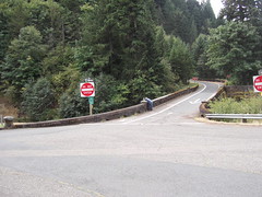
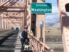
There is still a Bridge of the Gods at this site; it is a toll bridge, and bicycles are prohibited. So we were stuck on the Oregon side, interstate and all.

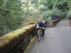
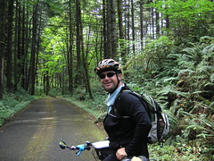
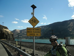
Before we had to get back on the interstate, though, we traversed a portion of the (read this in your best movie trailer voiceover voice) Historic Columbia River Highway State Trail. Just beyond Cascade Locks, this portion becomes a bike and pedestrian trail, so we had no motor vehicles to contend with. The first mile was utterly, jaw-droppingly stupendously beautiful. We went from the side of a road onto a path and into a primeval forest, surrounded by ferns, moss-covered trees, and a canopy of leaves. It was a totally different world. The path descended and then rose to a tunnel under the interstate, and then to a creek where there was a water treatment plant (near and dear to my civil engineering heart).

At this juncture, we were confronted with something that, regrettably, is far too common on bicycle trails across this country: contradictory signage. The other probelm we have found is LACK of signage, so perhaps the existence of a sign at all is a tiny blessing; but this was a sign that said "bike route", accompanied by an arrow sign pointing up a small hill. The problem was that it pointed up a road that was prominently marked "One Way" down, and was mounted on the same post as, and directly beneath, a "DO NOT ENTER" sign. A little farther up the road we could see the two "WRONG WAY" signs. But the happy little green bike route sign cheerfully directed us to ignore all the other signs; just go on ahead, you're OK, you're on bikes, it's not like you're REAL traffic. Go ahead. Break traffic law.

We finally obeyed the tiny green sign, ignoring the large, red, more anal-retentive signs telling us to obey the law, and found the trail again about a quarter-mile up the road. For a few moments, blissfully ignorant of what we would shortly have to do, we were happy.

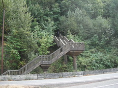
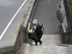
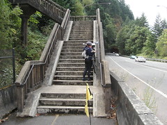
Then we found the staircase. The trail includes a staircase. A STAIRCASE. The only acknowlegement that bikes must traverse this monstrosity are grooves alongside the stairs so bikes can be "rolled" up. The pitch was too steep; we had to take the trailers off. So Nancy walked her bike up the SIX FLIGHTS while I walked her trailer up. Then we went back down and took my bike and trailer up the same way. Finally, I went back down to get my trunk, which I had taken off to make it easier for Nancy to balance the bike.

Oh, yes, yes we did get pictures. We got MANY pictures, some of us laboring to get our gear to the top, some of the stairway itself from the bottom and from the top, and finally one of the entire staircase from across the adjacent road (inaccessible to us on bikes, but a short hop over a concrete barrier).

We got all the gear to the top, bitching and moaning the whole way, wondering if the people at Adventure Cycling had even SEEN this thing. We couldn't imagine they had. If they had, I think they would have just told us to stay on the freeway.

Back to the freeway: we left the trail for a short, 5-mile trip on 84 again, before rejoining the Historic Trail once more. This portion is still under renovation, so the surface is scraped and rough, and full of hazardous potholes. It took us past Horsetail Falls and then Mulnomah Falls, where we stopped for a bite to eat. These waterfalls are not possible; they are thin cascades that emerge from the top of high cliffs and become feathery wisps as they descend. At least, that's how they look from afar. Up close, that feathery wisp is a still-powerful column of falling water.

Shortly after leaving Multnomah Falls, we saw a sign that said that the Historic Highway was closed west of Bridal Veil, up the road; the detour, naturally, was Interstate 84. So back to the freeway we went.

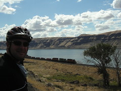
It was more than 16 miles, and the first 8 or so were almost a blur to me; and when we stopped at a scenic overlook, Nancy pointed out that we were making REALLY good time and that we hadn't had to climb a hill in miles; I was stunned to see how far we had gone, and even more, that I had not realized how flat the road was. I made a conscious effort to pay attention; and soon, I spotted a great blue heron down on the river. The drivers whizzing past could not see it, but I pointed, and Nancy saw it too. So it IS possible to see cool stuff while on the freeway. You just have to be on a bike.

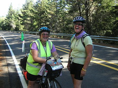
We got to Troutdale, and promptly met another cyclist, Gerard Woods, out on a liesurely 20-mile loop ride, who we asked for direrctions. He was very nice and led us around a less busy way than shown on the map to the bike path near Marine Drive, in northern Portland (near the airport). We rode and talked with him for about 9 miles, and finally exchanged information when we reached the cluster of hotels near the airport (where we would begin the process of comparison-shopping).

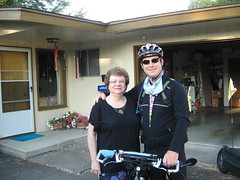
So, now, we will spend tonight and the next here in Portland, and tomorrow Jim and Suzi (my parents), will be up to spend the day with us, in a kind of pre-celebration of our arrival. In the next leg of our trip, we will head to either St. Helens or Clatskanie, on the way to Astoria. We anticipate less than another full week on the road before the end.

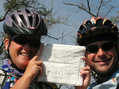
One last note: we have had a request for some "trip stats", information about miles, climbs, and other stuff to be posted on this site. We will compile some of those things and probably put them up after we reach Lincoln City. A tidbit to tide you over: to Portland, we have traveled a total of 6359 miles, taken 20 rest days, and gone through 20 states, 2 provinces and Washington DC. More soon!

Sunday, September 17, 2006

Did Lewis and Clark Cross the Columbia River This Often?

Saturday, September 16. Biggs, OR, to Hood River, OR.

After yesterday's adventure, virtually any change in the weather was certain to be an improvement; and so, when we got ready to go and there wasn't a hint of rain in sight, we counted ourselves fortunate, pointing our tires into the wind and rolling away.

Of course, it was still windy. And with the temperature just 53F, it felt like northern Minnesota in January to me, so I had on my arm warmers, my thermal jacket AND my wind/rain jacket, along with my windproof pants. We hadn't even gone five miles before I put my gloves on, too. Nancy, too, was bundled up, just not three LAYERS bundled up like me. But we were riding in sunlight, which was a nice change.

As we crossed the Deschutes River, we entered the Columbia River Gorge Scenic Area. There, along the bridge, were several fishermen; many more, too many to count, were aboard boats down on the water or wading from shore. We theorized that the wind had blown all the fish up here and that these were the wise fishermen who knew that (although, to look at them, perhaps "wise" would not be the first word that would spring to mind). Although the vegetation looked the same once we passed the sign as it did before, we noticed that soon, different trees were waving in the wind and that huge, exposed, upthrust layers of rock were clearly visible on both sides of the river.

Oh, the Columbia River. We had crossed it once back in Umatilla to get to the Washington side, and then again yesterday to reach Biggs. We had resolved not to cross that bridge at Biggs again, and had instead selected a route that would take us to The Dalles, where we would cross back into Washington on the bridge there. The idea was this: the Washington option is much flatter than the Oregon side, and there was a nice destination available there in White Salmon - namely, the Inn at White Salmon, and although we didn't have a reservation, I had called from Walla Walla and been assured that they would "probably not" be full this weekend. So we would ride to The Dalles first on the Oregon side, avoiding the treacherous bridge at Biggs and the long ascent to the route there.

The road from Biggs is a frontage road for about 8 miles, but then the route directs cyclists to ride on Interstate 84 for about 10 miles. This would be our second foray onto an interstate (the first being back in Wyoming where there just wasn't any other road); the shoulder was plenty big and separated from the lanes of travel by rumble strips, so we felt reasonably safe. But do this: next time you are on an interstate, look over at the shoulder and take in just how much crap there is over there. Then try to imagine some poor possessed soul trying to ride their bicycle over there. Ever see the bristly fringe on the bottom of some mudflaps on some of the big rigs? I saw a few of those on the side of the freeway today; I really was struggling to think of a way to attach one or two of those to the front of my bike to operate as a kind of "sweeper" to clear away some of the debris before I rolled over it. Neither of us got a flat, though, which must be some kind of small miracle. Alert the pope.

We saw no trains on the Oregon side for a long time, but eventually we DID see a HazMat cleanup crew doing their thing near the tracks. Although we don't know the nature of the incident there, we don't need to know very much to figure out why we hadn't seen any trains to that point.

As we neared The Dalles, the first thing we saw was the dam. We stopped for a picture, maybe a little dicey on the side of the freeway, but we had to document it somehow. Nancy has already posted that one; scroll down to see it if you want.

The bridge at The Dalles was not as bad as the one at Biggs, but it was pretty close. The east side of the bridge has a walkway that is about three feet wide, but the west side is little more than a curb. It is also two lanes, one in each direction, although there are no impediments in the centerline like on the bridge at Biggs. We stopped for a picture near mid-span (Welcome to Washington), and alternately rode and walked our bikes along the walkway (the wind played havoc with our balance, and it became too risky to ride in the crossing gusts). And, once we reached the other side, and followed US 197, we continued to feel the crosswinds until we reached the route on SR 14. It was there that we saw the road sign that said it was only 18 miles to White Salmon - woo hoo! I had WAY overestimated the distance, so we would be done sooner than 6PM! That was a huge boost to our psyches, even as we continued to slog through the deafening wind (our average speed today would end up at 7.9 mph).

It was also near this point that we encountered Googleville, which appears to be three buildings (two of which are, apparently, occupied). One building has two vending machines out front, and the other appears to be a house (fenced in). No people were in evidence. How did this place get the name Googleville? Does anyone know? We could not find any explanation there.

I should also note that the Maryhill Winery was 15 miles in the other direction - and that we could have been there in half an hour, even with the climb, if we had wanted to go there. But, choosing the promise of a safe place to sleep over the temptation of a few free samples of wine, we skipped it.

Cresting the first climb past Murdock, we could see substantial greenery on the Oregon side of the gorge, and several kiteboarders and even a few windsurfers down on the river. Nancy said they looked like confetti decorating the water. It looked like they were having a good time, darn them. If they could teach us how to rig a sail to the bikes, we'd be in business.

We decided not to stop in Lyle, just after the two tunnels with the "bicycles in tunnel" warning system (we had to push a button, similar to the one you press to activate the "walk" signal, to activate the warning); one van passed us in the tunnel, and then a truck slowed behind us until we emerged safely on the other side. We waved our thanks, and he waved back, smiling - that felt nice. The tunnels also gave us momentary shelter from the wind, which also felt nice. Really nice. I will enjoy the next windless day we have, enjoy it a lot, based on how good it felt just to be in those tunnels for a few measly seconds.

The road to Bingen, just before White Salmon, consists of a series of low rolling hills, exactly what I had expected based on the profile the map shows (it is depicted as dead flat). At one juncture, where old Highway 8 rejoins the route, the road we were on was bordered on both sides by water; beyond the water to our left, the railroad tracks ran straight, and then the river was beyond that. The backdrop was the beautiful cliffs of the gorge on the Oregon side, with the prominent layers of rock exposed but shrouded with vegetation. Mount Hood, it's peak enveloped by clouds and sporting fresh snow, loomed in the distance.

At Bingen, we turned onto 141 and began the long climb (!) up to the White Salmon Inn. Early on, we passed a group of people who were having a "Free Bake Sale" - anyone want to hazard a guess what the heck THAT means? I managed to pant "Not now" as I maintained my climbing rhythm, and Nancy passed up on their confusing offers as well. It took a while, but we eventually reached the White Salmon Inn.

You guessed it: the White Salmon Inn was full. But we didn't panic; I already knew that the nearest place with rooms on the Washington side was another 12 miles, and was trying to figure out how to break it to Nancy when the innkeeper, Janet, got on the phone to find us a place closer by. She found us a spot at the Hood River Inn, across the Columbia on a bridge that prohibits pedestrians and bicyclists, and suggested that her husband, Roger, give us a ride over to Hood River in their van. It took two trips, but that's how we ended up back in Oregon on a night we were supposed to be in Washington.

Roger and Janet, both 70, have been running the Inn at White Salmon for 16 years (although the Inn has been there since 1937); Roger was also the Mayor of White Salmon for 9 years. Janet ran a psych-med ward before becoming an innkeeper (which was apparently excellent experience for the job of innkeeper - taking notes, Becky?). They are a delightful couple and I really regretted not being able to stay there and talk more with them, especially because they are selling the Inn in March and will, like us, be temporarily jobless and homeless (but not hippie bums like us, because they won't be on bikes).

Roger said that the name White Salmon has two possible origins: one, the inevitable Lewis and Clark connection wherein the Corps of Discovery finds salmon here that wash ashore after spawning, dead and white, and two, that salmon caught here are white because they have not been to sea where they could have eaten tiny crusteaceans that turn other salmon's flesh its characteristic pink. We found explanation two much more plausible, but if anyone can find verification, we'd appreciate it.

Speaking of salmon, we had a yummy, yummy dinner here in Hood River - I had smoked salmon and wild mushroom ravioli, which was utterly delicious, and Nancy had the rigatoni with vegetables in surprising roasted-tomato marinara sauce. After weeks of grilled cheese sandwiches, patty melts, fries, and other such fare, this sumptuous dinner was a true and rare luxury. We even went so far as to order the big fat chocolate cake for dessert; we couldn't finish it, but it was not for lack of trying. We tried valiantly.

Tomorrow we hope to make it to the vicinity of PDX, where we can find an inexpensive room near the MAX station and ride in to Portland for dinner. We talked with my sister Kim, who lives out in Beaverton, but for clearly understandable reasons she can't meet us for dinner. We will, however, try to get in touch with my cousin Dan and his wife Geri, and maybe meet them instead,which would be an unexpected pleasure. We'll see if we can get up before the crack of 8 tomorrow, and if the wind has abated any. Will tomorrow be the long awaited non-headwind day?

Saturday, September 16, 2006

No Room At This Inn


No Room At This Inn
Originally uploaded by nstovall8.
By the time we had climbed up the 2-mile hill to the White Salmon Inn, they

were full up. But Roger and Janet, experienced innkeepers, not only found

us a room across the river in Hood River, but loaded us up and drove us

across the bridge.

Tunnel Warning


Tunnel Warning
Originally uploaded by nstovall8.
While we were fighting the winds today, we came on a short tunnel. I was

worried about the traffic inside until I saw this warning system.

Welcome Back to Washington


Welcome Back to Washington
Originally uploaded by nstovall8.
Crossing back into Washington at The Dalles was slightly better than the

crossing into Biggs, OR. We had a 3-foot wide concrete path to walk our

bikes on. The crosswinds were gusting too much for us to ride across the

bridge.

The Dalles Dam


The Dalles Dam
Originally uploaded by nstovall8.
Just before crossing out of Oregon, we stopped for a quick photo at The

Dalles Dam.

Multi-modal Transportation


Multi-modal Transportation
Originally uploaded by nstovall8.
While traveling along the Columbia River, there was barge traffic on the

water, freight trains on both sides of the river, lots of 18-wheelers, RV's,

cars, trucks and us.

Blown Into Oregon


Blown Into Oregon
Originally uploaded by nstovall8.
The winds were a little stiff as we rode along the Columbia, and into Oregon

for the first time.

Aunt Helen


Aunt Helen
Originally uploaded by nstovall8.
Matthew and Helen pose for a picture before we head off to our next stop and

she heads off to work. Zach had already left, his speedy new bicycle

getting him to school before 7am.

The Columbia!


The Columbia!
Originally uploaded by nstovall8.
We finally reach the Columbia River, and enter the scabland and desert of WA

and OR. The river is a real treat.

Whitman College


Whitman College
Originally uploaded by nstovall8.
A nice young couple took our picture on the steps of the Whitman College

Clock Tower. It's a really big tower; hard to get it all in one shot

(unless you have Holly's camera).

Matthew & Matilde


Matthew & Matilde
Originally uploaded by nstovall8.
At the Public Library in Walla Walla, we made friends with Matilde. She is

not, apparently, connected with the Walla Walla Public Library Policy

Police.

The Road to Walla Walla


The Road to Walla Walla
Originally uploaded by nstovall8.
At least on Middle Waitsburg Road, they knew we were coming. Once we got

off Hwy 12, this road took us by the back road, past the gun club, into

Walla Walla.

The Lesser Known Trail


The Lesser Known Trail
Originally uploaded by nstovall8.
In Dayton, WA we saw these banners, proclaiming the Lewis and Clark

Forgotten Trail. Not really sure who forgot what, though. My guess is that

this is where Seaman, their dog, gave up on them and found his own way back

home.

6,000 Miles


6,000 Miles
Originally uploaded by nstovall8.
Our last big milestone before we finish--of course we had to doodle on a

napkin!

As if YESTERDAY Wasn't Bad Enough . . .

Friday, September 15. West Roosevelt, WA, to Biggs, OR.

Nancy had arisen in the night, and had seen a beautiful, windless riverscape; and when she got back in the tent and told me, I suggested that we should get up right then and head out for Biggs. I wasn't completely kidding; and in retrospect, I wish we had left then.

But instead, we waited for daylight, and we talked with several of the windsurfer dudes, mostly about the days' forecast. One guy thought it would be windy the whole way, but the others thought we had a good chance to get to Biggs before it got really bad - even though, by all accounts, the largest pressure gradients existed there at the moment we left camp this morning. With an eastwardly-trending weather system, we were destined to run into it.

We stopped for some ice and water before leaving West Roosevelt, and then took off down route 14. The pattern from yesterday held true, with lots of truck traffic - but the winds were lighter and the road, overnight it seemed, had become smoother. We no longer felt compelled to get out off the shoulder for a smooth place to ride; there was plenty of room on the shoulder. The first half of today's journey was actually nice, and I started to think we might be able to go all the way to Lyle, 21 miles farther than Biggs.

Then we reached the base of the first 500-foot climb, covering most of 3 miles. As climbs go, especially the climbs we've done, this was pretty low on the challenge-o-meter; but, the road surface changed from the smooth, ample shouldered road we had been so enjoying to the crappy, chip-sealed, gravelly-shouldered, bone-rattling "surface" that had been the bane of our existence yesterday. If the climbing wasn't all that challenging, it was certainly bumpy. And, the westerly wind had begun to pick up.

I had been eyeballing the dark clouds to our northwest, hoping the obvious wisps of precipitation would not reach our expected position, or that, if it did, not make it all the way to the ground (as had been the case a few days ago, when rain evaporated before reaching the ground). But the expanse of the darkening clouds grew along with the wind, and the road continued to rise, effectively bringing the earth up to the level where the rain could reach it.

As we approached the John Day Dam, still climbing, the rain began in earnest, and we stopped to put covers on our backpacks and for Nancy to finally put on her rain jacket (I had BEEN wearing mine already, being the cold-weather wuss I am). Maddeningly, from where we stood on the side of the road, putting this gear on, I could see a hundred yards up the road to a point where it WAS NOT RAINING. I desperately wanted to just stand on the pedals and GET THERE, where we WOULDN'T GET ANY WETTER; but of course, as we got there, it had begun to rain there, too. So we continued the climb, into the wind, and under the increasingly heavy, and cold, rain.

Then it started to hail. My bell rang repeatedly under assault from the tiny chunks of ice, and my hands, already starting to go numb from the cold, were jolted back to life by the constant needling of the impacts. The winds grew in intensity but began to come from varying directions. We had begun to penetrate to the center of the low pressure system that was driving the wind.

With the road already wet and covered with tiny, melting chunks of ice, it was already pretty treacherous riding, and we had long since given up trying to find a smooth place to ride, hugging the shoulder for dear life; but the trucks continued to speed by, most without even bothering to change lanes, sending up collossal volumes of spume from the road and adding to the swirling wind with the vortex of their wake.

And in a moment I began to think it was as bad as it could get, I saw the lightning in the hills to our north; before I could even stop concentrating on the rain and hail long enough to wonder how far away the lightning was, I heard the thunder, booming down the canyons and echoing in the gorge.

I know, I know: there's no way. There is NO WAY it could have been that bad. There is no way someone could even make this UP it's so awful. And yet there we were, laboring through it all to push ourselves onward; pushing with an effort that, in the right gear, can propel us many yards with each stroke, but at that moment moving us distances better measured in inches. Frustrating, yes, but we didn't have TIME to be frustrated - we were wet and cold and windblown, and all we wanted was somewhere to stop and get out of the weather and the wet clothes, and into a hot shower. Biggs became our oasis, hopefully not just a mirage, where we could slake our thirst for a few of life's little comforts.

Soon we were unable to predict which direction the winds would be coming from at any moment, only that the wind would be blowing. Focussing hard to maintain balance and direction while watching for wayward traffic and dangerous road debris (of which, given the wind, there was a surprisingly ample supply), I was relieved to finally see the sign pointing to Biggs, realizing the unspoken decision I was sure we had both made to stop there for the day. By that time, the hail had stopped, but a light rain continued to fall. It was also near this point that we saw the sign pointing to Stonehenge (actually a replica, and functioning as more of a war memorial than as a solar observatory), but we elected not to make the touristy stop there due to the swirling, 30-mph+ winds, and the rain, and the lurking threat of more of the hail we had so recently left behind us.

The road to Biggs, prominently advertised a mile beforehand as US Route 97 to Bend, was marked at the turn as inconspicuously as the road to Stonehenge (the replica we had just bypassed), and at first I was not sure if it was actually the road we were supposed to take; it just said "Maryhill Park" and pointed roughly south. Finally concluding that it couldn't be anything else, we took it.

The road down is a steep grade and winds around a few times; it is easy to pick up a LOT of speed, even today with the confusing winds and rain. At speeds like that, it becomes even more difficult to maintain control, and we both had to brake often to stay upright. At one moment the wind was pushing us off the edge, and at the next moment forcing us out into the lane of travel. For once, the trucks seemed willing to give us enough room to maneuver, perhaps only because they didn't know where the hell we would go (like we DID).

We safely made it to the bottom of the descent, where we rolled on past Maryhill Park and the museum there (swirling winds, rain, hail), to confront possibly the single most dangerous, bike-unfriendly bridge we have seen on this trip. There are two lanes, one in each direction, with posts and road bumps dotting the centerline, and a gutter about 6 inches wide. Abutting that is a raised concrete "sidewalk" about a foot wide, too narrow to walk on WITH our bikes. With the winds (swirling, 30-mph+ winds) and the incline on the bridge, it was too dangerous to ride, so we had to walk in the 6-inch gutter with our bikes up on the narrow concrete walk. The trucks at least slowed down as they passed us with inches to spare. Finally, at the top, and absolutely livid, I waited for a break in the traffic and then brought my bike down to road level and took the entire lane for the rest of the ride into Biggs; Nancy followed suit. If some of the drivers behind us were delayed for a few seconds, so be it.

We reached our refuge, a TraveLodge, just as it began to rain again. But they had room, and soon we were basking in our oasis, enjoying the inexpensive luxury of shelter and running water. And, after a shower and lunch at Linda's Restaurant here in Biggs, described by one of the windsurfers as "kind of an armpit place", I recalled one of Melanie's comments from a cold morning in Wyoming: "Armpits are a great invention."

I couldn't agree more.

Blown Away

Thursday, September 14. Umatilla, OR to West Roosevelt, WA

After leaving the Desert River Inn, we crossed back into Washington on a bike path across the Columbia River. The wind had gotten stronger through the night, but had calmed down to about 20mph in the morning. So it was windy as we set out, and the winds just increased as the day went on. We rode next to the Columbia River in the desert landscape all day, alternating between adding and shedding layers as the temperatures rose and fell.

There are train tracks on both sides of the Columbia, and about a half-dozen of them went by us throughout the day. The wind was so loud, though, that the sound of the engines was drowned out! The last train to pass us on the Washington side was heading east, and he saw us and tooted the train's whistle in greeting.

We stopped for lunch in Paterson, and while we were inside, a small squall arose and sprinkled a light shower on us. The temperatures dropped noticeably, and I put on my rain jacket in case the showers continued. For about the next 45 minutes, we noticed that the wind had changed direction. What had been a strong WSW wind was now a NNE wind, which was a little easier to ride in. We got about 10 miles behind us when the winds changed BACK to the WSW wind, and we were back to battling the cross-winds again. This day was wearing us out.

We made only one stop after lunch, mostly because there was no place for us to get any shelter from the wind. I had picked up a package of M&M's at our lunch stop, and we shared them just to get the sugar rush. Because we were only able to make about 8mph, the day was waning and we still had 25 miles to go after our lunch break.

By the time we reached North Roosevelt at around 7:00pm, I was doing anything to keep from thinking about the wind and the way my knees were hurting. At the restaurant in North Roosevelt, we stopped for dinner, and met a young trucker who offered to put us up for the night in the cab of his truck (with a DVD player), and then transport us and our gear to Camas in the morning. A very tempting offer, but like the fools we are, we declined.

At just before 8:00pm, we turned on our headlights and rode to the West Roosevelt park in the dark. As we were trying to feel our way to the tent camping area, we met Greg, a 60-year-old windsurfer who had just traveled here from Greenville, SC. He gave us the flashlight tour of the park, pointing out good campsites and warning of the nightly sprinkler onslaught.

We chose to camp on the point, setting up camp by the waning light of my headlight. Laying down, snuggled up in our silk cocoons and wrapped in the human stuff sack was the nicest thing I'd done all day. During the night I heard a few trains in the distance, heard the sprinklers start up all around us, and heard a light rain gently falling on the rainfly of our tent. In the middle of the night, I awoke and looked out the tent to see the moon shining on the river and about a half-billion stars in the sky. It was quiet; there was no wind--we should have gotten up and started riding toward Biggs right then.

Thursday, September 14, 2006

The Oregon Desert

Wednesday, September 13. Walla Walla, WA to Umatilla, WA.

After saying our goodbyes to Helen and Zach, we rode over to Clarette's for breakfast, then stopped for ice and water at the Safeway before heading out for the day's ride.

The Walla Walla area has recently seen a surge in vineyards, and some of these vintners are winning prestigious awards for their wines. As we pulled into Lowden, there were several tasting rooms within sight of the highway-- 3 Rivers, Woodward Canyon, and Le Ecole No. 41. I'd have stopped, but none of the tasting rooms open before 10am. If wine isn't your thing, Walla Walla onions are famous for their sweet taste, and there are more than a couple of roadside stands. At a few places around here, you can pick up wine, onions, espresso and fill dirt.

If life had a soundtrack, we would have heard the warning when we saw the wind turbines lining the hilltops. An always-available, never-ending supply of wind makes this area a popular spot for turbine farms. If you're fond of oil refineries, these statuesque, odorless sentries are bound to disturb you. Back on Hwy 12, we have a wide shoulder--which is a good thing, because there's a lot of semi-truck traffic on the road today. My personal favorites are the hay trucks--they're large, smell nice, create a huge vortex of wind as they pass you and leave a swirling parade of confetti-hay behind. Not for the allergy-ridden.

After passing Touchet, there would be no more services of any kind on the raute until reaching Umatilla, some 36 miles away. We stopped at a c-store for a break.

At about 29 miles, we left Hwy 12 and followed Rt 730 to the Columbia River. The landscape here changes to desert, and in just a few miles we reached the WA-OR border. This area is called the Scablands, created by a flood some 20,000 years ago. An ice dam holding back the ancient Lake Missoula broke, sending billions of gallons of water rushing down the Columbia's channel. Odd that so much water created a desert, and that a river as large as the Columbia runs through that desert. The hills in this area look like something that you'd find in Utah or New Mexico.

Matthew was struck by the scent of the water, which was thrust at us by the wind. I'll let him describe it: The scent of the river brought images to mind I usually associate more with the coast - of docks and fishermen, and fresh fish. I get this picture in my head of people making their livelihood at the margins of the land, not pushed there by society but impelled there by their own need to be at the edge. All, just at the whiff of the Columbia River.

The wind picked up as we got to the Columbia, and by the time we reached Umatilla, we'd be riding into 35mph headwinds. The hotel staff said it was the windiest day they'd had in quite a while. Since there were no services in the area, we stopped and had a picnic lunch under the "Welcome to Oregon" sign. By 3:00pm, the skies had clouded over and by the time we finished the day's ride, we were both exhausted. We'd been warned that the wind can be fierce in the Columbia River Gorge, and we'd had our first taste of it. Yum!

Tomorrow, we plan to go to West Roosevelt, to camp in the park there. Our bailout point is Crow Butte Park, on an island in the middle of the river, just 30 miles from Umatilla; West Roosevelt, a bit more than 50 miles from here, opens the possibility of being able to stay the night in Portland on Sunday. We'll have to see if the wind dies down tomorrow.

Wednesday, September 13, 2006

Lunch with Aunt Helen

Tuesday, September 12. Dayton, WA to Walla Walla, WA As we left Dayton, we got back onto Hwy 12, headed for Walla Walla, a trip of only 30 miles. We rolled through Waitsburg after the first 10 miles, and saw the area where the firefighters are camped out. We also saw a couple of their helicopters and other equipment being readied for firefighting in a nearby field. . Outside of Waitsburg, we left Hwy 12 and turned onto Middle Waitsburg Rd. Almost immediately, the landscape turned into a rolling tour of grain fields. And I mean rolling hills, even though the map profile shows a steady downhill into Walla Walla.

Near the top of a healthy climb, one of the few motorists we'd seen all day slowed down to offer this pithy comment: "Seems like it'd be faster to walk". I retaliated with my best oxygen-wasting courtesy laugh, and he drove off. After several more of these downhill climbs, we finally reached the chainlink fence of the local gun club on the outskirts of town, and knew we were close to the end.

We arrived in downtown Walla Walla just in time to have lunch with Matthew's aunt Helen. When we fired up the cellphone to call her office, Matthew discovered that we had a voice message from the Fab4. They had just reached the coast, so I called them back to join in their celebration lunch. After our own lunch, we went to the post office, then on to the library.

Even though Matthew tried to explain that his father is a former Walla Walla resident, and graduate of Whitman College (located in Walla Walla), the library police would not allow non-residents to use their computers. Fortunately for us, a rebel librarian is in charge of the lab, and she logged us into two computers. Unfortunately, the USB port is blocked and I couldn't upload pictures.

We met Helen and her grandson Zach back at her house around 5pm, and went to dinner at the local Elmers. After a great dinner, we spent the rest of the evening visiting with Helen and Zach. Zach helped me log on to Helen's home PC, and I was able to upload a few pictures before I succumbed to the hide-a-bed in Helen's living room.