Sunday, July 30, 2006

Across the wind

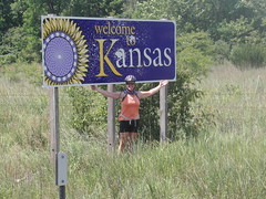
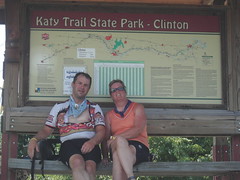
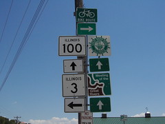
Sunday, July 30. Ness City, KS to Scott City, KS; Monday, July 31. Scott City, KS, to Tribune, KS.

Oh. My. Goodness.

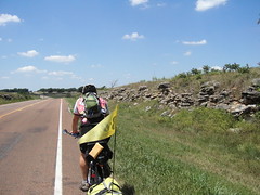
There had to be a day we would look back on and know was the worst one of the trip, and perhaps Sunday was it. The forecast was for 20-30mph winds from the south, meaning they would be crosswinds.

Oh. My. Goodness.

When the forecast calls for 20-30 mph winds back in Georgia, it means that the winds might reach that speed sometime in the afternoon when the storm passes over your neighborhood. When they forecast that here in Kansas, they mean that the winds will blow at that speed constantly, relentlessly, for DAYS.

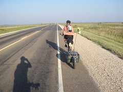
We worked all day fighting to ride west while resisting being blown north. It was exhausting. Occasionally we would get blown off the road. Once I was blown off the shoulder, and in the midst of correcting, got caught by another collossal gust, and was spilled into the dry grass.

The day was worsened by the fact that I'm an idiot. I noticed that we were averaging more than a mile and a half per hour less than yesterday, and dumbly insinuated to Nancy that she might not be exerting herself sufficiently. The wind makes you say stupid things, and that must be the stupidest thing I've said on this trip, maybe even in my life. I was punished all day by having to ride alone and wonder if she would forgive me. I'm an idiot.

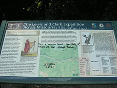
Before I was an idiot, though, we did get to see the historical marker indicating George Washington Carver's homestead near Ness City. He lived and farmed there for a few years before leaving to pursue his masters degree in agriculture. It was a nice rest stop, too, because we were able to get out of the wind a little.

We also saw our first tumbleweed (but certainly not our last, Becky later informed us). It's like seeing a bird you've never seen before but which is common where you see it. Others are a little annoyed by them but to us, it was exciting. It rolled along through a field to our south, looking like a hollow ball of string, or a rattan ball. Then it crossed the road in front of Nancy, bounced a few times, then vanished into a field of milo.

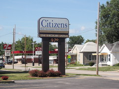
We stopped for lunch in Dighton, first passing and then returning to, apparently, the only restaurant in town, called Frigid Creme. As we passed it I hoped we would find something a little more appealing, but when we got to the Shay's Inn (on the other side of town), I went in to ask, and was told that was it.

It was at the Shay's Inn that we met a British couple who were there in support of some cross-country cyclists (we would get the whole story only later, in Scott City); they were waiting for their room to be cleaned, and then before we set off for lunch, they drove off west looking for their cyclists (who are going east). Before we left Dighton, we topped off with water and ice.

We made it about 2/3 of the way to Scott City before we had to stop and see if we could get some more water at a residence. There was nobody home, so we filled up at the farm pump in the front yard, and then sat on the front stoop in the shade for a little rest. While we sat there, we watched as a swallow repeatedly flew from behind a tree, hovered and drifted across the front yard on the strong wind, and then returned to the shelter of the tree. We decided he was playing.

When we reached Scott City, we checked in to the Chapparal Inn (finding that we were under a heat advisory). The person who checked us in was Heather, an 8th grader who also plays volleyball, basketball, and runs for the track team at her school. She also came to our room when it seemed that the AC wasn't working and let us know that it must have been wired backwards, because to get it to turn on, you needed to set the temperature very high. It was still blowing cold air, which was all we wanted at that point.

We decided that we were tired enough to have one of the few restaurants in town that were open BRING us food instead of us going there. That meant we could do our laundry and hang them outside between our bikes to dry; we figured that drying might take about 5 minutes, what with the heat and wind. So when Nancy went out to check on them and didn't come right back in, I went out to see what had happened.

She had met Cindy Brown, who was acting as primary support for a cyclist who is riding across the country west to east. That cyclist is none other than Jane, of Jane's Appeal (www.janesappeal.org, we think). We also learned then that the British couple we met in Dighton are also supporting this ride, helping the cameraman. Jane was diagnosed with cancer about 6 years ago, and was given 6 months to live. Obviously, she's' still going, and working hard to raise money for cancer research.

Monday. Knowing we would gain an hour on the ride today, as we cross into Mountain Time, we elected to use that hour sleeping in a little this morning. The wind was still cool when we left and stayed that way almost until we got to our lunch stop in Leoti.

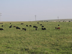
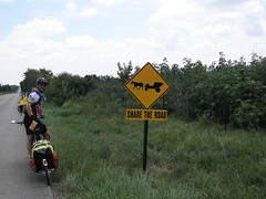
The wind was strong, which was hard to ride through by itself; but the task was exacerbated by the presence of numerous feedlots in Scott County. Feedlots smell. It is where they bring cows to feed them the rich diet they need to "finish" them before they are, well, "what's for dinner". That rich diet leads to some rich-smelling byproducts. Semis pulling empty livestock trailers would give us plenty of room, but the dry stuff emerging from the holes in the trailer, carried by the wind, inevitably hit us. Other trucks passed us which seemed to be hauling entire loads full of cow dung; from these, we were pelted with a veritable hail of dried cowpie pieces. Today was still better than yesterday, though, because Nancy was talking to me again.

When we got to Leoti, I just wanted to get a Gatorade at the c-store before we looked for someplace to eat. Neither of us was very hungry, but we knew that if we didn't eat something we would regret it somewhere in the next 22 miles. So we went to the restaurant in the Hi-Plains Hotel for a light lunch of sandwiches and tater tots. Why don't more places have tater tots? Hm. We also found that the local KSU extension office had left cards on the tables with "Table Topics", including information about cheese aging and mold (and the white crust you sometimes find, which is really just calcium salts that are totally harmless. You can cut it off if you don't like it) and about spider mite control. At leasst half of that information wass useful to us, and we're not even farmers.

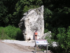
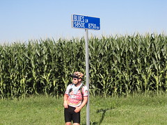
About 10 miles beyond Leoti is a tiny place called Selkirk. There is not much there, but by the old depot is the largest hand-dug well in the country. We could not see the bottom, and it was at least 25 feet in diameter, lined as far as we could see down into it with the native Kansas limestone. There was unfortunately not much information available at the site, though.

I ran out of water in my Camelback less than 4 miles from Tribune, where we would stop for the night, and had to empty one of the bottles of water I carry into the Camelback for the remainder of the ride - hot, hot water, but I was glad to have it.

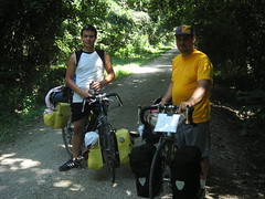
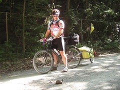
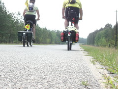
Just as we arrived on the outskirts of Tribune, we saw the only other cyclists we would see today, Christine and Sue, who were just leaving Tribune headed for Leoti. They had left Seattle in mid-June on the Northern Tier, and then hopped to the Trans-America route by riding from Sand Point to Missoula. Both had BOB trailers, and they told us they were heading to New Jersey.

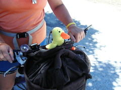
Their mini-mascots, woven finger puppets of a tiger and giraffe, were affixed on Christine and Sue's handlebar bags, respectively. We showed them Detour the Duck and told them the story of our trek. We also warned them to make sure they had plenty of water for the road to Loeti, but Christine told us they had learned their lesson a few days ago when she got dehydrated. Now they have a rule: drink at least one bottle of water every hour. They had plenty of water with them, under that rule.

When we arrived at the Trails End Motel, we met Bob, the proprietor, and his dog Sparky. He has two recumbents parked out front, and might be the most laid-back guy we've met yet. Nancy talked with him for a few minutes (while I made a hasty retreat to our room for a reason decorum precludes detailing here); turns out he's toured all over Europe and parts of Scandanavia. He also roasts his own coffee beans, he told us when he called our room a little later to offer us some. We might get some in the morning, but we were still too warm for it this afternoon.

Tomorrow, we may encounter some rain, but the wind is projected to continue. We will also enter Colorado, and our destination is Eads. We have been alerted to a place we need to stay in Ordway (with someone named Jillian), the day after tomorrow, by a few people now, and we probably will go there. If the heat advisory is lifted we may finally be able to camp again (cross your fingers). Wish us luck!

Saturday, July 29, 2006

Rush Center, Grand Central Station

Saturday, July 29. Larned, KS to Ness City, KS.

We knew that today's ride was going to be hot and windy. The forecast was for a high temp of 104, with SSW winds blowing 15-25mph, and since we had more than 60 miles to ride, we started out around 7:30am.

Our first 12 miles were relatively cool and flat, and the crosswind blowing from the south didn't seem too bad. Maybe it was because I knew that at the 12-mile mark, we'd make a right turn and have the 20+mph winds behind us, for the next 20 miles.

The tailwind delivered as promised, and we were flying on smooth, newly paved roads. I watched my cyclometer hit 20mph, and I was barely pushing the pedals. Sweet! (Happy Birthday, honey) Just as we crested the top of a hill, Matthew spotted a loaded cyclist coming toward us, struggling up the hill against the wind. We crossed the road and waited for her to top the hill. Caedmon is traveling from San Francisco, where she'd been going to school, to Philly, where she lives. She had been traveling with up to four other riders, including Ben, whom we had met yesterday (see "Flying Through Kansas"). Caedmon confirmed that Ben is likely to stop riding any day now, having tired of the prairie. Her other riding companions wanted to go at different paces, or take different routes or detours, so she's now found herself traveling solo. She didn't seem overly concerned about being alone on the road, although she did mention that another solo woman rider had warned her not to stay in Larned--she had been harassed during her stay there. Matthew shared our route through Missouri, Indiana and Illinois, then we headed on down the hill to Rush Center. The only bad thing about those last 20 miles was that they ended much too soon.

I was looking for a pit stop, and as we pulled up to the c-store at the crossroads, we met Merle and Elva Jean Stone. They're from Iowa, recently retired, and are riding from Astoria, OR to Yorktown, VA. Their blog is 2rollingstones.blogspot.com. They're riding much like we are, using the ACA maps as a guide, detouring when they feel the need, and riding about 50 miles per day. Merle is toting a BOB trailer; Elva Jean has panniers. As we visited at a table inside the c-store, another cyclist pulled up. David is traveling from Eugene, OR, where he was in school, to Yorktown, VA. He'd been on the road since July 6, riding 100-miles days for most of it. He'd never toured by bicycle before, but he looked like a natural. The bike he rode was one he'd built. He'd gotten it for about $130 at the co-op where he'd worked. I asked if he was happy with his gear. He'd alread gone through 2 hand pumps--one never worked even one time. Matthew told him about our mini foot pump, which had worked like a charm for refills and flats alike. David also admitted that he'd had to buy a tent after suffering through mosquitoes the first week. He was also going off the ACA route to visit family along the way--today he'd head east toward Lawrence, KS. Matthew gave him our Kansas road map, since all he had to work with was a small pocket atlas.

We exchanged contact info with Merle and Elva Jean, said goodbye to David, and then headed off into the crosswind. We had 33 miles to go, it was nearly 11:30am, and the day was getting hotter and windier. For the next 2 hours we fought to keep our bikes on the pavement as the stiff crosswind and passing semi-truck traffic buffeted us from nearly every direction. We had hoped to stop in Bazine for lunch, and then finish up the last 11 miles fortified with food and a break from the wind. But Bazine is a ghost town of 311 people, with almost no services. All we could find was a gas station that had vending machines and a couple of tables inside. Fortunately for us, the magic snack bag had just been restocked with care-package goodies, so we had sat, had a snack and a bit of a rest.

Back out on the road, the wind seemed to be picking up speed. Tomorrow's forecast is for SSW winds at 20-30pmh; perhaps this was a preview. By now we were both worn out from the heat and the wind, but off in the distance, Matthew thought he could see a grain elevator. By now we know that this means a town, so our spirits were buoyed by the sight. Sure enough, about 4 miles later we came to Ness City--a bustling metropolis of more than 1500 residents. We met most of them for dinner at the Cactus Club. We checked in to the only hotel in town, the Derrick Inn, and spent some time cooling off in the indoor, unheated pool. Then we jumped into the hot tub to warm up a little. How quickly we forgot that it was 104 degrees outside!

After dinner, we walked around the town to stretch our legs. The town is about 10 blocks long and 6 blocks wide--most of it still has brick streets, in pretty good shape. At the corner of one street sits "The Prairie Skyscraper", a huge edifice built of native limestone in 1888. The building is really handsome; I hope to get some pix of it tomorrow as we head out of town.

So, now everyone knows what Matthew did on his 40th birthday. He said if you'd tried to tell him that he'd spend any one of his birthdays in Kansas, he'd wonder what catastrophe had befallan him (those are his exact words). But now that he's here, he says he's glad of the way it turned out.

Unless we get some rain tonight, tomorrow is going to be another scorcher. This kind of heat makes Atlanta look downright comfortable! We're inching our way toward Pueblo, CO, where we'll have a couple layover days and visit with friends and family. Wonder who we'll meet tomorrow?

Friday, July 28, 2006

Flying through Kansas

Friday, July 28. Sterling, KS to Larned, KS.

We resolved to get up early to beat the heat today, and although it was after 6 when we finally got up we still managed to get on the road before 7:40. The route we faced was about 50 straight miles between Sterling and our destination for the day, Larned, with not even one town in between, so we expected to finish in the early afternoon. We prepared by bringing lots of water and snacks to be sure we would not run out of fuel.

We have neglected identifying some of the birds we have seen along the way, but maybe it has worked out for the best - today we saw just about every kind of bird we have seen since entering ILLINOIS. There were the usual suspects: red-wing blackbirds, mourning doves, and sparrows. But we have continued to see great blue herons all across Kansas, usually just one at a time, in the tiny rivers and isolated ponds. Today we saw egrets, too. The brilliant orange flash of an oriole caught our attention at one point, and a great flock of meadowlarks flew in unison over a field of corn. Two wild turkeys dashed off into the woods as we rode past, and a vulture posed for us atop a rusted windmill vane, conveniently framed by the entrance gate to the Proffitt farm. There were other birds we could not see in enough detail to ID, and others that we saw but did not recognize. We will have to consult with our west-coast birding affiliate with our observations.

Much of the bird life we saw today, perhaps, was because of the Quivira Wildlife Refuge, through which our route passed today. It encompasses the Great Salt Marsh and the Little Salt Marsh, and many acres of surrounding land. On both sides of the refuge, we were struck by the abundant pine trees and junipers that lined the road (even though beyond them we could clearly see fields under cultivation). The scent of the pine trees was an unexpected pleasure, and a welcome alternative to the other, more stupefying stenches that have assaulted us from time to time.

Just as we entered the Quivira NWR, one of the few cars that would pass by us this day drove by in the opposite direction. It was a station wagon, woefully overloaded inside and carrying three bicycles on a rack on the back; in the front seat, three people seemed to be uncomfortably close together. They waved back at us as they went by, and we were left to wonder what THAT story was. None of the scenarios I came up with seemed plausible. We might have eventually stumbled upon the right answer, but fortunately, fate intervened and we met Max, John and David a little further up the road.

In Kansas, since we left the Flint Hills and are now actually in the FLAT part, we can see for many miles. On this occasion, I could see the trio of riders long before we actually met them coming the opposite direction. The shimmery road-surface mirage effect blurred the bottom of their tires in the distance; they would be a single dark spike hovering over the wavy horizon, then split into two as the lead rider pulled out and drifted to the back of the line and let the second rider lead for a bit. Then they would merge back into the single, mysterious spike. We were just about 20 miles into the ride, much too early to be seeing things. I knew it had to be other cyclists; the question was, were they locals out for a training ride (which seemed likely if they were riding the paceline style they seemed to be), or were they cross-country touring cyclists like us?

As we approached each other, they drifted across the road to our side. There was no traffic at all, and we took up the majority of a lane as we stood and talked. Max (from Oxford), John (from Ohio), and David (from San Diego), are half of a team of cyclists raising money for cancer research by riding across the country from San Francisco to the end of the Trans-America route. They seemed to be traveling VERY light - David was wearing a patched tube like a belt of ammunition across his chest and had a tiny under-seat storage bag, and neither Max nor John seemed to have anything at all on their bikes. Good thing: they had started this morning before 2AM from Ness City, our destination for TOMORROW, and were headed to Newton, our stopping point from YESTERDAY, a total of about 170 miles. When we asked about their support, they described the station wagon we had seen pass us just a few miles before. The explanation was that the prairie is just SO BORING, that as a compromise only half of them are riding, half the time. The others (who comprise Ezra, Jacob, and Patrick today) ride in the support car. Max, John and David will ride in the car tomorrow.

We were not able to access their website when we stopped at the Larned public library today, but if anyone is interested in their efforts their website is www.crosscountryforcancer.org. It may have been the computers at the library; we were also not permitted to upload any pictures. Security concerns. Hmph. I guess the terrorists have already won Kansas.

Less than an hour after we said our so long and good lucks, we saw Ben from London. Ben started from San Francisco four weeks ago and is riding solo with loaded panniers. He had started late this morning from Larned and had not seen the trio of riders, but was also headed for Newton, so he may meet them tonight. He set out to cross the country, but thinks he may call it a trip in a week or so; the insinuation was that he had "not camped as often as he should have" and was maybe running low on funds, but we never found a tactful way to ask. In any event, he looked fit enough to make the whole trip, and we gave him what information we had about the road ahead. Nancy got pictures of him and of the other three for the blog, and we will post them when we can.

Nearing Larned, we were confronted with the unmistakable scent of feedlots. On the southeast side of town, there is one operation that seems to cover perhaps 50 acres (that we could see), maybe more. All the buildings were purple, even the crane, a reasonably attractive shade of purple, too. But the odor was an olfactory sucker-punch. My eyes watered. I had thought the haze we could see up the road was just the high humidity; now, I think maybe it was something else.

Despite the odiferous welcome, Larned turns out to be a nice, friendly place. We found the post office easily enough, right across the street from the library, and went to retrieve the three packages we were expecting: one from the hotel in Sedalia where we had inadvertently left our phone wall-charger (they graciously sent it ahead for us), one from Jim and Suzi with unknown delights, and one from Michal and Leroy. That last one contained a much-appreciated bag full of king-size Payday bars, which have unexpectedly been harder to come by than we thought. Jim and Suzi sent us a treasure trove of dried fruits and a couple more Payday bars. We seem to be well-prepared now for the next week, which takes us through some pretty sparsely-populated areas. Thanks!

We had made it to Larned in time for lunch, and upon hearing of the existence of a Wendy's nearby, Nancy apparently fixated on the possibility of having a Frosty. A Frosty is a chocolate "soquid" that you eat with a "fpoon", according to the advertising spots on TV. Nancy wanted one. So we went to Wendy's for lunch, where we met a very nice couple also having lunch who asked us the usual questions; and we asked ours, of course. He is a farm equipment salesman on the road four days a week, and she comes with him; they clearly enjoy each other's company. In their 60's, we presume, he owns some farmland which his son farms full-time, and he helps out on the weekends. He helped solve one lingering puzzle for us, though; he referred to one of their crops and "milo" and described the plant we saw several days ago, which we assumed was sorghum. Turns out it is the same thing. Sorghum has an alias. Who knew?

Tomorrow we head to Ness City, about 63 miles of (we think) mostly flat terrain. I know we will encounter some hills, but I think we are well-prepared for them. If we find a way, we will upload some pictures. Until tomorrow!

Thursday, July 27, 2006

Unexpected Cool

Wednesday, July 26. Rest Day in Newton, KS. Thursday, July 27. Newton KS to Sterling, KS.

Wednesday. 5:00am came much too early on Wednesday morning, and by the time either of us became conscious, it was already 7:30am and already in the mid-90's. We hadn't had a rest day since the Cedar Point Amusement Park, and it seemed like our bodies were telling us to take one today. We listened.

There were a few administrative tasks that needed administering, so Matthew took care of those, and then we were free to waste a day. Newton, KS, is not a big place, but it does have a movie theater, so we hopped on our bikes--sans trailers--and pedaled the 4 miles to the mini-mall. We settled on the movie "Cars"--an ironic choice, I guess. And even more ironic is the movie's message: it's amazing what you miss out on when you're going too fast. I doubt that the movie will create any substantial changes, but I'm hopeful that a new generation will be introduced to the "Route 66" song.

Thursday The unexpected rain began around 10:30pm Wednesday night, and it was still drizzling when we set out in search of breakfast. We set out for Sterling around 8:30am, a light drizzle still falling. The temperature was about 71, 30 degrees cooler than the day before. We were happy for some cloud cover and a cooling rain.

Today's route was mostly on rural highways, lightly traveled, but about half of the traffic was 18-wheelers. Throughout the entire day, though, trucks and cars gave us plenty of room when they passed. We rolled through Hesston and Buhler, stopping there briefly for a mid-morning snack. The next town we came to was Nickerson, where we had lunch at the Sunshine Cafe.

On the community bulletin board at the cafe were several posters announcing activities for "Clear and Nearly Day". An ice cream social, magic show and woodworking display were all on the agenda for the event. We asked Becky, our waitress, about the celebration. "Yeah", she said, "I had to ask about it too. When I first started coming here as a kid, it was always around the time of the Clear and Nearly Day." She told us that it's short for "Clearly Summer and Nearly Fall". It used to be celebrated in late August, but Becky said that in recent years it's celebrated earlier and earlier. This year, Clear and Nearly Day is July 29.

Since we were starting to dry out, it was time to get back on our bikes. The drizzle had continue while we were having lunch, and except for about an hour's break in the morning, the rain had been steady since we started. The forecast hadn't called for rain in this area; only the southwestern part of the state had been forcasted with rain. The landscape is really lovely today, including large fields of corn, millet, and cows. Today we also saw our first wheat fields, now just stubble since the wheat had already been harvested. We also saw our first sunflower fields. I had a hard time identifying them at first, since the flower heads were all turned away from us. I'll bet on a sunny day, those fields are stunning, but there wasn't a speck of shade on today's route so I was glad for the rain and clouds.

Once we left Nickerson, Sterling was just 10 miles down the road, less than an hour away. Not long after leaving Nickerson's "downtown", Matthew spotted 7 or 8 zebras in a field across the road. As we watched, 3 of them started running--wild animals. From our spot on the road, they were not high-contrast, black-and-white animals, but more soft, subtly-colored creatures. Their tails, legs and gait gave them away more than anything--except maybe the sight of camels in the next pen. I asked about the place when we got to Sterling; turns out that they are zebra and camel who live with other wild creatures at a B&B. (Presumably, the B&B also has rooms for humans, too.)

We also crossed both the Little Arkansas River and the Arkansas River today. (Pronounced "R-Kansas") I guess they're in something of a drought here, because we almost completely missed the Little river. Even the Arkansas River itself didn't look deep enough to support even a raft. In Georgia, these rivers might only warrant "creek" status.

Arriving in Sterling so early in the day was a little disorienting. The owners of the Sterling Inn are very gracious and helpful (like virtually every Kansan we've encountered), and the rain let up before we'd finished getting settled in. The evening is turning out to be sunny, but still cool enough to enjoy. We took a stroll through town, picked up groceries for breakfast, and had dinner at a recommended place called Paddy's.

Tomorrow we'll head to Larned, KS, a 54-mile ride with no services once we leave Sterling. The forecast is for temps around 100 degrees, so we hope to be on the road early enough to be in Larned before the heat gets to us.

Wednesday, July 26, 2006

The Road to El Dorado

Tuesday, July 25. Eureka, KS to Newton, KS.

Today we had more than a couple of route options. The short day would have been from Eureka to Cassoday, about 40 miles. The "classic" TransAmerica route from Eureka to Newton via Cassoday is about 75 miles, but between Cassoday and Newton there's nothing but cows. With today's heat reaching again into the 100's, we opted for the Adventure Cycling's wussy route. Still 70+ miles, traveling from Eureka to Rosalia, then on to El Dorado, Potwin, Whitewater and ending in Newton.

We were on the road before 7:30am, and for the first few hours the air was still cool. I may have been a little sleepy, but if Kansas flattened out overnight, I missed it completely. We're riding through the Flint Hills today, which is really lovely country. The type of landscape that I would expect to see in a spaghetti western--rolling hills, bunches of trees (with bunches of cows standing in their shade), and lots and lots of pasture and prairie. And the occasional oil well. I even saw a small herd of longhorns today. When I stopped to take a picture, all of them spooked and ran off--except one. And he was a beauty. A dark reddish brown color, fading to a lighter roan color with white spots on his rump. Even though he looked young (!), his horns were a couple of feet long on each side.

The winds today were out of the south and southwest again, and as the morning progressed, they got stronger. We were heading west, and managed to do a little wind-surfing again today, using the crosswind to help push us up and down the Flint Hills.

The road to El Dorado, our lunch destination, is actually Route 54. This road has a decent shoulder in some spots, no shoulder in others. The traffic isn't real heavy, but 2 out of 3 vehicles that passed us were 18-wheelers, making for some interesting riding. When a big-profile truck passes a small-profile bicycle in 20mph winds, the bicyclist knows it. The truck creates a vortex of wind as it passes, which simultaneously pulls the bicycle forward and pushes it outward. If there's no traffic in the oncoming lane, virtually all of the cars and trucks moved to that lane to pass us--and the vortex is too far away to affect us. But if the truck has to pass us in our traffic lane, the effect can be pretty dramatic. On an uphill, I kept checking my mirror to see if there's a big truck coming my way. It can be stressful to ride with these big trucks, particularly when the shoulder is narrow or non-existant. The cross-wind is loud, the big rigs are loud--and today, smelly. The wind swirls around your ears, making a constant noise. It whistles through all of our tires, and through the vents of our helmets. There is a lot of noise to contend with, along with the physical demands of trying to keep the bicycle and trailer on the road in between wind gusts. On one occasion today, I was riding behind (well behind) Matthew, and could see a semi-truck coming up from behind. Ahead, I could see a car coming toward me, and I estimated that the semi, the car and my bicycle would all pass each other at the same time. This part of the highway doesn't have a paved shoulder, but there is about a 6-foot gravel and grass shoulder--I decided to do a little cyclocross action and took off onto the shoulder as the car and truck passed me. Safe!

We stopped in El Dorado at the DQ, which is apparently quite historic and dates from the 40's, judging from the photos and posters hung in the shop. We didn't linger too long, though. The temperature was already 90 degrees at 11:30am, and we still had 40 miles to go!

The road out of El Dorado is Route 254, and it soon turned into a limited access road, complete with rumble strips on the shoulder. Seeing our next turn up ahead, we hopped the ditch between the highway and the access road to get to it. Once on Hwy 196, we took a right turn and had a tailwind! The wind noise that we'd been hearing all morning was abruptly gone, and the traffic dropped to nothing, too. What a relief to suddenly be cycling along a rural route with nothing but the sound of tires on the road. For the next 15 miles, we flew up and down hills until we had to take another turn, back into the crosswind. We went 7 miles to Whitewater, where we took a break and refilled our water. The clerk at the grocery store was also wishing the winds would calm down some. She's a windsurfer, but not experienced enough to handle the whitecaps that develop in these kind of winds. I asked where around Kansas she windsurfs; apparently the sailing is pretty good at East Lake in nearby Harvey County Park.

Back on the road, back in the crosswind, we struggled through another 10+ miles, passing a feedlot on the way (another great smell). Our last turn delivered another tailwind, and we flew the last 8 miles into Newton before stopping for ice cream. A film of salt covered us, leaving a gritty layer on exposed skin and turning our black shorts to a spotty grayish color. The straps of Matthew's helmet had turned white where the sweat ran off his face. Washing our clothes out required two rinses to get all of the salt out, but it was still so hot outside that our shorts, draped from our bikes, were completely dry by the time we got out of the pool.

Our lodging options tonight were either staking our tent in the city park, or taking a room at the Best Western. Guess which one we chose. Apparently, all of the hotels in the area are booked for the night. We managed to get one of the last remaining rooms, because we got into town in the afternoon. Sitting in the lobby tonight, uploading some pix, I heard several folks come in looking for a room. The only room left at this hotel is the honeymoon suite, also (conveniently) a smoking room. We've noticed (a lot) that outside of major cities, most restaurants and hotels will accomodate non-smokers--if forced to. More of their customers smoke than don't, I guess. Sometimes we get lucky. Tonight we are staying in a real non-smoking room, not one that has just had the ashtray removed. And dinner at Montana Mike's was completely smoke-free--and on a Tuesday night, we had to wait for a table, too. I was amused to see that Montana Mike's has about 20 locations in 6 different states--not, however, in Montana.

Tomorrow promises to be another hot one. We got an e-mail from fellow travelers Loree and Chris; they're back on schedule and nearing Pueblo, CO. They've come through the Appalachians, Adirondacks and the Ozarks--guess they're ready for the Rockies now. I doubt we'll see them again, but it's fun to hear where they're going and how they're finding the route. We're heading for Sterling tomorrow, instead of Nickerson, our original destination. Sterling has more services than Nickerson, even though it's off the route a bit. Maybe we'll see wheat tomorrow, or at least the remains from the wheat harvest. So far, though, I have to say that Kansans have been remarkably friendly. Cars roll by us, passengers and driver waving and tootling. Everyone we meet is open and friendly, even after they realize how crazy we are. It's a nice feeling.

Tuesday, July 25, 2006

4,000


4,000
Originally uploaded by nstovall8.
We reached 4,000 miles today, somewhere between El Dorado and Potwin.

Matthew's 40th birthday is Saturday; what a way to celebrate!

Drilling for Oil


Drilling for Oil
Originally uploaded by nstovall8.
We passed quite a few of these today. Most were lone pumps out in a

pasture, but there were a few "herd" of them to be found, too.

Bravehorn


Bravehorn
Originally uploaded by nstovall8.
This is the only longhorn that didn't run off when I stopped. He's

gorgeous! Maybe he's just too young to know better.

Longhorns, Leaving


Longhorns, Leaving
Originally uploaded by nstovall8.
Maybe they had jumped the fence and were in somebody else's pasture, but as

soon as I stopped to take their picture, the longhorns started to bolt.

Cows and Hills


Cows and Hills
Originally uploaded by nstovall8.
The landscape today included a lot of cows and hills, but very few trees.

I love Kansas in the morning . . .

before it gets really hot. This is the Flint Hills, near Rosalia, just

before 8am on Tuesday, July 25. It looks flat, but this is the top of a

hill. really.

Mystery Crop


Mystery Crop
Originally uploaded by nstovall8.
We think this crop (the plants, not the trucks) is sorghum. Anyone else?

Scott and Wendy


Scott and Wendy
Originally uploaded by nstovall8.
We met Scott and Wendy outside of Chanute, KS. They're heading the east to

Virginia, having started in Florence, OR on June 1.

Chanute's Safari


Chanute's Safari
Originally uploaded by nstovall8.
The old railroad depot in Chanute has been restored, and houses both the

Public Library and the Safari Museum. If you're in town, look for the

giraffe.

Safari Museum


Safari Museum
Originally uploaded by nstovall8.
This was a great museum (#1 in Kansas, I'm told), showcasing the life and

times of Martin and Osa Johnson. Osa was a local girl from Chanute, KS.

American Eagle Outfitter is opening new shops featuring a clothing line

inspired by the Johnsons' travels. Look for Martin+Osa stores this fall.

Kansas Rocks


Kansas Rocks
Originally uploaded by nstovall8.
I didn't expect to see so much rock in Kansas, so close to the surface. We

haven't gotten to wheat country yet.

The Road to El Dorado

Tuesday, July 25. Eureka, KS to Newton, KS.

Today we had more than a couple of route options. The short day would have been from Eureka to Cassoday, about 40 miles. The "classic" TransAmerica route from Eureka to Newton via Cassoday is about 75 miles, but between Cassoday and Newton there's nothing but cows. With today's heat reaching again into the 100's, we opted for the Adventure Cycling's wussy route. Still 70+ miles, traveling from Eureka to Rosalia, then on to El Dorado, Potwin, Whitewater and ending in Newton.

We were on the road before 7:30am, and for the first few hours the air was still cool. I may have been a little sleepy, but if Kansas flattened out overnight, I missed it completely. We're riding through the Flint Hills today, which is really lovely country. The type of landscape that I would expect to see in a spaghetti western--rolling hills, bunches of trees (with bunches of cows standing in their shade), and lots and lots of pasture and prairie. And the occasional oil well. I even saw a small herd of longhorns today. When I stopped to take a picture, all of them spooked and ran off--except one. And he was a beauty. A dark reddish brown color, fading to a lighter roan color with white spots on his rump. Even though he looked young (!), his horns were a couple of feet long on each side.

The winds today were out of the south and southwest again, and as the morning progressed, they got stronger. We were heading west, and managed to do a little wind-surfing again today, using the crosswind to help push us up and down the Flint Hills.

The road to El Dorado, our lunch destination, is actually Route 54. This road has a decent shoulder in some spots, no shoulder in others. The traffic isn't real heavy, but 2 out of 3 vehicles that passed us were 18-wheelers, making for some interesting riding. When a big-profile truck passes a small-profile bicycle in 20mph winds, the bicyclist knows it. The truck creates a vortex of wind as it passes, which simultaneously pulls the bicycle forward and pushes it outward. If there's no traffic in the oncoming lane, virtually all of the cars and trucks moved to that lane to pass us--and the vortex is too far away to affect us. But if the truck has to pass us in our traffic lane, the effect can be pretty dramatic. On an uphill, I kept checking my mirror to see if there's a big truck coming my way. It can be stressful to ride with these big trucks, particularly when the shoulder is narrow or non-existant. The cross-wind is loud, the big rigs are loud--and today, smelly. The wind swirls around your ears, making a constant noise. It whistles through all of our tires, and through the vents of our helmets. There is a lot of noise to contend with, along with the physical demands of trying to keep the bicycle and trailer on the road in between wind gusts. On one occasion today, I was riding behind (well behind) Matthew, and could see a semi-truck coming up from behind. Ahead, I could see a car coming toward me, and I estimated that the semi, the car and my bicycle would all pass each other at the same time. This part of the highway doesn't have a paved shoulder, but there is about a 6-foot gravel and grass shoulder--I decided to do a little cyclocross action and took off onto the shoulder as the car and truck passed me. Safe!

We stopped in El Dorado at the DQ, which is apparently quite historic and dates from the 40's, judging from the photos and posters hung in the shop. We didn't linger too long, though. The temperature was already 90 degrees at 11:30am, and we still had 40 miles to go!

The road out of El Dorado is Route 254, and it soon turned into a limited access road, complete with rumble strips on the shoulder. Seeing our next turn up ahead, we hopped the ditch between the highway and the access road to get to it. Once on Hwy 196, we took a right turn and had a tailwind! The wind noise that we'd been hearing all morning was abruptly gone, and the traffic dropped to nothing, too. What a relief to suddenly be cycling along a rural route with nothing but the sound of tires on the road. For the next 15 miles, we flew up and down hills until we had to take another turn, back into the crosswind. We went 7 miles to Whitewater, where we took a break and refilled our water. The clerk at the grocery store was also wishing the winds would calm down some. She's a windsurfer, but not experienced enough to handle the whitecaps that develop in these kind of winds. I asked where around Kansas she windsurfs; apparently the sailing is pretty good at East Lake in nearby Harvey County Park.

Back on the road, back in the crosswind, we struggled through another 10+ miles, passing a feedlot on the way (another great smell). Our last turn delivered another tailwind, and we flew the last 8 miles into Newton before stopping for ice cream. A film of salt covered us, leaving a gritty layer on exposed skin and turning our black shorts to a spotty grayish color. The straps of Matthew's helmet had turned white where the sweat ran off his face. Washing our clothes out required two rinses to get all of the salt out, but it was still so hot outside that our shorts, draped from our bikes, were completely dry by the time we got out of the pool.

Our lodging options tonight were either staking our tent in the city park, or taking a room at the Best Western. Guess which one we chose. Apparently, all of the hotels in the area are booked for the night. We managed to get one of the last remaining rooms, because we got into town in the afternoon. Sitting in the lobby tonight, uploading some pix, I heard several folks come in looking for a room. The only room left at this hotel is the honeymoon suite, also (conveniently) a smoking room. We've noticed (a lot) that outside of major cities, most restaurants and hotels will accomodate non-smokers--if forced to. More of their customers smoke than don't, I guess. Sometimes we get lucky. Tonight we are staying in a real non-smoking room, not one that has just had the ashtray removed. And dinner at Montana Mike's was completely smoke-free--and on a Tuesday night, we had to wait for a table, too. I was amused to see that Montana Mike's has about 20 locations in 6 different states--not, however, in Montana.

Tomorrow promises to be another hot one. We got an e-mail from fellow travelers Loree and Chris; they're back on schedule and nearing Pueblo, CO. They've come through the Appalachians, Adirondacks and the Ozarks--guess they're ready for the Rockies now. I doubt we'll see them again, but it's fun to hear where they're going and how they're finding the route. We're heading for Sterling tomorrow, instead of Nickerson, our original destination. Sterling has more services than Nickerson, even though it's off the route a bit. Maybe we'll see wheat tomorrow, or at least the remains from the wheat harvest. So far, though, I have to say that Kansans have been remarkably friendly. Cars roll by us, passengers and driver waving and tootling. Everyone we meet is open and friendly, even after they realize how crazy we are. It's a nice feeling.

Monday, July 24, 2006

Kansas: Day 2.5

Monday, July 24. Chanute, KS to Eureka, KS.

Well, Gunnar, it looks like you'll win the Kansas bet. Since we're only in Eureka tonight, I doubt that we'll make it through Kansas in 3 days. Not that we're not trying. Today's ride was about 62 miles; tomorrow could be close to 70 (then again, it might be more like 40).

I want to set the record straight about a couple of things. First off, Eureka is the "Horse-Racing Capitol of Kansas". Don't know who else was in the running, but the sign welcoming visitors to town leaves no room for debate. Second, Kansas is not all about wheat--I haven't seen a stalk of it yet. The landscape on today's ride took us through more beef country, a few cornfields, and what we think are sorghum fields (you can add your vote to identify the mystery crop when I post the picture). And lastly, Kansas is about as flat as a waffle. We're not talking the Ozarks here, but our rides in Indiana, Illinois and Ohio together had fewer hills than the last 2 1/2 days.

Today we had some fun with the wind. For a few miles early on, we actually had a tailwind--probably 15-20mph. It was great; pedaling was easy and I was daydreaming about being able to keep up with the Phonak team on the Tour de France. Then the road took a turn and the wind was in our faces.

We met Scott and Wendy, traveling from Florence, OR to the end of the TransAmerica trail in Virginia. They started on their journey on June 1, and once they reach VA, they'll head back home to Vermont. Their gear was packed in front and rear panniers, and each also had a handlebar bag. We swapped trail stories--during the past week's heat wave, they were on the road at 2:30am so they could be at their day's destination by 11:00am. And I thought we were doing great by being on the road by 7am! I gave Wendy our blog address and e-mail. Hopefully she'll be in touch so we can follow-up on their trip.

A few miles after meeting Scott and Wendy, we stopped at a roadside c-store for a snack and a break. There we met Linda Harvey, who gave us some good advice about the roads ahead. Linda, if you're reading this, thanks!

Scott and Wendy recommended the cheeseburgers at a Bait & Tackle Shop in nearby Coyville, so we stopped in for lunch. The cheeseburgers and the Texas toast are both pretty good there. Waiting for us after lunch was a really steep hill, one that we could see from the bait shop. It took every gear I had to get to the top of it.

After that, we still had about 30 miles to Eureka, and the only thing in between would be cows and crops. It was a hot day, probably in the 90's. But the wind was still blowing 15-20mph, and for about 10 miles we were actually able to, well, windsurf. The wind was blowing across us, and when the road shifted enough that we were diagonal to the wind, it didn't take either of us very long to figure out that we could use our bodies as a sail. We tacked into the wind with our front tires, and made the most of it.

Once we got into Eureka, there was a pool waiting for us at the Blue Stem Lodge. Nothing fancy, but we had the pool all to ourselves. Dinner options were either Pizza Hut or Sonic, and we walked over to the Sonic. Neither of us had ever been to a Sonic, so we didn't realize that it's a drive-in. No eat-in area at all. Matthew made the engine and demanding children noises while I placed the order, and we soon had dinner delivered to our parking spot.

Tomorrow's ride will be another long one, too. About 70 miles, with temps in the upper 90's. We'll be looking to get an early start--but we'll probably wait until the sun rises before we get on the road.

Sunday, July 23, 2006

On Safari!

Sunday, July 23. Ft. Scott, KS to Chanute, KS.

As we left Ft. Scott this morning, we got a clearer picture of this southern-midwest town. My first impression of the town when we arrived yesterday was that this was a cowboy's town. The (historic) downtown area dates from around 1888. Many of the town's streets are brick, even beyond the main street in town. This is a town that is holding its' own; the buildings are well-kept and painted. The building trimmings aren't ornate, but there is quite a bit of detailed woodwork around the eaves of each building. One building's awnings were wooden slats that had been curved to form a graceful, sloping shape. The railroad tracks run near the downtown district, but the MK&T trains have long since ceased stopping in Ft. Scott. There are plenty of trains still running through the town, tho. We heard their whistles throughout the evening.

Once you're clear of the downtown district and the residential areas that surround it, the Ft. Scott Community College and a large hospital and medical complex are the last signs of city life to be seen for nearly 20 miles.

This area of Kansas is rocky, hilly (I was as surprised as you) and not suitable for corn or other grain fields. Beef grows pretty well here, though, particularly Angus Beef. And if you have cattle, you need horses. We saw a fair number of both on today's ride.

The hills we rode today are long, slow inclines, although we did climb a couple that might be classified as foothills. Today's weather was about as perfect as you could ask for--temps in the 80's, blue skies dotted with puffy white clouds, and a cool NW breeze blowing 5-10mph. It felt like Atlanta in November. We rode for about 30 miles without finding a town, village or c-store, but since it's Sunday there's no telling if anything would have been open, anyway. Matthew spotted a gravel drive and some tree shade, so we stopped there for our customary trailside snack of PayDay bars. I wandered off to find a "necessary" spot, and ended up with some grass burrs in my shorts. (Have I mentioned how envious I am of men's plumbing?)

A small, mixed breed dog found us while we sat--he was very meek and Matthew befriended him immediately. I don't know where he could have come from, and how he found us so quickly. Dogs seem to have a sixth sense when it comes to sensing bicycles, though. (Or maybe we do smell that strong)

Back on the road again, Chanute was only about 20 miles away, and the riding was glorious. The ups and downs kept me from getting bored, and I think that the sight of us kept the cows and horses from getting bored. We almost got a couple of horses to run with us, but both times they didn't quite take the bait. A few miles before Chanute, we saw a large sign advertising the Martin and Osa Johnson Safari Museum, located in Chanute. Thinking that a safari museum in the middle of Kansas was going to be a pretty cheesy affair, I started to wonder what we'd find in town.

We pulled into Chanute and made a left at the light, following directions we'd seen on two motel billboards. As we made the turn, I saw the Public Library and Safari Museum, both installed in the restored (historic) railroad depot.

Just after the turn, we came on the Safari Brewing Company and the Tiogo Suites Hotel. We stopped in front and went inside to check it out.

The hotel is one of the first fireproof hotels to be built in the US, in 1929. After some extensive restoration a few years ago, the hotel is now open again. The Safari Brewing Company is located off the lobby of the hotel, brewing up 12 original beers with names like Safari Wheat, Cabeza de Vaca, Crocodile Razz, Bora Bora Brown and Serengeti Stout. Mugs, Pints, Frosted Fishbowls, Giraffes (1/2 yard) and Growlers are served up, even on Sundays. The hotel has 12 rooms, all named for famous Kansans such as Buster Keaton, Vivian Vance, Osa Johnson and ZaSu Pitts (We are staying in the Louise Brooks room.)

And since the Safari Museum was open (and nothing else in town is) we dropped over for a visit.

Martin and Osa Johnson were adventure and film pioneers. Both from Kansas (Osa was born and raised in Chanute), this pair traveled to remote parts of Africa and the South Pacific from 1917 to 1937, inventing the genre of wildlife documentary films as they went. Neither of them had any training, unless you count Martin's stint as a cook aboard Jack London's ship "The Snark" when he was 23. Osa married Martin when she was 16, and had not been 40 miles away from Chanute prior to that! It's a fascinating story, and the museum has some wonderful artifacts from the Johnson's lives as well as from various parts of Africa. Osa and Martin filmed parts of Africa that no longer exist, and their photos and films have been used by scholars and researchers for many years. The museum trip was a great diversion in an unexpected spot.

For the next week, temperatures are expected to climb into the 90's again, so we'll try to get early starts to beat the heat. Tomorrow's destination is Eureka--can't wait to see what we'll find there.

Saturday, July 22, 2006

Now we ARE in Kansas

Saturday, July 22. Butler, MO, to Fort Scott, KS. We awoke to another nice day in the heartland, our second in a row now. The wind was downright COOL and I briefly had the heretical thought that I should don my arm warmers.

Still not on any official BICYCLING route, we of course did not encounter any other cyclists today, and given the fact that we were in western Missouri and eastern Kansas all day, we almost didn't see any other PEOPLE most of the day. It was almost like being back on the Katy Trail.

We passed through the tiny burgs of Virginia, Hume, Prescott, and Fulton before finishing the day in Fort Scott; and although we began the day on the same kind of rolling terrain we enjoyed yesterday, it began to flatten out in Kansas, almost as soon as we crossed the border. We did have a little excitement when three dogs charged from their yard, but my commanding NO! gave us a moment to get some room between us and them. I did have to circle back and charge at one of them, growling loudly as I did, to get him to run back to his yard. But that was it; all the other dogs pretty much phoned it in today.

We almost got a trio of horses to run with us, and before we left Missouri we had a crowd of cows staring at us, perhaps thinking we were bringing them food.

Once in Kansas, we came across a "Share the Road" sign, but with an unexpected twist; instead of a bicycle, the picture on the sign was of a horse-drawn carriage. We are in Mennonite country. The Mennonites came to Kansas in the the 1870's from the Ukraine in southern Russia, where they had settled nearly a century before after being driven from their native Holland. Cartherine the Great had invited them to settle the Ukraine; but the ascension of Czar Alexander II and his "One Czar, one language and one religion" policies caused them to look for a new home. They came to Kansas, and brought with them a strain of wheat called Turkey hard red winter wheat, hardier than the summer wheat settlers were then using. That, and their establishment of mills to grind the wheat solidified the role of Kansas as the breadbasket of the country.

On the road into Fort Scott, we passed a horse-drawn carriage headed in the opposite direction; we figure they make about the same speed as we are now, about 10-12 mph.

And now we are here in Fort Scott, a former cattle town. The downtown area is dotted with buildings that date to the 1880's that sport architectural details that seem a little out of place in far eastern Kansas; as we walked around, we saw three photography studios, numerous antique shops, and more than a few empty storefronts. Most of the downtown streets are brick.

We have a reasonable expectation of good weather for the next several days as we pass just north of Wichita (and perhaps being able to go see Katie and the drum corps there). Tonight we ate at a mexican restaurant that was actually REALLY GOOD. That's not just the margaritas talking, either; the food had authentic flavor we haven't experienced in a great while. It's a shame we have to leave it behind tomorrow, but on we must press to Chanute, KS.

Back to Mennonites for a moment - Floyd Landis, former Mennonite and now leader of the Phonak cycling team, finished Stage 19 of the Tour de France with enough time in front of his competition to effectively win the race. There is one more stage, but it will be a largely ceremonial parade into Paris. Recall it was the Green Mountain bicycle shop that fixed our trailer tire in PA, the shop to which our newfound friend Sandy drove me on a day we might have found no other place open. So, congratulations to Floyd Landis, the first person to win the Tour de France in eight years NOT named Lance Armstrong, and to all the folks at Green Mountain, milk it for all it's worth!

Share The Road


Share The Road
Originally uploaded by nstovall8.
Once in Kansas, we stayed off the major highway and found a secondary road.

Turns out that it's a horse and buggy route for the Amish residents in the

area. Haven't seen this kind of "Share The Road" sign before!

Welcome to Kansas!


Welcome to Kansas!
Originally uploaded by nstovall8.
I had to hop a ditch to get to the sign, but we've made it to Kansas.

Black and White


Black and White
Originally uploaded by nstovall8.
The white on my mudflap is the fine limestone dust from the Katy Trail.

Normally, the fender and mudflap are the same color.

Put a Fork in Me


Put a Fork in Me
Originally uploaded by nstovall8.
I'm done. We finished the Katy Trail at it's end in Clinton, MO. We were

so hot and tired that this is the best mug shot we could get.

Lincoln City or Bust


Lincoln City or Bust
Originally uploaded by nstovall8.
In the dust that collected on my BOB trailer after just 2 days, I could

trace this message.

Ragtime


Ragtime
Originally uploaded by nstovall8.
Part of the sculpture depicts this ragtime pianist and other musicians. It

was while Scott Joplin lived in Sedalia that he wrote "The Maple Leaf Rag".

The Katy Trail Sculpture


The Katy Trail Sculpture
Originally uploaded by nstovall8.
A Missouri artist worked with local Sedalia schoolchildren to creat this

sculpture for the restored Sedalia MK&T depot. It's hard to photograph and

get much detail, but it's a wonderful piece of art.

Pat & Joe


Pat & Joe
Originally uploaded by nstovall8.
We met Pat and Joe at the Boonville Depot. They're 3rd and 5th grade

teachers from CO, riding the trail in the opposite direction as we were.

They gave us a few other suggestions for rail-trail paths.

Railroad Light


Railroad Light
Originally uploaded by nstovall8.
This is the only remaining light signal from the MK&T line. It stands on

the trail, now rusted and lifeless, an iteresting artifact. The chance to

get this close to a railroad light signal doesn't come along that often.

The Rail to ??


The Rail to ??
Originally uploaded by nstovall8.
This spur just disappears into the prairie--just a reminder of what was once

here.

Boonville's Caboose


Boonville's Caboose
Originally uploaded by nstovall8.
Boonville has restored the MK&T depot, and added a caboose museum, as well.

This caboose was donated to the city by the Union Pacific RR, which had

absorbed the MK&T.

Uma & Matthew


Uma & Matthew
Originally uploaded by nstovall8.
We met Uma, who is walking the US from Wyoming to the East Coast. She and

her dog, Flossy, expect to reach trail's end in October.

Lewis & Clark Slept Here


Lewis & Clark Slept Here
Originally uploaded by nstovall8.
Really. And they left this sign, indicating that they found the services

along this part of the trail somewhat lacking.

Spiderman


Spiderman
Originally uploaded by nstovall8.
Who is that masked man? Our bandanas gave us some protection against

inhaling and ingesting spider webs along the trail in the early morning

hours.

Standing Rock


Standing Rock
Originally uploaded by nstovall8.
This is a piece of bluff that has not been eroded with the rest of the

ridge. It's been used to mark various flood levels since 1903.

Public Comment


Public Comment
Originally uploaded by nstovall8.
Someone has made his opinion part of the public record at this information

kiosk on the Katy Trail.

Are We There Yet?


Are We There Yet?
Originally uploaded by nstovall8.
A typical trailhead on the Katy Trail. The shade around the depot is pretty

scarce.

Corn and The Ozarks


Corn and The Ozarks
Originally uploaded by nstovall8.
Just over the tops of the cornfield, you can see the Ozark Mountain range.

Dodged that bullet by riding the Katy Trail; can't imagine crossing those

mountains in 100+ temps.

Manuevers


Manuevers
Originally uploaded by nstovall8.
At various point along the Katy Trail, where the trail crosses public roads,

there are these barriers which cyclists have to manuever through on each

side of the road. They're there to keep motorized vehicles from entering

the trail, but there's not a lot of clearance for cyclists, either.

Along the Lewis and Clark Trail


Along the Lewis and Clark Trail
Originally uploaded by nstovall8.
The views from the Katy Trail along the Missouri River are pretty great,

even considering the heat. The Missouri has changed its path since the

Discovery Corps sailed alongside its banks, and flooding was one of the

reasons why the MK&T abandonded the rail. The Katy Trail still suffers from

road degradation when the Missouri overflows its banks.

Friday, July 21, 2006

Off the Trail and Onto the Roller Coaster

Thursday, July 20 and Friday, July 21.  Sedalia, MO to Clinton, MO, to Butler, MO.
 
Thursday.
I had a bad night on Wednesday night, probably due to heat stress.  By the time 5:00am arrived, I had to tell Matthew that we were going to have to take a rest day in Sedalia.  I hadn't had more than an hour of continuous sleep all night, and I certainly didn't want to get on the trail given the condition of my stomach.  I delivered the news to Matthew and fell asleep, not waking up again until 7:30am.
 
By that time, I had recovered somewhat, and since the day's ride was only 40 miles, we decided to set out.  We stopped at the depot in Sedalia which had been closed by the time we reached it on Wednesday, and toured the Katy museum, restored depot and gift shop.  So we didn't set out on the trail until after 10:30am.  There were 4 trailheads on today's ride, each less than 10 miles apart, giving us the opportunity to at least take a break in the shade about every hour.  I hoped that the low mileage and frequent breaks would allow me to finish the day's ride. 
 
The route on the trail today was as rolling as we had seen on the trail.  Rail beds are generally very flat, because locomotives are unable to climb much more than a 5% grade.  The route between Sedalia and Clinton traversed 2 rivers, and so there was a one-mile climb and descent before and after each of the two river crossings.  The path between Sedalia and Clinton boasts the trail's highest point--another uphill and downhill for us.  Because we were now in the Osage Plains, I wasn't expecting to have much shade, but there were stretches of moderate shade in between stretches of full exposure to the sun.  I tried not to think about the heat, but because we had left so late, it was already hot.  I would find out later that this was our hottest day, about 107 degrees.  Even the breeze was hot, hot hot.
 
This final stretch of the trail is also it's newest.  There's another stretch from Clinton to Machens that is being developed, and I read in the Sedalia paper that plans to connect the Katy to Kansas City are also in the works.  The first leg, 7 miles from Sedalia to Green Ridge, was almost all downhill.  Nice.  After a stop at the trailhead, we set off on the second leg. from Green Ridge to Windsor.  After another 8 miles of fast, somewhat shaded trail, we stopped at the Windsor trailhead for a snack, and refilled our ice and water at a nearby c-store.  (Also a good opportunity to mingle with air-conditioning)
 
The leg from Windsor to Calhoun was only 7.5 miles, but we took the opportunity to stop at the trailhead and sit in the shade.  The last leg of the trip, from Calhoun to Clinton, was only 9 miles, but we ran out of shade almost as soon as we left Calhoun.  By the time we got to Clinton, I was exhausted.  We sat for a few minutes in the shade, but the wind was so hot that we might as well have been sitting in a furnace.  I insisted that we take a picture of ourselves at the end, proof that we'd done it.  When I looked at the picture later, I realized just how beat up we both were.  Neither of us could muster a smile for the finish!
 
We had a couple more miles to ride to the day's end, the Hampton Inn.  We stashed our bikes and trailers in the hotel's conference room.  In the dust that had collected on the top of my BOB trailer, I was able to write "Lincoln City or Bust".  We collected the things we'd need in our room, and headed off for showers.  Dinner was a short walk to the nearest eating establishment, an Applebee's.  Sitting in the restaraunt, we noticed again how it feels like the South here.  The accents have changed again in Missouri--we could have been eating at Applebee's in Lawrenceville, GA.  It'll be interesting to see if Kansas will feel like a southern state.
 
We borrowed the hotel's laptop and I was able to upload some pictures, but the computer was so slow that I didn't get all of the trail pix uploaded.  Matthew was surrounded by state maps again, developing a route that will get us from Clinton back to the Adventure Cycling TransAmerica route.  It was after 10pm when we both finally turned out the lights.  The forecast for Friday called for a 70% chance of thunderstorms, but the hotel staff told us it was pretty unlikely we'd see rain.  The heat was forecasted to break with the storms moving in, though.  We had planned only had a 40-mile ride for the day, but I would ride twice that--in the rain--if the heat dissipated.
 
Friday
Again the alarm went off at 5:00am, and again we ignored it until 8:00am.  I looked out our window and saw that we'd have some light cloud cover.  I could also see evidence of a good wind, which the weather channel clocked as NE 16mph.  What?  An actual tailwind?  I couldn't imagine it. 
 
We drifted out to the lobby for breakfast, and almost immediately were drawn into a conversation with a couple from Nebraska.  Beth and Dean were travelling to Memphis to visit their son Adam, who is an avid cyclist.  He's ridden the BRAN (Bike Ride Across Nebraska) since he was 13.  In later years, Beth and Dean would drive along the route with him and his riding buddies, providing SAG support for the BRAN event.  They clearly think that bicycling is good for you.  They seemed to feel that the career choices of their son and his buddies--policemen, soldiers and FBI agents--was influenced by their early exposure to cycling. 
 
As we sat talking, the big black thunder cloud that had appeared in the west blew through the area.  Except for a brief period of high winds, we'd never have noticed.  Not a drop of rain appeared, so we finished up breakfast and prepared to hit the road.  Again, it was late morning before we left, but with such a short day ahead, I wasn't too concerned.  I finally felt 100% again, and was really hoping that a drop in the temperature would give us a good cycling day. 
 
We were amazed at the difference in temperature as we hit the road.  It was in the 70's, almost 30 degrees difference from the day before.  And the wind was indeed at our back, a cool breeze coming out of the NE.  For the first 20 miles, we headed west, fairly blown along by the wind.  We averaged over 14mph on rolling hills.  The landscape here is still rural, and although we did see cornfields, there were more cattle than we'd seen in IN and IL.  I caught the scent of some newly-baled hay, and was immediately transported back to my great-uncle Frank's farm in Salem, OR.  I remember visiting there as a city kid, completely taken in by farm life.  Frank raised cows, sheep and hogs, farmed acres and acres of some kind of grain, and also had an apple orchard.  We kids terrorized the sheep, got sick on apples, fed the pigs and rode the hay wagon during our visits.  The scent of the hay brought it all back again.
 
After the first 20 miles, we turned south for a while.  The wind was now blowing across us, but it still felt heavenly.  Riding a paved road after days of packed gravel was great--smooth and quiet.  The crunching noise of the packed limestone had filled our ears for 4 days, and now it was gone.  The roads we took--Rt 18, K and H--looked worse than they actually were.  Except for a few rough spots, the ride was smooth.  Dark patches of asphalt that would have ordinarily signalled a rough spot had been smoothed out by traffic and maybe even melted by the heat.  But the best part of the ride today were the hills.  Rolling hills from start to finish.  Geared up to my highest speed, I sped down, trying to collect as much momentum as I could to make it back up the other side.  Some hills I could ride back up to the top without much effort, on others I dropped down to some of my lowest gears.  And there was no break in-between the hills.  Really, it was like riding a roller coaster--down and up, down and up.  There was little traffic on the roads, and those cars we did see gave us plenty of room.  At one point, I was at the top of a hill and could see at least 3 more hills laid out in front of me.  Since I was ahead of Matthew at that point, I really felt like I was in the front seat of a great roller coaster--about to make the first drop.  These kind of roads are just plain fun.
 
As we got into Butler, our day's destination, we stopped to check on directions at a local grain store.  The two guys we found inside were friendly and helpful about getting us out to "52 Highway", as they called it.  I noticed that other local folks use the same phrasing, putting the number before the designation.  It'll be interesting to see if we find that in Kansas, too.
 
Even though we had left late, the weather change, our low mileage and roller coaster roads combined to give us an easy day.  The 41-mile trip had taken us just over 3 hours; I still had time for a nap after lunch.  Tomorrow we head into Kansas; I hope to be able to post some pix later tonight.  Tomorrow's stage of the Tour de France is likely to be pretty exciting, now that Floyd Landis has cycled his way back into contention.  We'll be looking for a hotel, bar or speakeasy with an OLN connection in Fort Scott.

Thursday, July 20, 2006

The Missouri Bluff


The Missouri Bluff
Originally uploaded by nstovall8.
A pretty spectacular piece of rock, eh? With the river on one side, the

bluffs on the other, the views on the Katy are worth the heat.

Rick & Claudia


Rick & Claudia
Originally uploaded by nstovall8.
nother touring pair, Claudia and Rick are following Adventure Cycling's

Lewis and Clark Route. We'll pick up that route again in Montana; they'll

be home in Indiana by the weekend.

Greg & Tim Long


Greg & Tim Long
Originally uploaded by nstovall8.
A father and son duo, riding the Katy from one end to the other in 8 days.

Farmer on the Hill


Farmer on the Hill
Originally uploaded by nstovall8.
On a ridge above the trail, this barn greets riders.

Treats on the Trail


Treats on the Trail
Originally uploaded by nstovall8.
Ted Drewe's Custard and a Grafton peach.

Trail Traffic


Trail Traffic
Originally uploaded by nstovall8.
One of the many turtles we passed on the Katy.

Katy in the Morning


Katy in the Morning
Originally uploaded by nstovall8.
The Katy Trail, in the morning, in the shade.

Get Going Somewhere


Get Going Somewhere
Originally uploaded by nstovall8.
Ironically, the Bike Route points toward the Missouri River. So we got on a

ferry and crossed the river out of IL and into MO.

Blues Lane


Blues Lane
Originally uploaded by nstovall8.
America's Music. Even corn gets the blues.

97 Degrees @ 4PM


97 Degrees @ 4PM
Originally uploaded by nstovall8.
At the time we took this, 97 degrees was the hottest ting we'd seen. Five

days later, we'd be happy to see temps in the double digits.

Our Mascot


Our Mascot
Originally uploaded by nstovall8.
Detour the Duck, rides up front on the "snack bag". He is the official

mascot of "The Scenic Detour"

Sears House in Carlinville


Sears House in Carlinville
Originally uploaded by nstovall8.
One of the Sears houses that we saw in Carlinville, IL. There are about 12

blocks of these homes in Carlinville, a former mining town. Most are in

good condition; some need work.

Playing Second Fiddle


Playing Second Fiddle
Originally uploaded by nstovall8.
Mr. Accordian is buried in the same cemetary as Lincoln (really. go look

for yourself) As a matter of fact, you get to Mr. Accordian's grave before

Lincoln's.

Get Your Kicks On Route 66


Get Your Kicks On Route 66
Originally uploaded by nstovall8.
We rode on Route 66 through Springfield, IL, early in the morning, humming

the whole time.

Command Central


Command Central
Originally uploaded by nstovall8.
Armed with a water pistol and sweat collectors on the handlebars, Matthew

just barely has room for the map and his odometer.

Prairie Lick

Wednesday, July 19. Hartsburg, MO to Sedalia, MO.

The plan today was to ride 50-some miles from Hartsburg to Pilot Grove, continuing along the Katy Trail. We spent a restful night in Hartsburg, since the only thing in town open was The Hitchin' Post. The Hartsburg Inn, where we stayed, was very comfortable, but in most states, converting your garage to a bedroom and bathroom does not qualify your establishment as an "Inn".

We were out on the trail by 7:00am, and spent the first 2 hours in relative coolness and shade. Like yesterday, we were the first humans through the trail, and were covered in fine cobwebs in no time. Riding with our bandanas pulled over our faces (a la cattle rustlers) gave us the protection we needed from inhaling or ingesting too many of them. We didn't expect to see any locals on the trail today, due to the heat. Today's heat index of 111 would have kept any sane person off the trail.

And so it began to look as though our ride today would be scenic but uneventful, and we'd be off the trail right around lunch. It's nice to have a plan--otherwise, you wouldn't even get out of bed, would you?

Today's route was very scenic, and also historic. We rode along the Missouri River for some time, and passed an actual campground where Lewis and Clark and the Discovery Corps stayed in 1804. High up on one of the bluffs, a natural stone archway can be seen. The arch has been noted by every explorer who's come this way, and I'm noting it here so as not to break the chain letter. Explorers before L&C's time named it the Roche Percee (pierced rock), and the name has stuck. A town just beyond the arch is named Rocheport, and we stopped for a quick break there. They have a very nice little depot at the trail, complete with A/C, a cafe, bicycle shop, restrooms and city hall. Larry, whom we had met two days earlier at Defiance, showed up with his wife. He had finished up yesterday's ride in Rocheport, and was heading back to his home in Colorado today. He too had found the lack of services on the trail was a problem. By the time he got to Hartsburg, where we stopped for the night, he was out of food and low on water. Since the Hitchin' Post wasn't open when he came through Hartsburg, he continued on another 20 miles before stopping. We chatted for a bit and met his wife Jane, who had been SAG'ing his trip on the Katy Trail. It was here that Matthew broached the subject of continuing on to Sedalia instead of stopping at Pilot Grove. It would be a long day, but it would make tomorrow's day very short. And since we'd gotten such an early start on the day, another 25 miles wouldn't be too bad, would it?

It was now about 9:30am, and the trail was heating up. We shortly came on to a really stunning view of both the river on the left and the bluffs on the right. There is a natural water supply and the Lewis & Clark Batcave below the bluff, level with the trail (really. Go look for yourself). The cave is on private property, so I could only get a quick peek into a dark cave, but about 50 feet above the trail on the bluff were remnants of Indian pictographs. L&C did not mention them in their journals, but other explorers did make note of them. It's possible that they were made after the Discovery Corps came through the area. The bluff is exposed to the river, and easy to see from a distance. Matthew speculated that the pictograph may have indicated the presence of clear water to other river-going Indians. It's a beautiful spot, and we spent some time looking around the site.

The shade was giving out and the heat was rising, so we pushed on. We did see a couple of locals out on the trail, and a pair who looked like they might be touring. They blew by us as though we were invisible, but with them out of the way, we could concentrate on the small figure further up the trail. As we got closer, I saw a backpack left in the shade, and a lone figure, walking in the opposite direction. We stopped for a chat, and discovered that Uma and her dog Flossy, are walking the country from Wyoming to the East Coast. She's from Ashland, OR, and last year walked from OR to WY. This year she's completing the journey, and had just found the Katy Trail about 5 miles earlier. Flossy had run off to spend some time in the shade, and Uma was going to collect her. We exchanged contact information, wished her a good trip, and headed on. Boonville was only about 5 miles away, and it was still before noon. We decided to have a quick snack, and wait for lunch until we got to Pilot Grove, another 11 miles down the road. As we pulled up to the restored depot, we saw a restored caboose and decided to look around while snacking.

I've never been inside a real caboose, and this one looked like it could be pressed into service at any time. Another visitor came in while we were there, and she told us about her first train ride from Kansas City as an 8-year-old girl. She hadn't heard about the rail line being converted to a bike trail, but said she could see herself riding the trail with us.

And as we climbed down from the caboose, another couple of riders pulled up to the depot. Joe and Pat are 5th and 3rd grade teachers from Glenwood Springs, CO, and were riding the Katy Trail in the opposite direction from us. They had started with BOB trailers and another friend, but the friend wasn't feeling well and decided to follow them in a car and take their trailers with him. They were meeting in Boonville at the depot to have lunch in town. They assured us that the trail ahead of us was mostly shady, and we'd have no trouble making it to Sedalia. Good thing, because now it was almost 1:00pm.

The trail out of Boonville was shaded, but we'd already done 40 miles and the heat was beginning to break me down. And was I imagining it, or was the trail sloping up?

We passed by, or through, maybe, a little burg named Prairie Lick. There was nothing trailside that would indicate that the town still existed, but when I saw that name, I knew that was the definition of today's ride. Hot and dry. We'd both filled up our Camelbacks with ice and water before leaving Hartsburg. Matthew carries 100 ounces, mine is 72 ounces. By the time we reached Boonville, we were both out of water, so we refilled there. What we needed now was lunch.

Pilot Grove was now in sight, and we found The Lunch Box Deli right off the trail. A sandwich, chips, and a chocolate shake all tasted great, and a I had a bottle of water, too--just in case. We got some ice from the deli, and filled up with water one more time before hitting the trail.

Clifton City was 12 miles from Pilot Grove, and Sedalia another 12 beyond that. Turns out that I had not been hallucinating about the trail slope--we were riding the last licks of the Ozarks. From Pilot Grove to Clifton City, the trail rose gently for long crawls, but then sloped back down for pedal-free periods. The trail was canopied in shade for the majority of the 12 miles, but when the canopy disappeared, we felt the lash of the day's 111-degree heat.

The last 12 miles into Sedalia took us out of the rolling Ozarks remnants and into the flat, broad Osage plains. While this meant we had less shade, the breeze helped keep the temperature bearable. The Katy Trail dumped us onto the city streets in Sedalia, and we found ourselves at another restored depot, where the Sedalia Chamber of Commerce has its' office along with a museum and gift shop. All closed, since it was now 6:00pm. There was a spur of railroad track outside the depot, with a sculpture celebrating "The Cradle of Ragtime Music". Scott Joplin wrote "The Maple Leaf Rag" while living in Sedalia. Further along the depot's plaza is another large sculpture, created from iron. The sculpture was a collaboration between local schoolchildren and a sculptor. The iron piece is difficult to describe, and difficult to capture with my camera. In a roller-coaster type of design, a collection of characters are dancing along this rail line. Characters including musicians, children, chickens, pigs, bunnies, horses, dogs and cyclists mix with iron images of the MK&T trains and the (historic) Hotel Bothwell. Which is where we are staying tonight. The hotel was originally opened in 1927, and restored in 1999, with 48 rooms, the Ivory Keys Lounge, an Italian restaurant, and coffeeshop. It was in this hotel that Harry Truman found out that he'd gotten the nod from the Kansas City political boss to run for the Senate. He'd go on to serve two terms in the Senate before becoming President.

So after a very long day in the saddle, and 75+ miles in the heat and humidity, we're in Sedalia. We have one more day on the Katy trail, less than 40 miles. Then we're on to Kansas. I've heard from several sources that the heat is supposed to break in the next day or so, and Joe & Pat mentioned that the humidity tapers off after we reach the 3000 ft elevation. We will continue to watch our hydration levels, and hope for cooler temps. Right now, though, I can hear my pillow calling to me. More later from the dusty trail.