June 22, 2006. Oswego, NY, to West Webster, NY. Perhaps it was optimistic of me to expect that a route that stuck close to a lake would be flat; we have ample proof that such routes are usually hilly in the extreme. For instance, much of the route around Lake Champlain, the roads near Lake Lanier, and of course, Devils Lake near Lincoln City, are all far from flat. So I suppose I should not have been surprised by the ups and downs we rode today, until it became too much and we went to Sodus. But I have gone too far already.
It had rained torrentially overnight in Oswego, though our bikes, protected in an alcove area outside our room, were dry. We expected that the wind would make the riding cold, so we each started out wearing a wind shell; but, the temps were warm enough that we stopped within a few miles to strip the shells off.
We are continuing on the Seaway Trail between points today, which happily coincides with the originally planned route in spots (emboldened as we are by our successful traipse off-route up to Montreal, we now regard the original route as more of a rough guideline than as a strict "must follow" route). As we approached one intersection of the routes, near Fair Haven, we saw a sign for the "Fly by Night Cookie Company", and decided to stop in to check it out. As we got near, it looked like just an ordinary house; but when we got up close, we could see some amazing details in the front. The wooden posts supporting the porch roof Are all carved into quasi-totem poles (all hand-carved by the owners' son, we would find out). The inside doubles as not just a cookie store (with many different kinds of homemade cookies), but also as a miniature museum, with most of the walls sporting a miniature dollhouse city. We got four cookies for later, took several pictures of the front of the building (which Nancy will post soon).
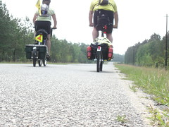
We got back out on the road and had not gone very far (just up a big hill outside Fair Haven) when we had to stop for a moment to right Nancy's chain; at that moment, two other cyclists appeared over the crest behind us and stopped to talk with us. They had left Boston just 8 days before, traveling a more ambitious 63 miles a day than our goal of about 50. They had arrived from Portsmouth, England, to ride cross country, and they are headed for Astoria by a route somewhat similar to ours, except that they will leave the Northern Tier in Ohio, heading southwest towards the Transamerica Trail in Kentucky.
After talking with them for a bit, they headed off down the road while we tended to Nancy's chain, but we soon caught up with them as they puzzled over the directions on their map (the same one we have, and are sort of following/ignoring as it suits us). They had missed a turn, and were trying to figure out where they were. So we told them about the Seaway Trail and what we were doing, and we rode with them for a while, hoping to have lunch together in Sodus Point. Somewhere near Wolcott, they must have stopped because when we looked back, they were gone, even though they had made it through the last light and there were no places to make a turn. We continued on to Sodus Point, thinking they would catch up.
Up and down, up and down we went, and so when we got to a point where the Seaway Trail continued forward but the ACA map turned towards the lake, we took the ACA route thinking it would put us on flatter terrain. Wrong. It was worse, if it were possible.
We had a lovely lunch at Captain Jacks in Sodus Point, and spent some time trying to identify a place to stay near our intended destination (there aren't any, it turns out). It was tough to use the phone because the maps it displays are so small, so we decided to ask if there was a library nearby. There was, in Sodus, about 3 miles away, so we headed there.
One thing we discovered was that there aren't any places to stay in the historic Ontario Beach Park section of Rochester, known as Charlotte. We were seriously thinking about stopping right there in Sodus because of the hilliness, not sure if we had another 25 miles in us (after already going 48 miles). But I identified a different route, and asked the librarians if it was feasible; they said it was, but that we'd be better off taking a third option, Old Ridge road, because it was flat. Flat!
We had settled on a place near West Webster, probably 10 miles from the festival. The route the librarians suggested was, true to their word, flat. Such a relief, after the hills next to the lake. And we got where we were going in good time, finishing with a total of 71 miles on the day.
We had dinner at a nice little Italian place near the hotel, Maria's, and shared a half-carafe of wine (that went straight to our heads). It was delicious!
We've touched base with Mary Beth and expect to meet her brother and his family tomorrow, and play it by ear. We'll probably go to Brockport and to the festival, and think about where to stay. We know we will be in Niagara Falls Sunday and Monday nights, so we have a couple of relatively easy days ahead of us. More tomorrow!More tomorrow!

No comments:
Post a Comment