Friday, September 08, 2006

Missoula!

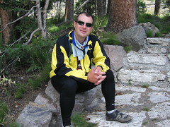
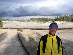
Wednesday, September 6. Conner, MT, to Missoula, MT. Rest day, September 7.

Missoula. The name was just a distant target many months ago, a foggy image of the place where the Adventure Cycling Association was headquartered, and where we would stop to tell them of our many exploits, the way we had cobbled together so many of their published routes, and what we had found that should be added to their maps or corrected.

Yeah. Then we decided somewhere in New York that we wouldn't stop there, since it was 13 miles out of the way. We figured the ACA wouldn't be very interested in our trip, since they undoubtedly see hundreds of other cross-country cyclists each year. We'd just be two more faces.

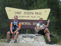
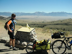
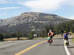
Then my drivetrain began to fail, and competent help seemed available only in Missoula. That, and one more package was waiting for us there. So we would go there after all. We would have to ride our longest day to get there; fortunately, Montana was fresh out of mountain passes, having hurled three of them at us in the past two days.

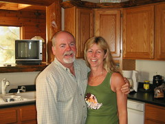
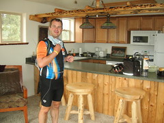
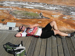
Leaving Conner was difficult - not because of the terrain, but because of the big, comfy bed Tom and Char had provided us in their guest house. True to form, we woke up just before 8 and joined our hosts for a good breakfast of cereal and bagels before leaving. They were a delight, and treated us tremendously well, all as they prepare for an open house on Thursday. Yes, the ranch is for sale; and it can be YOURS for the right price. And, if you have to ask . . .

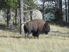
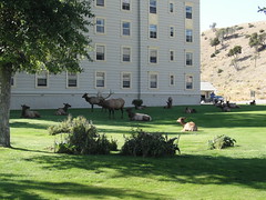
Their place is a prime 32 acres located on the West Fork Bitteroot River and comes complete with a guest house, main house and tipi with fireplace. There is also a resident moose nearby. If you are interested, let us know and we'll put you in touch.

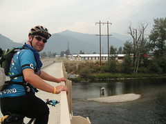
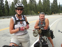
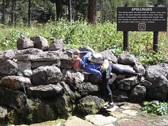
We made very good time on a clear, warm morning to Darby; we went through Hamilton, Corvallis and all they way to Stevensville before stopping for lunch. We found to our amazement that we had been averaging over 14 miles an hour over the 45 miles there.

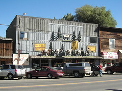
Arriving in Stevensville, Nancy initially pulled up to a place she thought would be good for lunch, but they were not open. Rolling up to the next intersection, we pondered where to go; and as we did, a woman walking by stopped to ask us about our trip. We answered her questions, and then asked her if she could recommend a place for lunch. She was happy to help; she pointed out two places, but said that she would choose the Old Coffee Mill and Eatery just across the street. That turned out to be an excellent recommendation - we had a very satisfying lunch there, including a fine dessert (oatmeal raisin cookie for me, chocolate-covered peanut butter bar for Nancy) and a relaxing hour or so.

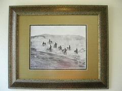
In the restaurant, numerous framed photographs hung on the walls, photos taken by a couple of locals (19 year old boys, we were informed). Some of the pictures looked remarkably like the Oregon coast, and so we asked about them - and found that they are indeed from parts of the coast that we might actually be pretty familiar with. Quite a coincidence, I thought. But then, the Oregon coast is a really remarkable and beautiful place, so perhaps we should not be surprised to see photographs of it placed on the wall as artwork. It IS art.

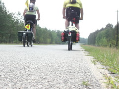
The road from Stevensville to Lolo, highway 93, is paralleled by a bike path the entire way, making that portion of the trek pretty stress-free. We did not meet another cyclist until after we went through Florence, and they were locals, not touring; they did not stop to talk with us, anyway.

Rain threatened off and on all the way to Lolo, and when we finally had to get on 93 for the last 13 miles into Missoula, it did sprinkle a bit; but it was too little to dampen our spirits. We had a wide shoulder and little wind, which, had there been more roads to choose from, might have caused us to question whether we were on the right road.

Missoula is a city that is alive with cyclists, even away from the U district on the east side of town. Paths line both sides of the Clark Fork River where it flows through the downtown area, with spurs that radiate off in various directions; but not only that, many of the main thoroughfares have bike lanes delineated on them. Bike parking abounds. It almost feels like Portland. Our arrival was too late to visit the ACA offices (or the post office, for that matter), so we got checked in to our accommodations and set ourselves to the necessary tasks of laundry and blogging. Nancy would post pictures tomorrow while I got my bike fixed, after we visited the ACA offices in the morning. It was a good plan.

After a very good night's sleep on the fluffiest bed we've slept in since, well, last night, we set off for breakfast and the post office. Char had provided us with a map of Missoula, a very good map produced by Discovery Map that looked like a cartoon aerial view of the city, with many specific businesses identified (including the bike shop where I will go for repairs). I love maps like this because it helps me visualize where things are more easily. So I planned to guide us to a cafe called Hob Nob Cafe on Main Street before going to the nearby Post Office; but, when we reached the spot where it should have been, it was not there. We stopped at the next intersection to discuss it (sense a recurring theme here?).

A man walking by asked if we needed directions somewhere, and I told him what we looking for and showed him the map. He took one look at it and said "Oh, that's an old one. Here, I have the latest edition. I'm the publisher." This turned out to be Kevin, and he actually is the publisher of the Discovery Map of Missoula; he had a portfolio full of the 4th edition (the one Char gave us was the 2nd edition). Don't you love coincidences like that?

He recommended a place nearby, the Shack Cafe, for breakfast, so there we went, and then off to the post office before going to the ACA offices. Unfortunately, the downtown post office is NOT the place where they handle general delivery - that is farther away on Kent Street. Hmph. We got some postcard stamps so the trip wouldn't be a total waste, and then walked over to the ACA offices.

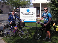
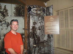
As you enter the Adventure Cycling Association offices, on the left, there is a large corkboard with pictures of the cyclists who have stopped in this year. Each photo has the name of the cyclist and the date they stopped in, and also where they came from and where they are going. We looked them over and saw pictures of people we had met, including Kim, Luke, and Blaise; the Chris's, headed to Denver from Anchorage, AK; and Bunny, Jordan and Katie, whom we had met outside Riverside, WY.

We got our picture added to the wall, and I took advantage of the computer they make available to check e-mail (and attachments); and while we were there, the ACA staff photographer asked to take our picture in a more formal fashion, such as they might publish in their monthly magazine Adventure Cyclist. I don't harbor any beliefs that our pictures might be published, but it was fun to have them taken anyway.

The ACA staff was not exactly ebullient, which I must admit was disappointing but not really a surprise. I was just happy to add our image to the board, with the longest itinerary I could find there. That's something, but it was not the goal of this journey, of course.

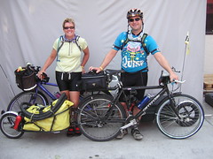
We set off for the bike shop, and when they had set to work Nancy took off for the post office where they DO handle general delivery. When she returned, since my repairs were not yet complete, she took the opportunity to look around; and she found a bargain on the last two Craft lightweight thermal jackets in the shop, marked down 40% and in our sizes. Was it a sign? I think so. We got them both.

Nancy left again, this time to get some pictures posted (at last!) while I continued to wait for the repairs to be finished; and when I took a test ride, the tech said that the frame might actually be flexing enough to allow the chain to come off the gear in front. That means I will not be able to exert the full force I am capable of exerting on the pedals, which actually is a good thing - it means the chain and the rest of the drivetrain might actually last longer. It also means I will probably have to get a new bike when we settle in Portland. Gunnar, any advice? I already know the answer to that.

I took a spin out on the paths along the river and found myself at the baseball stadium for the Pioneer League team here, the Missoula Osprey. They are a farm team for the Arizona Diamondbacks, and their last home game of the season (before the playoffs, that is) is scheduled for tonight. Seems like a good diversion - and the first opportunity to catch a ballgame since we left Lawrenceville.

We walked to dinner at a mexican place near the hotel, and then walked through Caras Park and past the carousel that was installed in 1995. We watched as a girl on a multicolored horse repeatedly grabbed plastic rings from the mouth of a dragon as she whooshed by. After the carousel stopped briefly so more people could get on, she continued to gather rings until, at last, there were no more.

We got to the ballpark in the bottom of the second, and the Osprey were already leading 3-1. We had no sooner sat down when one of the Osprey players pounded a long home run to extend the lead to 4-1. Before the end of the third, the lead was 6-1, and although the visiting Helena Brewers posted 3 in the fourth, the Osprey went on to win it 6-4. The between-innings activities included ushers hurling bags of Cracker Jacks and Peanuts into the crowd, a young boy leading the crowd in the YMCA dance, and a tire rolling race. Also, everyone entering the park received a numbered team photo, and prizes (mostly gift certificates to local businesses and signed, game-used memoribilia like baseballs and broken bats) were awarded based on the number on the photos. We didn't win anything. We also bought some 50-50 raffle tickets to support a local middle school - and didn't win that, either. Still, we did find out what the giant L stood for on the mountain next to the mountain with the M on it - it stands for Loyola High School. One mystery solved.

Tomorrow we set off for at least Lolo Hot Springs, and perhaps farther. It remains to be seen whether we can climb all of Lolo Pass in one day. We'll see!

Thursday, September 07, 2006

The Bitterroots


The Bitterroots
Originally uploaded by nstovall8.
The Bitterroot Mountains and Bitterroot River are very scenic spots.

The Formal Portrait


The Formal Portrait
Originally uploaded by nstovall8.
The "official" picture, on the loading dock of the Adventure Cycling

Association offices. Their copy is a black and white, non-digitized

version. Both were taken by a professional photographer, Greg Siple.

A Kodak Moment


A Kodak Moment
Originally uploaded by nstovall8.
Outside of the Adventure Cycling Offices in Missoula, MT, an informal

picture for this year's wall of touring cyclists.

Tom & Char


Tom & Char
Originally uploaded by nstovall8.
Our hosts at River Dance Ranch in Conner, MT, just outside of Darby. We

enjoyed their company, their guest house, and their resident moose.

Guest House


Guest House
Originally uploaded by nstovall8.
Tom and Char graciously invited us to spend the night at their ranch--little

did we guess we'd have such posh accommodations!

Sarah and David


Sarah and David
Originally uploaded by nstovall8.
After smoking my brakes a little, we're able to stop on the downhill slope

of Chief Joseph Pass to talk with Sarah and David. They live in Essex,

England, but love to cycle in the US.

Chief Joseph Pass


Chief Joseph Pass
Originally uploaded by nstovall8.
At the top of Chief Joseph Pass we make our final crossing of the

Continental Divide. For the remainder of this trip, we're on the Pacific

side.

The Innocents


The Innocents
Originally uploaded by nstovall8.
A notorious gang of criminals would rob stagecoaches and other travelers on

this stretch of road in Montana, then beat feet back to Robber's Roost.

This building isn't the original Robber's Roost, but is built on the spot of

the original and did serve as a stagecoach stop until the trains made them

obsolete. Turns out that the sheriff in Ennis was the gang's leader. No

mention if he was also the coroner.

Pronghorn Deer


Pronghorn Deer
Originally uploaded by nstovall8.
On our way to the Big Hole National Battlefield, these deer were grazing

quite close to the road. They spooked a little as we slowed and then

stopped, but I was still able to get a decent picture. They're such

beautiful animals.

Jackson Hot Springs Lodge


Jackson Hot Springs Lodge
Originally uploaded by nstovall8.
The lodge where we met Tom & Char, and Ann Mary & Diane. And had a great

dinner.

Neigh-bors


Neigh-bors
Originally uploaded by nstovall8.
No rooms were available in Sheridan, but we had a lovely campsite and very

nice neighbors at the town's ballpark.

Kim & Matthew


Kim & Matthew
Originally uploaded by nstovall8.
In Virginia City, we meet up with Kim who is cycling her way from Seattle to

Connecticut. She saw our bikes and looked for people in bike shorts. She

found us at the ice cream place--duh.

Ennis Cafe


Ennis Cafe
Originally uploaded by nstovall8.
Ennis is a small town with a western flair and a lot of cowboy character.

Between Ennis and Virginia City


Between Ennis and Virginia City
Originally uploaded by nstovall8.
At the top of the 10-mile climb out of Ennis, you can look down the valley

and almost see how far you've come. It's all downhill from here!

Tie One On


Tie One On
Originally uploaded by nstovall8.
We arrived in Ennis just in time for the big "Tie One On" fly fishing

festival. Big doings in town; we were lucky to get a room for another

cold night.

Montana!


Montana!
Originally uploaded by nstovall8.
I can hardly believe that we're in Montana--but still in Yellowstone Park.

Only a few states left to traverse on our way to the Pacific Coast.

Bacteria Mat(t)


Bacteria Mat(t)
Originally uploaded by nstovall8.
After a couple days without a hotel room and private shower, he's just one

big Bacteria Mat(t).

Who Pooped in the Park?


Who Pooped in the Park?
Originally uploaded by nstovall8.
In almost every gift shop in the park, we see copies of a kids' book

entitled "Who Pooped in the Park?" I was able to get digital documentation.

History of Bicycles in Yellowstone

Since the early 1900's, folks have ridden bicycles in Yellowstone. How come

there aren't better facilities?

I Am the Boss of You


I Am the Boss of You
Originally uploaded by nstovall8.
The other young buck in this herd now gets his life lesson today.

The Floor Show


The Floor Show
Originally uploaded by nstovall8.
Outside our window at the Mammoth Hot Springs Hotel, the players gather on

the lawn for today's performance.

The Army Bicycle Corps


The Army Bicycle Corps
Originally uploaded by nstovall8.
This Army Bicycle Corps was stationed in Missoula, and sent on a 900-mile

tour of Yellowstone Park. So far, my favorite photo from early park days.

Terraces With Water


Terraces With Water
Originally uploaded by nstovall8.
This part of the terrace is still fed by the hot springs above it. No

telling how long any of these thermal features will last, given the effects

of any earthquakes or other seismic activities. Plan your vacation now!

Missing Camera


Missing Camera
Originally uploaded by nstovall8.
On the decking near Mammoth Terraces, we noticed this camera mount. Some

clearly disturbed it.

On the Steps at Apollinaris Spring

Not many stop at Apollinaris Spring these days, but when stagecoach was the

only way to travel, a stop here was a welcome treat.

Taking a Drink


Taking a Drink
Originally uploaded by nstovall8.
It's not as easy at it looks, and of course now there's a warning to treat

the water before drinking it. Ignorance can lead to dysentery, I guess.

Canyon Lodge


Canyon Lodge
Originally uploaded by nstovall8.
Canyon Lodge is a 50's-era hotel spot in the Park. What is most charming,

though, are the elk who wander past your bedroom window.

Clever Coyote


Clever Coyote
Originally uploaded by nstovall8.
On a short stop at Obsidian Cliffs, a local coyote picked his way through

the meadow, across the road, and into the forests around the cliffs.

Porcelain Basin


Porcelain Basin
Originally uploaded by nstovall8.
After the storms had passed, we rode up to the Porcelain Basin near Norris

Junction to see the thermal features there. We also got treated to a double

rainbow.

Glacial Leftovers


Glacial Leftovers
Originally uploaded by nstovall8.
This stone was left behind by a glacier. Trees are growing up around it

now.

Yellowstone's Grand Canyon


Yellowstone's Grand Canyon
Originally uploaded by nstovall8.
The Grand Canyon of Yellowstone Park is pretty spectacular. I should have

been paying attention during that geography lesson.

LeHardy Rapids


LeHardy Rapids
Originally uploaded by nstovall8.
LeHardy Rapids really nice spot for a short break, even though it was still

pretty cold that morning. Thousands of fish swim up the rapids every year

to spawn.

Park Slang


Park Slang
Originally uploaded by nstovall8.
In the early days of the park, you could either stay at the posh Lake Hotel

or at the prmitive Wylie Tent Village. A sort of Yellowstone slang

identified guests as a dude or sagebrusher. Staff had their own nicknames,

too--I want to be a "heaver" when I grow up.

Family Portrait


Family Portrait
Originally uploaded by nstovall8.
Before we parted ways in Yellowstone, we paused for one last group photo.

(with the limited selection of colors in bicycle clothing, we all just ended

up matching each other most of the time) Left to Right: Rob, Matthew,

Melanie, Deanne, Jess, Nancy.

Family Vacation in Yellowstone


Family Vacation in Yellowstone
Originally uploaded by nstovall8.
Matthew's trying to convince the Park Ranger that we're all a family--mom,

dad and 4 kids. Jess helped out by rolling up and fighting with Rob over

the park map (Daaaaad! It's MY turn to get the map!) The Ranger let us all

in our our Park Pass--perhaps despite ourselves.

Ready . . Set . . Go!


Ready . . Set . . Go!
Originally uploaded by nstovall8.
My camera took the shot before everybody was in place--a pretty good action

shot, tho. Left to Right: Rob (halfway up the sign), Matthew (directing),

Deanne (casually composed), Melanie (just about made it), Jess (something

she'd prepared earlier) and Nancy (did the camera go off?)

The Grand Tetons


The Grand Tetons
Originally uploaded by nstovall8.
We decided that traveling from east to west you'd get the best views of the

Tetons. They about take my breath away.

After the Stack


After the Stack
Originally uploaded by nstovall8.
But, he finished the whole stack.

Yes Folks, He's A Real Engineer


Yes Folks, He's A Real Engineer
Originally uploaded by nstovall8.
After I'd left my BOB locks at a roadside stop, Matthew fashioned closures

for me from a plastic coathanger he found on the side of the road. They

actually work better than the locks did.

The Downside of Togwotee Pass


The Downside of Togwotee Pass
Originally uploaded by nstovall8.
Deanne and Jess are pointing to the sign that declares we're heading toward

a 17-mile, 6% downgrade. The sign lies. Rob and Matthew are in front,

Melanie is already halfway down the mountain.

Topping Togwotee Pass


Topping Togwotee Pass
Originally uploaded by nstovall8.
Thanks to Melanie's drive, and everyone else's compassion, we made it to the

top of Togwotee Pass in a single day. Thirty (30) miles of climbing to the

top--only 3 miles in the back of a pickup because of road construction.

Ice Slough


Ice Slough
Originally uploaded by nstovall8.
This little creek flows into the Sweetwater River, and was well-known to

have ice in it well into July. Today, there's not even any water in the

creek, although I did talk with a cyclist who slept here and complained that

he was nearly carried off by mosquitoes.

THE Trail


THE Trail
Originally uploaded by nstovall8.
For a while, we followed a very well-known trail, used by folks heading to

Oregon and California, as well as the Mormon pioneers on their way to Utah,

and the Pony Express Riders on their way to deliver the mail. Where the

asphalt has not covered them up, you can still see the ruts made by wagon

wheels.

Split Rock


Split Rock
Originally uploaded by nstovall8.
This was a well-known landmark, used by many travelers in the area. You

could see it for days before you reached it--sort of a high plains Statue of

Liberty.

Bill At Bill's Peak


Bill At Bill's Peak
Originally uploaded by nstovall8.
We met Bill near Rawlins, and rode with him when he felt like slowing down.

Here he is at Bill's Peak.

Continental Divide #1


Continental Divide #1
Originally uploaded by nstovall8.
Detour and I catch a break at the top of the Continental Divide.

Luxury in Conner

Tuesday, September 5. Jackson, MT to Conner, MT.

Our original plan for today was to end in Darby, but with Tom and Char's generous offer of sleeping at their ranch, we would stop about 8 miles short of Darby. Even so, we rode over 70 miles.

The road from Jackson to Wisdom was a fast 18-miles. Of course, in my head I'm doing the math and thinking that at this rate, we'll be in Conner before lunch. Right before arriving in Wisdom, I noticed some short cone-shaped objects and then realized that I was looking at an airport runway. The flight control "tower" appeared to be a small building with a half-moon on the door . . .

At Wisdom, we turned off Hwy. 278 and began a 27-mile climb to Chief Joseph Pass. Like the climbs from yesterday, this one started out very gradually. At about 10 miles into the climb, we pulled off for a visit to the Big Hole Battlefield National Monument. The monument commemorates the slaughter of Nez Perce Indians by US forces under the command of General Gibbon. The Visitor Center shows a 25-minute historical video, and there is also a small museum with original artifacts from the battle, including Chief Joseph's red jacket. It is a sad place, though, and the Nez Perce return every year in early August to remember the battle.

We left the battlefield around 2pm, and got to the top of Chief Joseph Pass right before 4pm. It is a very cool thing to be riding in a valley, then foothills, and then be surrounded by the forested mountains. At the top of the pass we were once again at the Continental Divide, at an elevation of 7,241 feet. We could see Idaho and the Lost Trail Pass, named by Lewis and Clark because it was an Indian trail which was notoriously difficult to follow.

We turned onto Hwy 93, and began a really long--9 miles--downhill. And not just a descent, but a screaming descent, accompanied by twisting, turning switchbacks. There were a number of places where I had to apply my brakes to keep under the posted speed limit. Through the tears in my eyes, I strained to watch for any bumps or irregularities in the road--now would not be a good time to lose control of my bike. Every now and again, I could smell something and wondered if it was my burning brakes. Turns out that ahead fo me, Matthew was wondering the same thing. He finally realized that the car in front of him was riding its brakes the whole way, and that's what we smelled.

After about 3 miles into the downhill, we saw two cyclists coming up the pass. My brakes squealed as I slowed and then finally stopped. Sarah and David are traveling from Essex, England, riding from Alaska to Denver. They do a lot of cycle-touring, and enjoy traveling in the US. This year they only have 3 weeks vacation, but last year they had 6 months and were able to ride the Pacific Coast and then both the north and south islands of New Zealand. They had started the day from Hamilton, and would end their day at May Creek Campground--about 5 miles from the top of Chief Joseph Pass. Hope they have a chance to check in on the blog--pictures will be uploaded in the next few days.

Our steep descent continued for another 6 miles, through the Bitterroot Mountains, putting this downhill at the top of my list of favorite downhills. Even after the sharp decline ended, we rode generally downhill for another 14 miles to the Conner Cut-off. At the cut-off, we stopped to call Tom and Char, letting them know we were near their ranch.

Tom met us at the next turn, and we followed him back to the house. He showed us their guest house over one of their outbuildings, and invited us to take showers and then come over to the house.

The guest house was a beautifully-appointed apartment, including a fireplace, kitchen, bedroom and full bath, all decorated with a western flair. Really, really nice. I wanted to dive onto the bed as soon as I saw it--an extra-tall bedframe, lovely quilt, fluffy pillows were calling my name. But hunger won out, and we were soon showered and headed to Tom and Char's house.

From their back porch, binoculars in hand, I saw my first live moose. He's a bull, and according to Tom is about 5 years old. He's been in and around their property for the last few years, so they've kind of watched him grow up. He was on the other side of the river that runs through their ranch, the West Fork Bitterroot River. The moose was calmly munching on leafy tree branches, and I was surprised to see that he was nearly all black, not black and brown as I had supposed. It was fun to watch him for a little while--until Char arrived with a plate of cheese, crackers and fruit.

Tom has a fully furnished tepee down by the river, too. Carpeted, with a fireplace and furnished with a futon for sleeping. Tom offered to let us sleep there, and I was tempted. Close to the river and the moose, but I knew that Matthew would be happier with four solid walls and a roof over his head.

Tom and Char drove us to dinner at a local place--the West Fork Lodge--where we met the owners, Heidi and Tex. After a great meal, and beer from the Hamilton Brewery, we were very ready to crawl into--onto--that comfy bed. I was asleep within a few minutes, and didn't move until the next morning.

Wednesday, September 06, 2006

I'll Pass

Monday, September 5. Dillon, MT to Jackson, MT.

Even though today's mileage would be less than 50 clicks, we'd be climbing two mountain passes with only a 13-mile gap between them.

We're now in the Bitterroot Mountains--these mountains stood between the Discovery Corps and the Columbia River. They're a rugged range, with velvety foothills and craggy peaks. Smoke haze from Montana's various wildfires are veiling our views of the range, and roughening our throats as we roll along.

Before I even think about climbing a mountain, I have to have breakfast. We could, of course, have breakfast in camp, but our uninvited guests are still sleeping it off in their pickup truck, so we opted to break camp and find someone else to make us breakfast. Just on the outside of town we find Sparkey's Garage--fortunately, they're serving breakfast. And just what can you get for breakfast at the garage? Weak coffee, for one thing. Sort of surprising, really. I always thought that motor oil was really just coffee that had been left on too long, Nevertheless, Matthew got the "Standard Service"--ham, eggs, hashbrowns and toast. I had my perennial favorite--french toast. If I can't get the caffeine I need, then I make do with a sugar high.

By the time we finished breakfast, the sun was warming up the day. I was actually looking forward to climbing the passes. Not that I've become some kind of hill-acious addict; I have just come to realize that I can do these hills. The mountain ranges in the West have manageable grades, unlike the painfully steep grades found in the East. So, while I know it's going to take me a while, I do know I'm going to get to the top. And now that Matthew is handicapped thanks to his damaged middle ring, I can sometimes beat him to the top.

As we leave Dillon, we ride by newly-mown hay fields. The smell of the timothy and rye grasses drying in the sun is one of my favorite smells. Apparently it's also irresistable to the local deer population, because the fields are filled with several hundred deer. They're too far away to tell if they're pronghorn deer or just the garden-variety, but they do look very domesticated, lounging on top of the soon-to-be-baled hay.

Badger Pass is our first climb, 19 miles outside of Dillon, 6,760 feet high. We're already at 5,200 feet, and I'm hoping that the 1600 feet of climb will be a gradual climb. Of course it's not, and the last 3 miles to the top are slow, slow, slow. It's now 1:00pm, and we stop for about a half hour to rest. After stretching our legs and having a snack we roll back down to about 6,000 feet, and then start the next climb.

Big Hole Pass is at 7,360 feet, so we only have about 1300 feet of climbing left. Just like Badger Pass, the last 3 miles are the worst, but at last we make it to the top. It's just 4:00pm, but the next 11 miles are a downhill slope to Jackson. We make it there in under 45 minutes.

Jackson has a population of 50, and just a couple of businesses are located on Hwy 278, the main drag. The Jackson Mercantile and a garage (one that services cars) are across the street from the Jackson Hot Springs Lodge. This is a home-grown, real-Montana-rustic place. The majority of cyclists on this route stop here, if only to camp. The fee for a patch of grass out back includes use of the hot springs. We're here for a room, though, and tonight we're in luck. The Labor Day Weekend traffic has all headed home, and rooms are readily available. This is not to say that the place is deserted, though. I was surprised to see the lodge's restaurant fill up with dinner guests. There were a number of cars outside cabins and rooms, and the rooms on either side of ours were both occupied.

As we were checking in, a couple arrived wearing leather motorcycle chaps. We nodded hello, and to my surprise, the man asked how we liked our BOB trailers. He said he'd just gotten one, but hadn't had the chance to use it. We'd meet this couple in the restaurant a little later, and find out they had been out for a drive from their ranch in Conner. While they had a beer, we chatted about our trip. When they found out that we were heading to Darby, he drew us a map with directions to his ranch, and invited us to spend the night with them. We accepted, and it was only at this point that we introduced ourselves. Tom and Char wanted to pay forward the courtesy and kindness shown to them when they've been bicycle touring--we were the lucky recipients.

The restaurant at the lodge was a complete surprise. In this one-horse town, I thought the best I could get would be a grilled cheese. But the lodge has a complete dinner menu, including a salad bar with spring greens, garbanzo beans and five varieties of fresh fruit. Matthew had chicken breast stuffed with feta cheese, spinach and sundried tomatoes on a bed of saffron rice; I had a 3-cheese pasta with cherry tomatoes and green snap peas that tasted so fresh they must have been picked while I was watching the deer grazing.

While we were having our salad, two women came in and sat at a table near us. We struck up a conversation with them, and soon found out that they were visiting Jackson from Missoula. We also found out that they had both lived for some time in Portland, OR. Ann Mary had been a Portland city commissioner; Diane is now running for a legislative seat in Missoula. We hit it off with them right away, and enjoyed their take on life in Portland and Missoula. They also gave us a heads-up on the Nez Perce Battlefield National Park just ahead of us on the way to Darby, and a good book store in Missoula. We probably won't see them in town; they don't plan to be back until after we've gone. Dessert and coffee (real, rich coffee) gave us an opportunity to continue our conversation, and we talked about Yellowstone Park (they visit the park a lot), moose sightings (us-0, them-lots) and grizzly attacks (Diane lost friends). Maybe we'll catch up with them on a visit to Portland--Diane mentioned that her brother lives in Tuallatin.

After dinner we toyed with the idea of finding the elusive hot springs at the lodge. Really, it's the whole reason the lodge is there, and yet we couldn't find any sign of it (them). I'd been reading a Montana Magazine write-up about the lodge, and discovered that the hot springs are nothing more glamorous than a cement pond. And while you'd think that after climbing two mountain passes we'd both be ready for a soak in a hot springs of any kind--we both took a pass on the pond. And passed out in bed a short time later.

Tuesday, September 05, 2006

Dual-duty Day

Saturday, September 2. Ennis, MT, to Sheridan, MT.

We knew that the first thing we would have to do today (on our bikes, at least) was climb the 10 miles to the pass between Ennis and Virginia City, and we were a little anxious about it. We didn't know yet whether we were going to stay in Virginia City or go on to somewhere down the road, so the climb might be just the first thing we did or it might be all we did. So to get ready for the task, we sat down to a hearty breakfast at Yesterday's Cafe.

We also decided to take care of a minor issue with our car back in Lawrenceville, which for Mary's sake I will not go into here; suffice to say that we had to send a fax identifying ourselves as the owner and authorizing Dan to retrieve the car. Simple, just send a fax with the proper information and a written letter explicitly identifying Dan as the one to give it to, right?

The drugstore's fax machine is set up so that it blocks it's ID from caller ID systems on receiving fax machines; the place where we had to send the fax will not accept faxes from places that block their ID. We had to fax it somewhere else; so we called Mary Beth (who's in Canandaigua, but gave us her fax number at home where Andrea could retrieve it), and sent it there. That worked, and hopefully that's the end of it.

All this took time, and by the time it was all over we were leaving Ennis around 11. We didn't even need our jackets anymore, and soon we were hot from the effort of climbing, and wanted to shed even more layers. We only stopped twice on the way up, once at the scenic overlook so we could look down into the Madison River Valley.

At the overlook there was an informational display about the importance of maintaining the land for the wildlife, and that the most dire threat to the wildlife now was the ongoing subdivision of ranchland for the purposes of development into homes. There was also a small engraved marker down the hill a little, memorializing a woman as a "loving mother"; clearly, her children had come here, to this overlook, which might have been one of her favorite places, to place a marker to remember her. There were some small red flowers carefully placed next to the engraved stone. We didn't know this woman, but her kids had taken the effort of placing the memorial, so we paid our silent respects.

From the top of the pass we commenced a screaming 5-mile downhill to Virginia City. As we approached town, I could see the speed limit signs and realized I was speeding, and not by just a little; the speed limit abruptly changed to 25 and I was moving at over 40. I wasn't anxious to get a ticket, but a small part of me wanted one just so I could frame it later. No such luck.

It's odd; whenever we reach a new town, one of the first things we always manage to find is the ice cream shop, if one exists (and don't you just pity the towns that don't have one?). Arriving in Virginia City, true to form, we immediately found the ice cream shop (with a small motor operating out front, connected by pulleys to two old-fashioned wooden ice cream buckets, constituting their manufacturing center). We met Kim while having real handmade ice cream in the seating area by the sidewalk; she had seen our bikes and spotted us right away (very few other people were wearing spandex).

Kim is riding across the country West to East, having started in Seattle, and is hoping to be in Connecticut by the first part of November. She has been through Glacier National Park, and had forged her own path down to Missoula and onto the TransAmerica Route; she is pretty pragmatic about the possibility of snow later on, indicating that she'll get there some other way if necessary (she had to attend a wedding the first part of August, which is why she left so late).

We exchanged information about our respective experiences, what to expect and so on, what other cyclists we had encountered (she had met the Fab Four and had heard about us already from them), and advice about places to stay and places to avoid. Kim has a blog, but her sister is the one who updates it most of the time; the URL is becycle.blogspot.com.

We had a nice long chat, long enough that by the time she left, we were hungry for lunch, so we ate at the Virginia City cafe, something quick and light, expecting to essentially roll the rest of the way into Sheridan (we decided to go there over lunch). The profile on our map shows it as a pretty steady downhill. Yeah, right.

Before we left Virginia City, we met a family from Billings; the woman told us that her father had cycled from Chicago to their new home there. They told us they had just bought a piece of land in Ennis, subdivided from a much larger ranch. We guessed they hadn't stopped at the scenic overlook, or if they had they didn't read the sign; whatever the case, we smiled politely and edged away.

We left Virginia City around 3:30 for Sheridan, and immediately found the headwind we had been expecting. While it is generally downhill to Sheridan, the profile omits the fact that there are two mile-long climbs along the way, features that seem large enough to have found their way onto the profile map; but, as we have noted before, the profiles provided on these maps are woeful and generally tell us what NOT to expect on the way. We now refer to them as "poorly estimated elevation profiles", or PEEPs. We THINK we're getting good info, but we're not.

On the way between Alder and Sheridan, we met Luke, another cyclist Kim had told us about. He is a recent High School graduate taking a year off to tour the country by bike before going to college. He has a blog, too: www.crazyguyonabike.com/doc/alongstrangejourney. He said he does try to update it as often as he can, but sometimes that means a week or so.

To the title of this entry: we were amused to see campaign signs for someone running for Sheriff AND Coronor, and got a picture of it. In rural areas like this, many times people have to pull double duty (and so do PLACES, like the Post Office/convenience store/saloon/cafe/RV Park in Cameron, which we passed on the way). In Sheridan, it is the IGA and Ace Hardware where Nancy ultimately went to get us dinner.

All three hotels in Sheridan were full because of the county fair in Dillon; as a result, we ended up camping at the town park, which itself pulls double duty as a ballfield and tent campground. At first, as Nancy went off to the store, I scoped out places to put the tent near the small river that wound through the park; but then, I thought I would see if I could open one of the bathrooms near the ballfield. One was locked, but the other one was open, so I didn't even have to try to break in. I realized that putting the tent nearer this small brick building accomplished two things; one, it was near the bathroom, and two, it shielded us from the road and most of the streetlights there (and the prying eyes of passing drivers). In the field next to us there were three horses; beyond the trees next to the river we could hear cows bawling at each other. To cover those sounds, I brought out my XM radio, but found that to receive a signal I had to hold the small antenna up above the picnic table. If only I had something rigid to attach it to, I thought, looking around for something suitable - then I saw the flagpole on the back of my trailer. Wedging that pole into a small hole on the end of one bench, and attaching the antenna to the top, created what Nancy called XM "on a stick". We had a good jazz accompaniment with our camp dinner.

Nancy discovered, while at the store, that the town has free wi-fi on Main Street; that would have been useful if we were actually ON Main Street, but it was still impressive.

Overrnight, it got very cold next to the creek. Now that we're sharing a large human stuff-sack, Nancy's staying a lot warmer on these cold-camp nights. However, in her efforts to absorb some of the warmth I radiate at night, she pushed me to the brink of the air matress in the middle of the night. The only thing holding me on it was the sleeping bag; I hung precariously over the edge. After a few adjustments, we were comfortable again, but the dangers of the combined sleeping bag remain.

We're going to Dillon tomorrow, and expect to have to camp again, with the fair still going on; but at least there is a KOA there, which means real showers and real laundry. Maybe we'll go to the rodeo for Jess' sake. We'll also be going to the Patagonia outlet store, which ships things for free if you are a touring cyclist, opening up all kinds of purchase possibilities. We'll just see if they have anything left in our size; this weekend is their big Labor Day sale, half off everything. I can't wait to see what they have.

We're out of that . . .

Sunday, September 3. Sheridan, MT, to Dillon, MT.

We awoke to cows mooing this morning; the ones making all the racket last night were the same ones making all the racket this morning, we supposed. We lay there for a bit, listening to them, before finally getting up around the crack of 8.

We had camped for free in the Sheridan town park, and for a change the morning was warm (surprise!) when we got out of the tent. We had our usual camp breakfast of oatmeal, peanut butter and honey wraps, and coffee, before packing up and heading off downhill to Twin Bridges.

We managed to average nearly 15 mph on that first leg to Twin Bridges, heady stuff after some of the laborious and difficult days we have had before. In town, we turned west onto SR 41, in the direction of Beaverhead Rock and Dillon.

We had been warned by eastbound cyclists about this 18-mile stretch of highway 41; there are no shoulders and, with rolling terrain, limited sight distances much of the time. We knew we would have to ride VERY defensively, and perhaps even tick a few drivers off in the name of safety, but we felt up to it. Since it was a Sunday, I even thought people might be a little more courteous; these are proudly God-fearing people, after all.

Well, I was wrong. There were lots of rude drivers on 41, even one woman driving a car full of children that flipped us off and shouted an obscenity as she passed. Many drivers, unable to see far enough ahead to safely pass, stomped on the gas pedal and brushed by us far too close as they tried to stay in their lane. By the time we finally reached the part of 41 that has a decent shoulder, I was livid; I wanted to tell Montanans that in 5500 miles, through 16 states, two Canadian Provinces, and even WASHINGTON DC, we had not encountered as many jerks as passed us on 18 miles of a Montana road, and that they should be profoundly embarrassed. Even the drivers in SOUTH CAROLINA seemed like the epitome of courtesy by comparison.

We passed Beaverhead Rock at about 23 miles, and stopped to read the markers for the wetlands there, and for the rock formation itself. The wetlands, the Montana DOT is very proud to tell you, were created by the DOT on land that USED to be wetlands but which were drained for grazing purposes. This effort was done to mitigate the effects of road construction elsewhere in the state (which, one should infer, involves the destruction of wetlands). The area was populated by large numbers of sandhill cranes, ducks, herons (we think), and at least one deer we could see. It made for a nice diversion from the idiot Montana drivers.

There were no hotel rooms in Dillon, as we expected, but the KOA was just down the road a bit, so we went there to set up camp and leave our trailers to ease the ride around town. We got some free water from a church group doing "community service" and handing out information about their organization before going to get a campsite; we also stopped in at the Chamber of Commerce to find out where the Patagonia outlet was, and while there also saw a beautiful Lewis and Clark quilt that had recently been made specifically for display there.

After setting up camp, we went off to the Patagonia outlet; it was a busy place. Numerous people, like us, were busily pawing through every rack in sight looking for things in their size. We got two new waterproof jackets, four thermal layers, two hats, a scarf, and a pair of swim trunks for, all told, the regularly-marked price of just one of the jackets. We had decided to get new jackets because our old ones have stopped being waterPROOF and have started being waterABSORBENT. Nancy would later donate her old jacket to a nearby church thrift shop.

We also went to Sagebrush Outdoor, right next door, and got Nancy's sunglasses replaced (20% off!); she has been dealing with a cracked lens ever since she accidentally sat on them in Indiana. They had the very same pair, so naturally, we saw that as a sign that she had suffered enough, and bought them.

Back at camp, we went swimming while doing the laundry; there, we watched several kids tormenting each other with an inflatable raft (and happy about it, apparently). We tried to occupy a few spots at the far end of the pool but inevitably got splashed repeatedly, and ultimately had to admit defeat and get out.

Once all our little housekeeping chores were done, we decided to go get some dinner. The seemingly straightforward job of finding a place that had viable vegetarian options (for the newly-converted Nancy) and which did not reek of smoke proved more difficult than you might think. Finding the first three separated from the public by smoky "casinos" or "saloons", we were thrilled to finally find one that proudly proclaimed itself smoke-free. There was really only one vegetarian option for Nancy, though - not a problem in itself, at least not until the waitress informed us that the chef was OUT OF PASTA (I wanted pasta too). We were in some disbelief that a good portion of their menu was simply not available on this, possibly their busiest weekend; the truth was that the chef had run out of COOKED pasta, and that some was being prepared as we quizzed our waitress about whether there really wasn't any more pasta, and prepared to tell her that there was an IGA right ACROSS THE STREET.

So, there was pasta, but it would be a little while before it was ready. That was fine; Nancy got a glass of wine, and I ordered the restaurant's signature Margarita. But, strike two, the bartender couldn't make their SIGNATURE DRINK because she was OUT OF TWO OF THE FIVE INGREDIENTS. I felt like I should point out that there was a liquor store WITHIN SIGHT of the restaurant, but refrained, and got a soda instead..

Then, strike three, the chef informed us that he was OUT OF ALFREDO SAUCE. He had enough for Nancy's dish but not for my order, and wanted to know if substituting shrimp scampi (and tomatoes and mushrooms) would be OK. I agreed, figuring we had already found the only smoke-free restaurant and that leaving now would just leave us hungry.

To the chef's credit, the dinners were great. We were pleased to see that they were not out of coffee, and so we each got some, and asked about desserts. Strike four, they were OUT OF ICE CREAM. I couldn't help myself; I finally pointed out that there was a grocery store across the street, but I don't think it registered with the waitress. We got the tuxedo cheesecake instead, which turned out to be pretty good. All in all, we were satisfied, despite the many things they were out of. I gave them high marks for effort in the face of those embarrassing shortages.

Returning to our campsite after dark, we knew it would be a while before the ambient sounds died away; there was the Aaron Tippin concert that started at 8, and the Beaverhead County Fair would be going until late. We also realized that we could hear the music coming from the downtown square, nearly a mile away, and that would not cease until after 2am.

We decided to lay in our tent and read. I still had nearly 180 pages to read in my book, so I figured I could read until I was tired and sleep regardless of the noise.

I finished the book around 3am; the people at the adjacent campsite had returned around 2am and had stood around talking loudly until nearly 3. I could also hear the sound of a truck engine idling: I figured when they were done talking, someone would get in the truck and leave, and it would be quiet.

In retrospect, I should have gotten up to investigate when, finished with my book, I could still hear the engine idling but nobody talking. I lay there for quite a while, getting more and more irritated that someone had just left their truck idling so near that I could smell the exhaust; I think I finally slept a half-hour or so but after the alarm went off at 6, and I abruptly realized that THE TRUCK WAS STILL RUNNING, I was in disbelief. I finally got up to see what was going on.

Our neighbors had stuck some of their drunk friends into one of their trucks and PARKED IT ON OUR CAMPSITE, which is why it seemed so near. It was near. Hell, it was just about on top of us.

Later, I realized what I should have done; I should have gotten in to the driver's seat, driven the truck to the road out in front of the campground, parked it in the middle of the street, and then taken the keys, arming the alarm before I left, with the three passed-out passengers still in it. Instead, I was so incensed that I went straight to the office to ineffectually complain. They said, in essence, that it was better than last year, and that it wasn't really all that bad.

Nancy has helped to teach me how to take this kind of transgression in stride; earlier, I was emotional and angry, but later I was able to laugh about the sheer idiocy of the whole situation, including my own stupidity. I hope to be able to just roll my eyes and let it go soon. Soon.

Tomorrow is a big day - two mountain passes. That's why we wanted pasta - for the carbohydrates. We'll see how that pans out.

Monday, September 04, 2006

I've Got Spurs, That Jingle, Jangle Jingle

Friday, September 1. West Yellowstone, MT to Ennis, MT. As we left town this morning, we encountered road construction right at the edge of town. We didn't have to wait long for the pilot car, though. Seems that there was a "government horse" with colic that needed to get to the vets. We had about 9 miles of smooth, new pavement before turning left to stay on Hwy 287. This is ranch country, and many times the only evidence is the log ranch gates with the ranch's name hanging from a wooden sign over the top beam. If these ranches have houses or barns, they're hidden back in the hills. I saw a ranch gate that identified the Lonesome Dove Ranch, but it looked more like a "ranchette" than a working ranch.

We soon found ourselves riding next to Hebgen Lake. This area is famous for a 1959 earthquake--an earthquake that was so powerful that it changed many of the geological features of Yellowstone Park.

Hebgen Lake is quite large, and we rode alongside of it for quite some time. It's a really picturesque area. Hebgen lake is held back by a dam, which held during the earthquake, but a mountain lost its footing and slid into the Madison River, blocking its route. The Corps of Engineers quickly opened up a channel to avoid flooding, and Quake Lake was formed. So now there are two lakes to enjoy right in the Madison River valley.

As we neared the Visitor Center, it's pretty obvious which mountain fell down. The rocks have been cleared off the road, but the rockslide is still very visible on either side of the road.

Today's ride is a long one--about 73 miles, with almost no services in between. Last night's weather forcasted SE 10-15mph winds. Today's reality is NW 15-20pmh--guess which way we're heading?

We stopped at an RV park after about 30 miles, but the cafe didn't open until 3pm--it was 2pm. We had made sandwiches before we left in the morning, so we had lunch on the cafe's porch. While we were resting, a man pulled up and announced that he was thinking of buying the place. "There's potential RV sites; it can only get busier" was his comment. Apparently, $3 for a gallon of gas isn't slowing down the RV traffic.

The map's profile showed a gradual descent into Ennis after the pass at the Visitor Center, but we found a couple of long uphills. Coupled with the headwind, we were having a grand day in the saddle. We finally reached Cameron, which is the first town after West Yellowston--62 miles after West Yellowstone. There's not much there--a Post Office, and a combination saloon, cafe, c-store, cabins and RV park. Of course we stopped in at the c-store for a snack; but as soon as we'd made our purchase we had to escape outside because of the dense cloud of cigarette smoke. MT law prohibits smoking in restaurants (yippee!), but everything else is fair game.

And speaking of fair game, the c-store had provided special restrooms for the local deer population. Doors labelled Doe and Buck were also labelled "For Customers Only". Deer? Do they get a lot of walk-in traffic?

After our snack, it's just 11 miles to Ennis. The shoulder has turned into a 3-foot obstacle course. Take your pick trying to ride the 6 inches between the white line and a 12-inch rumble strip or the 12 inches on the right side of the rumble strip that slopes precariously down the hillside. Oh golly this is fun--I can't wait to see what awaits us in Ennis. I still can hardly believe that we're riding our bicycles through Montana, but the song in my head is "I've Got Spurs, That Jingle, Jangle Jingle". I remember words from my childhood, which may or may not be the actual lyrics: I've got spurs that jingle, jangle, jingle, as I go riding merrily along. And they sing "oh ain't you glad you're single"--and that song ain't so very far from wrong. Anyone know the next verse? Later I hear Matthew humming "Drifting Along with the Tumbling Tumbleweeds", but he tells me that during the ride, the song in his head is Frank Sinatra singing "Ain't That A Kick In The Head".

At a bend in the road, we saw a bunch of cars off to the side of the road, looking suspiciously like a Yellowstone wildlife sighting. It is. A black bear is reported to be visible in the foothills behind us. I don't see it, but I do run off the shoulder trying to look. So we stop and I still can't see it, but Matthew does. So now I guess the only major wildlife we've missed are moose. Maybe that's what waiting for us in Ennis.

About a half-mile outside of town, we see two very nice looking hotel/resorts, but there's no restaurants nearby, so we continue on into town. Just at the eastern edge of town is the Riverside Motel. It's right next to the Madison River, and looks pretty nice. What we don't know at this point is that there's big doings in Ennis this weekend--it's the annual Madison River Fly Fishing Festival (Tie One On). I don't know if the motel attendant felt sorry for us because I crashed in the 4 inches of soft gravel that covers their parking lot, but we do get their last cabin for half-price. The cabin sleeps six and has a full kitchen, including a single bed. There's a living room with pull-out sofa and another single bed, but we decide to sleep in the one single-purpose room--a bedroom with a double-bed and direct access to the bathroom.

Once we get cleaned up, we walked into town for dinner. The town has two Chinese restaurants, both of which have been recommended by the motel staff. Interestingly, both of the restaurants are inside the town's saloons. We chose the Chinese Garden (just through the Longhorn Saloon, they'll seat you shortly), and were pleasantly surprised by the large selection and great-tasting food. My fortune cookie says: "Everything will now come your way". At first I'm thrilled, but then I remember that headwinds and moose are in the category of "everything". Matthew's fortune reads "You have a winning way. Keep it." Good advice, I guess.

Ennis is a cute Western town, and one of the few we've seen lately with a movie theater (other than the IMAX). The pharmacy also claims to have a real marble soda fountain inside the pharmacy's cafe. We'll check it out for breakfast in the morning. I really can't wait to just sleep--today's long ride against the wind with no real breaks has left me doggone tired.

Sunday, September 03, 2006

Leaving Yellowstone

Thursday, August 31. Old Faithful to West Yellowstone, MT.

At just past 6 this morning, we awakened to the sound of gushing water - it turned out that we COULD hear Old Faithful from our room, but that the wind the previous night had been too loud for us to hear it then.

Let me just say that staying at Old Faithful Inn is very cool. The Inn is currently undergoing some preservation,and so the exterioor doesn't look it's best, but inside, it's everything a Junior Forest Ranger could hope for. Everything (except the commodes) is made from rough-hewn tree limbs--ceiling, railings, stairs, 4th-floor tree loft. This is what a lodge at Yellowstone should look like. The main Inn dates from 1904, and rooms here don't have in-room plumbing. Showers and toilets are shared. The east wing built in 1913, the west wing, built in 1927, both have bathroom and shower in each room. These wings were remodeled in the early 1990's, but retain the original character and furnishings. Our room was on the top floor, facing Old Faithful. (We had a perfect view of the geyser, but views from rooms on the lower floors was obstructed by trees that have grown up over the years.)

At breakfast in the Inn's dining room the next morning, we met a trio that we'd first encountered at Mammoth Hot Springs Hotel. She is here trying to attract the young, seasonal workers from Yellowstone to a ski resort in Park City, Utah. Except for Mammoth and the Snow Lodge at Old Faithful, Yellowstone's hotels close down in October. Apparently, there were about 20 other resort recruiters in Yellowstone this week, all vying for the same seasonal staff. She had brought her husband and daughter, Olivia, to the park as a mini-vacation. On both occasions that we spoke, her husband mentioned his concern about the possibility of us meeting wildlife on the road. We had actually shared a highway with bison on two days, and found each episode far from dramatic. As we talked further, though, he recounted a camping story of his own. Young and foolish, he didn't believe that bears were in the area where he and his buddies were camping, and decided to prove the point by smearing syrup on a stick and tossing it into their campsite. The bear that found the stick later that night, also got close enough to his face that he still remembers the sound and the force of the bear's breath. No wonder he worried about us.

The ride today was fairlly short; a 30-mile, generally downhill ride to West Yellowstone. Luckily, the wind didn't pick up until later in the day. The air had cooled off considerably, and today's high was only predicted to reach 60 degrees. Even though the sun was out, we put on several layers, including ear warmers, long pants, jackets, and gloves. Still, the ride today was beautiful, and we really enjoyed our last day in Yellowstone.

Our first stop after leaving Old Faithful was the Black Sand Basin. Like the black sand beaches in Hawaii, the lava flow from the volcano breaks down into black sand. Here, it's obsidian rock, in Hawaii it's aa or pahoehoe (more fun to say, but still black sand). The features here include Rainbow Pool, Sunrise Pool and a very active Cliff Geyser, which erupts every few minutes. The Iron Spring Creek flows through the basin, completing the gamut of water features.

Along the route today, we saw quite a few cyclists heading toward the park. Some were clearly day-trippers, carrying nothing but a water bottle. Others carried panniers, presumably loaded for touring, and one poor fellow was actually hauling TWO trailers behind his bike. Understandably, he was moving very slowly up the incline. I was really curious about him, though I didn't want to interrupt his uphill climb. How far was he going? How much stuff does one person really need?

We pulled off for a bathroom stop and noticed a Backroads van and trailer parked nearby. We'd seen these before in the park, and have seen their brochures for active vacations, both in the US and around the world. I could see someone setting up a picnic lunch outside the trailer, and wandered over for a chat. Nancy, a Backroads trip leader, had drawn lunch duty while her partner was leading the 20-person group on the morning hike. We talked with her about working with Backroads; she seems to really enjoy the work. This is her second year with Backroads, and she's excited to be leading a trip in Italy next year. We left her to finish setting up for lunch, and continued on our merry way.

Along the way today, we passed Grand Prismatic Spring. We'd stopped at the Midway Geyser Basin on the way toward Old Faithful, and saw the spring up close. This time we saw it from a slow descent. The spring itself is flat on the ground, difficult to see even when you're on the boardwalk next to it. Most people know it from the aerial photos that are taken of the spring, showing the rainbow of colors that ring the water. But I immediately knew that I was seeing Grand Prismatic, because the steam that rose from its' flat surface was rainbow-colored! It was a beautiful sight, and once again I wished for Holly's camera.

Today was another big day for wildlife sightings. Bison, elk, geese, and a Great Blue Heron were visible from the road. Just before we left Yellowstone Park, we crossed the Montana state line. With 16 states, Washington DC and 2 Candian provinces under our tires, we've got only 4 states left--Montana, Idaho, Washington and Oregon. We're closing in on the 6,000-mile mark.

We arrived in West Yellowstone around 2pm, and went straight to Freeheel and Wheel to see if they could help Matthew's shifting problems. The wrench there agreed to see what she could do, but ultimately, she recommended that he get a new chain, cassette and front middle ring. He spends so much time in the middle ring, and puts so much power into every pedal stroke (some would call it gear-mashing), that he's worn the teeth on the middle ring out. And this tech recommends changing out all the parts on the drivetrain at once. She didn't have the parts he'd need, but gave us a name and number for a shop in Missoula. We called them later and made arrangements for the work to be done when we get there in a few days.

That done, I picked up some souvenir "Bike Yellowstone National Park" socks, and a new bite valve for my Camelback. It's been leaking pretty much from the start of the trip, and this one little part fixed the problem for good.

After the wrench had adjusted Matthew's bike as best she could, she asked him to test it out. He took the opportunity to ride around West Yellowstone, and picked out a hotel for us. ;-)

After we checked in, we had time to shower and then headed over to the local IMAX theater to see the 5pm showing of the National Geographic presentation of Lewis and Clark's journey west. Great show, narrated by Jeff Bridges. At one point on the trek, after climbing to the top of a huge mountain range, they reached the summit and were expecting, hoping, to find the headwaters of the Columbia River. What they found was another mountain range. I know how they feel. The whole time we were in the Rockies, they surrounded us. We passed through other ranges before meeting the Tetons, and now that we're through Yellowstone, we're in the Gallatin range. The Discovery Corps had a rough time of it in the Bitterroot Mountains, and we'll be on the Lewis & Clark route through there in another week.

We had dinner at the Timberline Cafe, and met table of four siblings and one spouse who were visiting the area. One of the men was from Tifton, GA, a retired college professor. Two of the sisters were from Kentucky, and the married couple from lives in Jimez Springs, New Mexico. They were interested in our trip, and we gave them the URL for this blog. Hopefully we'll hear from them once they get back to internet access.

Tomorrow we have a big day ahead of us. 73 miles from West Yellowstone to Ennis, MT. The forecast we saw at the cafe is calling for SE winds, 10-15mph. We'll be heading NW--can a tailwind be in our future?

Friday, September 01, 2006

License Plates

An aside: back in the early 1970's, my Dad and I went to Yellowstone, and while there, we cruised through the parking lot at Old Faithful trying to document as many different license plates as we could. We counted plates from 48 different states, missing only Louisiana and, I think, Maine.

Back to the present: we did not cruise around the parking lot, but we have seen many different license plates nonetheless. All the western states were present, with Montana, Idaho and Utah the most common. Wyoming was relatively uncommon despite the fact that we were actually IN Wyoming; more abundant were Washington and California, and even Colorado. Of all the western states, Oregon was the least common. From this one can only conclude that Oregonians seldom leave Oregon, certain in their knowledge that they would only be disappointed.

All the midwestern states were rerpresented, and so were all the southern central states (even Louisiana this time). Missing from the south were Tennessee and Mississippi, and the two Georgia license plates we saw were both from Gwinnett County.

From the northeast, we saw all but Rhode Island and, again, Maine. Unusually common was New Jersey. Logically, one must conclude that either people in Maine are not aware of Yellowstone, or that they are but that they drive to New Jersey, steal a car there, and THEN drive to Yellowstone. There can be no other explanation.

We saw two Alaska plates but none from Hawaii. I'm guessing that, in the intervening 30-odd years, all the Hawaiians who were capable of driving to the mainland to see Yellowstone have already done so.

Although I don't recall the stats regarding Canadian plates on that first trip, we saw half the provinces on this one. British Columbia, Alberta, Manitoba, Ontario and Quebec were all present. We presume that both inhabitants of Saskatchewan were snowed in and couldn't make it.

To round things out, we saw one international plate from the Netherlands and one from Germany.

All of the foregoing is to say, Yellowstone seems to attract people from all over, and they all drive through the park at speeds that can't possibly allow them to enjoy it. If you had driven hundreds of miles to see Yellowstone, wouldn't you want to get your money's worth?

To Old Faithful

Tuesday, August 29. Mammoth Hot Springs to Old Faithful, within Yellowstone National Park.

Ever since we came down the 5-mile descent into Mammoth Hot Springs, I've been psyching myself up for the ascent. After a relaxing rest day in Mammoth, and a hearty breakfast in the hotel's dining room, we started out to conquer the ascent. Thankfully, the 5-mile climb was the first part of the day's 50+ mile ride, and somehow, it proved easier than anticipated. Part of the road was under construction, so with one-way traffic delays, we didn't have many cars to contend with. And, we got all kinds of thumbs-up (thumb-ups?) from the construction crews. As I thought, we had plenty of time to enjoy the Silver and Golden Gates on the crawl to the top of the pass.

As we crested the summit, we again saw Swan Lake and Flats, and the Gallatin Range; a bit later, we passed North and South Twin Lakes and Apollinaris Spring--all sights we'd seen on our trip down to Mammoth, so we didn't slow down for them this time.

Once we reached the crossroads at Norris, the road's shoulder reappeared, giving us plenty of room at last. Nice, not to have to focus so fiercely on the mirror anymore - especially since we were now on road we had not covered before and wanted to be sure to take in all the sights to be taken in.

First up was Artist's Paintpots, a few miles beyond Norris. The steep, rough trail took us past frothing, steaming pools and upwards to the bubbling mud pots; we decided that the bubbling mud looks like faces with wide eyes and big, O-shaped mouths. We laughed as we provided the various soundtracks the faces could be singing - Goodnight Irene, Santa Baby, and even Mr. Sandman. We seemed to be the only ones laughing at the mud pots. I don't care.

Back in the parking lot, we sat and enjoyed a few snacks; we noticed a van with a Georgia license plate, and most remarkable was that it was from Gwinnett County, where this whole long trek began. We sat there a while, but the driver and passengers did not return by the time we felt it necessary to leave, so we don't know if it was anyone we know. There was a couple that stopped and parked right in front of us, but they didn't go up the trail. They asked us if it was worth the walk, and we perhaps undersold it - for us, virtually everything is worth the walk, but we've seen so much that we unconsciously draw relative comparisons to some of the other spectacles. They sort of shrugged and got back in the car. I just don't get it.

Next on the road was Gibbon Falls, the main elevation-losing feature on the Gibbon River. Riding along Gibbon River, with views only possible from a bicycle, we kind of felt sorry for all the cars, RV's and busses passing us - there was no way they could be experiencing this the same way we were. It wasn't until we got to the falls that I looked at the elevations of the places we were going - Madison Junction was a full 300 feet lower than where we were standing, but Old Faithful was another 300 feet higher. We would descend to Madison Junction and then have to climb back up to the elevation of Old Faithful. In the gathering wind. It occured to me that this would be a good day for sightseeing, taking multiple stops to get off the bike.

We reached Terrace Spring, about a mile from Madison Junction; as we arrived, there was just one car there, leaving as we rolled up. We had the little-known sidelight all to ourselves.

The climb from Madison towards Old Faithful seemed much longer than it was because of the relentless HEADWIND. Although the actual length of the climb turned out to be just under 2 miles, it seemed like we were going up for the entire 16 miles there.

As I hoped, we made several stops: first was Fountain Paint Pots (where our bikes blew over and some good samaritans stood them back up for us), followed shortly by the Midway Geyser Basin (where we saw Excelsior Geyser Crater and the Grand Prismatic Spring pouring steaming water into the Firehole River), and then the Biscuit Geyser Basin. In that stop, we saw Jewel Geyser, which erupted just as we approched. Another feature there was the absolutely stupendous Sapphire Pool, which rightfully is called the most beautiful spring in the park. The pool is deep, and the center is an impossible shade of pure blue, the likes of which I believe I have only ever seen before in dreams. Around the edges exist thermophiles (a word hurled at us repeatedly in the educational signs standing at nearly every such pool), microscopic creatures that subsist in very high-temperature water. The neat thing is that you can tell how hot the water is by the color of the thermophilic colony there. They range in color from green to yellow to orange and brown. The result is a rainbow around the periphery of hot springs.

As we were leaving, we saw a small group of people looking up towards the road on our right, and shifting our eyes to that direction we were startled to see a Buffalo walking by, not twenty feet from us. It sauntered on by, paused to "lighten his load", and then moved on. Amusing as this was, we were even more startled to find that, once we got back out on the road, this same buffalo had managed to make his way up to the road and block traffic. We cautiously picked our way around the jam and continued on our way.

Finally, near 7pm, we arrived at the Old Faithful Snow Lodge. We had spent just over 5 and a half hours cycling, but the whole day had taken almost 10 hours because of all the stops. We were exhausted, but not so much so that we would miss seeing Old Faithful erupt, for over 4 minutes, just after 8pm. We caught it all on (digital) film before heading off to dinner. Before we ate, though, we walked in to Old Faithful Inn (and by the way, WOW). This Inn is the truly historic property in this area, dating to 1904, with wings built in 1913 and 1927. It is a huge log structure and is cozy while still voluminous. More on that later, though.

At dinner, we had the first really flavorful dinner we've had in the park (other than our camp dinners) - fruit-stuffed pork chop slices and portobella-quinoa ragout. It was delicious and filling, and we ate too much.

We were tired enough that we were able to sleep despite the sound of thundering footsteps and what we believed to be construction activity directly above us, lasting until after 1:30am. They were at it again before 6am, so imagine my surprise to find that upstairs from our guest room was - another guest room. The noise was coming from OTHER GUESTS. I was appalled.

We had breakfast and checked out, and began our exploration of the upper geyser basin before our anticipated departure for West Yellowstone. We wandered down to the end of the trail, and then back, pausing at most every pool and geyser, every fumarole and steam vent, joking every once in a while that the wind seemed to have let up (usually during particularly strong gusts). Although we hadn't planned on it, we elected to have lunch before leaving, and headed over to the grill in the Snow Lodge, choosing a quiet table for two at the back.

While we sat there eating, one of the grill employees, Bob, stopped and asked us where we were from. We told him Atlanta, and it was very nearly the last thing we said for about the next 15 minutes as "Preacher" Bob (he is a preacher, we found out) spoke at length about his time helping the homeless in Atlanta, his experience with a murder suspect, his three college degrees, how he had two heart attacks, broke his femur, and was stabbed 14 times. We could only sit in rapt attention as his story went on and on. And on.

In the short span of time we had to talk (as Bob left to bus tables), we decided to take one more day at Old Faithful, this time sleeping at the Inn we were so enamoured of yesterday. We beat a hasty retreat to the Snow Lodge front desk so they could check to see if the Inn had a room available.

They had room at the Inn for us, a room that faced Old Faithful and that was on the third floor, so we could actually see the geyser (unlike lower floors, which had views partially obstructed by trees). It was a little pricey, but you only live once, so we took it.

We watched one eruption from our room and then went to the expansive lobby to get some blogging and reading done. Around 6, a man sat at the piano and began playing; I drifted over and requested Satie's Gymnopidies #1, which he promptly played beautifully. It was nice, relaxing.

We enjoyed a lovely dinner (although we had to wait until 9), and turned in about a half-hour before Old Faithful was due to erupt again; I was able to stay up long enough to see it, but Nancy was asleep. I just wanted to see if we could hear it from our open window, but the wind was still so strong and loud that it drowned out the sound of the geyser.

The wind is supposed to be calm tomorrow, and we intend to get started early for a change (with one stop at the Black Sand Basin before leaving the Old faithful area). We'll see. Until then!