Wednesday, August 30, 2006

Mammoth Hot Springs

Sunday, August 26 and Monday, August 27. Norris, WY to Mammoth Hot Springs, WY.

When we got up this morning, the air outside the tent was cold. And since we were next to the Gibbon River, and it had rained in the night (and don't forget, hailed the previous afternoon), the air had that damp-cold feeling that requires a good strong cup of coffee to shake off. Fortunately, I have a bag of Starbucks and a stainless steel French press. Along with the coffee, instant oatmeal went a long way toward warming us up for the day.

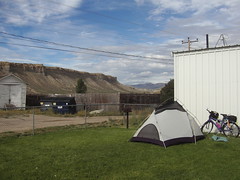
The sun is beginning to show through the trees, so I take the rain fly off the tent and lay it out in the sun to dry, along with our bicycle covers. By the time we get packed up and ready to roll, it's close to 10am.

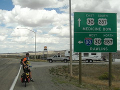
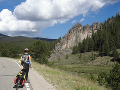
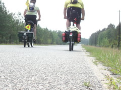
Today's ride is another short day, only 21 miles to Mammoth Hot Springs. There's no shoulder on the winding road here, so we spend some amount of time helping motorists remember how to pass a vehicle when there's oncoming traffic. We have become mistrustful of any car, truck or RV that doesn't slow down when it approaches us from behind, and are fearlessly taking the lane to remind drivers that they'll have to cross the yellow line to pass us. This tactic jolts them back to reality, and they have been very patient, waiting until they have a clear view of the oncoming traffic before they pass us. Of course, once we can see that the way is clear, we give back enough of the lane for them to pass us. Well, the signs in the park do warn bicyclists to watch out for cars, so I feel like a park ambassador when I take the lane.

The first stop-and-gawk feature we come to is Roaring Mountain. The thermal features that we've seen so far in the park have been in basins, but Roaring Mountain's vents and fumaroles are seen up and down the mountainside. There's not much water in these vents, and the sound of the steam escaping from the vents is the inspiration for its' name.

It's said that the explosive sounds from Roaring Mountain can sometimes be heard 4 miles away at Obsidian Cliffs, but we didn't hear the mountain while we were stopped at the cliffs. A small clutch of visitors alerted me to the presence of a coyote in the meadow to our right, and I was able to get a few pix before he crossed the road and disappeared into the woods beneath Obsidian Cliffs. These cliffs are absolutely beautiful; arrowheads made from the rocks here were widely traded by Indians throughout North America. I couldn't help thinking that when the first Indians came upon these cliffs, they must have thought they'd won the lottery. Even now, after countless years of legitimate use by local Indian tribes, and theft by visiting touristas, these cliffs are tall, dark and handsome.

A few miles later, we stopped at Apollinaris Spring. These days, motorized traffic usually blows right by the spring, but in the days when stagecoach travel was the only way around the park, a stop here was a welcome respite from the dusty road. Apollinaris is a natural mountain spring, now fitted with pipes to allow visitors to take a drink or fill a water bottle. In earlier years, visitors were glad to have the clear, cold water en-route to Madison Junction, but there's now an official Park Service notice warning thirsty visitors to drink at their own risk--purify first.

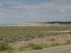
Beyond the spring lies Swan Lake Flats, and Swan Lake. There's no information about the area, but it's typical of the varied topography of the park. One minute you're in the wooded hillside, overlooking Yellowstone's Grand Canyon and the next you're on a flat, grassy plain. Not far beyond Swan Lake is a lookout point with a great view of the Gallatin Mountain Range, and peaks such as Sepulcher Mountain and Electric Peak. The ride next to this meadowland extends for a few miles, and as we head toward the hills again, we see the road signs indicating a steep (6%) downgrade. Whoopee! The descent will take us to the Mammoth Hot Springs area, where we'll stop for the night. As we fly down the hillside for the next few miles, we pass through the Silver Gate and the Golden Gate features. Here, the rock formations are bold, in-your-face clusters of boulders that perch precariously beside the roadway. I know they're not likely to give up their hold on the hillside and come thundering to the pavement as I ride by, but the thought does cross my mind. I hit a maximum speed of 34mph on this downhill. I know that I'll have plenty of time to look at these rock formations again--when we climb up this road and backtrack to Old Faithful.

Before getting to the Mammoth Hot Springs commercial area we stop at the travertine terraces. In contrast to the park's basins and calderas, the terraces are built up by the water that flows up from underground. The minerals in the water build tier upon tier of cascading, terraced stone, and they and the waters that flow over them are a stunning sight.

After walking, oohing and aahing our way along the boardwalks of the Hot Springs area, we coast down the hill to the Mammoth Hot Springs Hotel. I am glad that we're staying in the hotel tonight--last night was cold, and there's a back-in-time feeling about this place. The original hotel is long gone, a victim of poor construction. The current hotel's rooms are a wing that was added on to the original hotel in 1937; the lobby, gift shop and map room were added to the hotel soon after. Our room has a bath and shower, although most of the rooms share toilets and showers down the hall. Our room is on the the back corner of the hotel, and we have two windows. One overlooks the road to Gardiner, MT; the other looks out over the hotel's lawn and beyond to the buildings of Fort Yellowstone. We get checked into our room around 3pm, just as a small herd of elk are arranging themselves on the lawn outside our window. This is too much for me to resist; while Matthew is in the shower, I grab the camera and head down to the main event.

A small crowd of visitors has begun to gather on the sidewalk that borders the lawn. A few of the elk are grazing, a few are sprawled out on the grass, a few more are curled up on the lawn, and I even notice a few are curled up and grazing--lay-zee! The big buck with the impressive rack is standing in the midst of the herd, and suddenly he charges at one of the young bucks--chasing him right toward a camera-toting onlooker! She turns and flees out of range, but that's when two rangers suddenly appear in our midst, corraling us to the opposite end of the lawn. The floor show continues when the big buck chases the other young buck to the outskirts of the pack. The female elk have barely moved during all of this male posturing. The rangers keep herding us further from the lawn area, so I break from the crowd and head back up to our room. Matthew has seen the whole show from the safety of the third floor.

In the lobby of the hotel is a large montage of photos from the late 1800's. They've been colorized, and not very well, which makes them seem less life-like. Two of the photos depict groups of visitors, in full Victorian garb, scandalously posed ON the terraces of the Hot Springs. Ever since we entered the park, we've been cautioned, cajoled and commanded to protect the park and its' fragile ecosystems by staying on the trails and boardwalks, but in the freewheeling, pioneering, early days of the park, it was de rigeur to literally leave your mark on the park. I love these photos, though. Frankly, I'm impressed with these travelers, the women especially, for enduring a difficult and dangerous journey to visit Yellowstone. I think that if it had been me, I would have demanded to be in the picture, even though I can't imagine clamboring onto the stone terraces in dress shoes, a floor-length, full-bustle skirt, bonnet and parasol. Another photo depicts a Tally-Ho stagecoach that ferried passengers through the park on their visit, and another shows the stone arch at the park's entrance, but my favorite photo is an artfully arranged group of 8 men, in uniform and standing with their bicycles, at various levels of the Hot Spring's terraces. These are the boys of the Army Bicycle Unit, on a 900-mile route that includes Yellowstone.

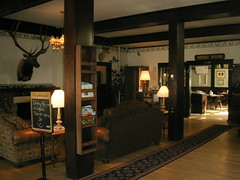
I have ample opportunities to admire these photos--daguerrotype copies of these five photos are hung in every hall and every room in the hotel. I'm a little disappointed by the hotel's decor; the paint scheme is bland almost to the point of being colorless. The hallway lighting is sparse, almost depressing, but I guess the pale wall color reflects what little light there is. Our room is very comfortable; plain but not sparse. Maybe I'm not the best judge these days--carrying the furnishings of your "room" in a trailer behind your bike might redefine the term sparse. Anyway, I get the feeling that the hotel's interior decorator didn't quite understand patrons who'd come all this way would want to feel their wilderness inside and out.

Our original plan was to stay in Mammoth one night, then camp at Madison Junction, about 35 miles away. The next day we'd ride another 15 to Old Faithful, and spend the day visiting the geyser area there. With the memory of a cold campsite still fresh, we thought maybe we could ride the 50 miles from Mammoth to Old Faithful in one day. Matthew checked on available rooms at Old Faithful, but there were none to be had. Instead, we extended our stay at Mammoth a second night--which gave us a little more time to explore the area.

After breakfast the next day, we spent some time walking around Fort Yellowstone. Some buildings are made with local stone, others from timber, and date from the days before the National Park Service existed. At that time, the Army policed the park, but without any authority to prosecute poachers or other violaters. When the NPS folks arrived, the officers' houses were used for rangers and their families; this continues even today.

At the "new" guard house, built in 1911, the concrete steps are crumbling and the building looks ready to be abandoned. Reading the guidesheet, though, Matthew discovers that this building is still used as a jailhouse. And as I round the corner of the building and step off the front porch, a ranger pulls up with a handcuffed, orange-jumpsuited prisoner in tow. So there.

In the evening, we attend a slideshow presentation in the map room of the hotel. The topic is "Touring Yellowstone in 1902--From The Scrapbook of Mr. and Mrs. Carland". The whole presentation is wonderful, and so unexpected. The story begins with the park employee giving the presentation. He's a 28-year park employee, who began his career at the park as a dishwasher. He now plays piano in the map room for a few hours in the evening, and also gives the scrapbook presentation.

He found the scrapbook at an estate sale in New Mexico about 8 years ago, and has been researching it ever since. The scrapbook captures a month-long, 9,000-mile, cross-country train trip taken in 1902 by Mr. and Mrs. Carland (get it, train trip, the CARlands) from Albany, NY. Their trip is in a special car, because they are headed to a Shriners convention. Their journey takes them from NY across the country to Los Angeles, then up to Seattle, and on to Yellowstone before heading east again.

The audience was informed that the entire month's trip cost $250 per person--including all meals, transportation and accomodations at Yellowstone. They stayed at the original Mammoth Hot Springs Hotel, but were two years too early to stay at the now-famous Old Faithful Inn. Instead, after a 45-mile stagecoach ride from Mammoth, they had a room in a hotel near Madison Junction. With the advent of cars, folks just continued another 7 miles to Old Faithful and the Madison hotel became useless and was eventually razed. Another amusing factoid about accomodations in that era was that hotels routinely were short on space, and would often assign parties who didn't know each other to share the same--bed.

The Carlands spent 5 days at Yellowstone, and, judging from the pictures and postcards in the scrapbook, saw pretty much the same sights as we are. Probably the same sights as most travelers to the park would see.

The only accomodations available at Old Faithful in 1902 were tents, and that's where the Carlands stayed. These days you can choose from the Old Faithful Lodge, the Old Faithful Inn, and the Snow Lodge. When we arrive at Old Faithful tomorrow, we'll be at the Snow Lodge. Later.

Tuesday, August 29, 2006

Hailstorm

Saturday, August 25. Canyon, WY to Norris, WY.

In retrospect, I should have expected the hailstorm. Over the last few days I had been mentally going through my gear, trying to see if there was anything that I no longer needed and could send on to Oregon. The replacement bicycle clothes that I'd asked Becky to bring to Pueblo weren't necessary--the clothes I'd been wearing were holding up fine. The small, soft-sided cooler was also a candidate for being sent ahead. We hadn't had any food items that needed to be kept cool--other than snack food, we didn't really have any food that needed keeping at all. And my full-length, fleecey, rain-shedding tights could go, too. I think they were the final straw.

We rolled over to the post office at Canyon, planning to box up our unnecessary items and ship them out. But we had forgotten that today is Saturday, and the P.O. In Canyon is not only a temporary office, but closed on Saturdays. We'd have to haul around our extra stuff for another 2 days, and hope that the P.O. In Mammoth Hot Springs would be open for us on Monday. Before we could get rolling, we met a couple from Utah--and their white Scottie dog, Buddy. They come up to the park every year about this time, and have done so for the last 8 years. They've travelled all over the park, but prefer the central location of Canyon for their daily excursions. After the usual bicycle-trip questions, they gave us the scoop on our road ahead. Nice shoulders into Norris, nice campground at Norris on the Gibbon River. We thanked them and rolled out of Canyon.

Today would be another fairly short day, but we knew that there would be a number of stops on the way to Norris. Not far from Canyon, we stopped to see Inspiration Point and a glacial boulder. More fabulous views of the Grand Canyon and the Lower Falls area. The boulder was easily twice our height, discarded like a pebble by a passing glacier in the last Ice Age. Lodgepole pines had grown up around the boulder, so now it appeared to be caged in by their tree trunks.

A little further down the road we stopped at Grand View and Lookout Point, eager for more views of Yellowstone's Grand Canyon. And in sort of a geological history lesson, Inspiration Point's viewing platform is about 100 yards shorter than before the 1975 earthquake in the area. The platform at Grand View is actually a little disconcerting to stand on. It's perched way out into the canyon, and visitors have an incredible view of the falls, the canyon walls--and all the way down to the river some 900 feet below. The disconcerting part is that at it's furthest point out into the canyon also tilts downward. I felt as though falling into the canyon would be far too easy.

From Grand View we walked down to Lookout Point, where an osprey nest had been sighted in the canyon. Several people had cameras and telescopes set up to watch the bird nest, and we could hear both the parent and young osprey's calls echoing around the canyon. We then walked back up the hill to our bikes.

Soon, the road would take sharp downhill, and take us down to the Norris Geyser Basin and the turnoff to the campground. Our plan was to head to the campground, set up camp and then go back to the geyser field sans trailers.

As we started down the incline, passengers in a car coming up from the other side were waving their hands excitedly--the international sign for "wildlife ahead". Sure enough, as we got part way down the hill, a lone buffalo was ambling his way down and across the road. I saw my chance to get a great close-up shot of a truly magnificent beast, and began to creep closer to him--using the traffic in the downhill lane as cover, of course. Unfortunately, this ploy worked too well, and I never did get a clear camera shot of the buffalo. Besides, I could hear Matthew behind me, whispering encouraging words like "stay right where you are, please" and sucking his breath in sharply.

Once free of the wildlife traffic jam, we sailed down the mountain and took a right at the crossroads. The Norris Campground, along with the Ranger Museum, was one mile ahead of us. Finding it was no problem, and as we pulled in to the registration area we saw the signs directing us to find a campsite and then come back to self-register and leave payment in the lockbox at the entrance. We would encounter more of the hiker/biker prejudice when a volunteer ranger allowed us to stay at a "regular" campsite on the condition that we only stay one night.

At Loop A, I found what I thought was a nice site, but Matthew declared it "kind of in a low spot". I followed him to higher ground, and as we passed one tent site, I recognized the occupant. Bill, whom we had met at Grandma's in Lamont. Even though it was after 1pm, he was packing up his stuff to try to reach West Yellowstone before nightfall. It had rained at the campsite the night before, and his tent was just beginning to dry out. As we stood talking, we felt what we first thought was rain, but quickly realized was hail. I slid my bike under a tree, thinking that the hail wouldn't last too long, but Matthew brought his bike and trailer up under the eaves of the campsite's restroom facilities. I joined him and Bill there in a matter of minutes, and then raced back out to my bike to put a rain cover on it (yes, the one that is shaped like a fitted sheet).

We stood under the eaves of the building for about 30 minutes, watching the pea-sized hail accumulate on the ground like snow, feeling the temperature drop, too. Once the hail finished, we watched dark clouds moving into the valley, and could hear the thunder, still off in the distance--but not too far off.

We both pulled on our waterproof booties and I put on my full-length, fleecey, rain-shedding tights before venturing out to set up our tent before the rain began. Just as we finished getting tent-stuff in the tent and food-stuff in the bear box, the lighting, thunder and rain began the afternoon show at Norris Junction. I was reading for a little bit, but after putting on another layer of clothes and getting into our human stuff sack, I decided a nap was a better use of my time. By the time I woke up, a couple of hours later, the storm had passed and the skies were clearing. This seemed like a good time to visit the Norris Geyser Basin, so we rode back up the road and arrived around 6pm.

A huge tour bus pulled up and disgorged its passengers just as we arrived, so we watched to see what direction they headed--and then took the opposite path. This geyser basin is large, and features geological wonders named Emerald Spring, Puff n' Stuff Geyser, Green Dragon Geyser and Steamboat Geyser. An information marker dated Steamboat's last major eruption in May 2005, but it was still spouting out water and steam today, making quite a respectable showing. As we walked on the boardwalk through the lower basin, a rainbow--and then a double rainbow--appeared in the sky. It was a beautiful, late summer, early evening, and yet the landscape was so other-worldly that I felt like I was on another planet. It was great.

As we cycled back to the campground, we passed a small herd of elk on the meadow right across from our camp. They were causing only a minor slowdown in traffic,though. Once back in camp, dusk was on us and we set about making dinner. The darker it got,the colder it got, and we left the stove flame on to generate a little heat while we ate. We didn't waste any time cleaning up the campsite and getting everthing stowed in the bear box. We snuggled into our silk liners, then zipped our two sleeping bags together to make one huge, human stuff-sack. The night was cold, but we stayed warm--and dry--all night. Tomorrow we head for Mammoth Hot Springs, and a room inside.

Monday, August 28, 2006

Go Dawgs!

Friday, August 25. Bridge Bay, WY to Canyon, WY.

There is a quaint tradition in Yellowstone where Christmas is celebrated on August 25. The lore is that one year in the 30's, a huge snowfall occurred on August 25, stranding the staff and visitors inside the park. The staff, known in park slang as "savages", celebrated their plight by singing Christmas songs, decorating trees, and pretending to be elves. Thus began the tradition of the "Savage Christmas", and it is still celebrated in the park each year. Lucky for us, we have a room at the Dunraven Lodge in Canyon tonight, but it seems as though the "savage" xmas tradition has become nearly as commercialized as the "civilized" celebration. Christmas decorations are up in every shop, but there's no real xmas spirit to be found. I guess since only a small percentage of Yellowstone is open in winter, one freak snowstorm 30+ years ago isn't enough to create a solid tradition.

But the day did start out decidedly on the chilly side, and a breakfast of hot oatmeal and hot coffee was what we needed to get started. The sun was out, but since we were at over 7,700 ft in altitude, the air was still cool enough for us to put on jackets and tights.

Our first stop was at the LeHardy Rapids, where huge numbers of trout fight their way upstream every year to spawn . . . and then die. I always think of Wyoming as a dry and dusty cowboy state, but here in Yellowstone the water features almost outnumber the lodgepole pines. Matthew and I surveyed the LeHardy Rapids, speculating where we would shoot the gap. As though we're somehow qualified to have that discussion, since our experience with white water of any sort is limited to a week on the Class 2 rapids of the Chattahoochee River. Navigating rapids seem much safer and easier from the safety of the observation deck built by the Yellowstone engineers.

The road left the Yellowstone Lake area, and we soon found ourselves in Hayden Valley. The valley is an old lake bed, formed when glaciers created a lake during the last Ice Age. The Yellowstone River meanders through the valley now, and a large herd of bison was grazing in the valley as we rolled through. Also rolling through the valley was a rainstorm, so when we stopped to admire the buffalo, we took the chance to put on the remainder of our waterproof layers. All set now.

While some rain fell as we traversed the valley, by the time we reached the mud volcano, we were once again under clear skies. The mud volcano area is a fabulous stop, full of bubbling and fuming vents with names like Black Dragon Springs, and Sour Lake. There's a lot to see here, but in our bright yellow rain jackets, I felt like we were on exhibit, as well. An older couple riding a Harley Gold Wing motorcycle announced that we were living out his, if not her, dream of riding across the country on a bike. They were from Utah, just taking a few days to enjoy the park before returning home. A young couple with a 5-month-old black lab named Heater and a penchant for extreme sports engaged us in a conversation about scuba diving in Florida (a subject which we're less qualified to discuss than shooting rapids). They felt a connection to us because we're both freewheeling our way across the country to new lives. They are moving from Bend, OR to Biscayne Bay, FL, sightseeing as much of the country as their pursestrings will allow. Then an older couple from Montreal stopped to ask about our trip. They are hosting friends from Germany, who don't cycle, but confided to us that they'd much rather see Yellowstone from a bicycle seat. They are members of the Bicycle Adventure Club, an organization that Pam and Fred Freed told us about when we met them near Rhinebeck, NY. The 2007 trip is in Russia, from St. Petersburg to Warsaw. Maybe we'll see them again.

And finally, after touring the volcano area, we stopped for a snack before continuing on and found ourselves the object of some amazement by two motorcyclists from Missouri. One of them just kept shaking his head in disbelief; the other declared that "if it don't have a motor, I ain't getting on it".

Canyon Lodge was just up the road, but before Canyon was Artist Point, the Grand Canyon of Yellowstone and the Upper and Lower Falls lookout points. Matthew's dad, Jim, had forwarded us a picture taken when Matthew was about 8 years old. Jim's recollection is that the photo was taken at Artist Point or Inspiration Point, and our plan was to try to recreate the old photo with the current, older version of Matthew.

I don't think I've ever been to Yellowstone before (help me out here, mom), but even if I had, there's nothing in my memory from the visit. So I was utterly stunned by the sheer-ness of Artist Point and the Grand Canyon. Yes, the Upper and Lower Falls are incredible, stunning and awe-inspiring, but the rock formations of the canyon leaped out and grabbed me from the first instant. The colors are chalky pastels of reds, browns and yellows, formed by time and water into sharp ridges that break into the canyon and balance chunks of stone at impossible angles. Trees--firs--have grabbed on to these shallow, vertical ridges and grow as though they are surrounded by the safety of a wooded forest. If you were to paint such a picture, it would be classified as cubist-post-modern by anyone who hasn't seen this canyon. It is a place that I am glad is protected by the National Park Service.

It's a short ride from Artist Point to Canyon, where we checked in but found that our room was not yet ready. This isn't a problem for us, since we were feeling the need for food, but I have noticed that Yellowstone services walk to the beat of a different drummer. For one thing, a large number of staff are temporary. Many of them are students, working in the park during summer vacation. A large number are international students. Every staff member wears a name badge that also includes their home state. Many of the badges I saw were from Eastern Europe--Russia, Romania, Czech Republic, Ukraine, France. The staff members that I spoke with are in the park for about a 3-month gig. Just the size of the temporary staff must make training difficult at best. Most of the staff is pretty fluent in English, although it's easy to tell that those who are less fluent become part of the housekeeping staff, while those with more confident English are wait-staff and front-desk staff at the hotels. In such a quintessentially wild, western park, America's first national park, I didn't expect to hear so many different accents--at least not from the staff. Not that I was expecting the housekeeping staff to be wearing spurs and spitting tobacco, but I guess I underestimated the number of temporary staff needed to provide services for the 2 million visitors that descend on the park each year. I didn't realize that we were importing so many international students to help tell the Yellowstone story.

By the time that our room was ready, we'd had a quick bite to eat at the Canyon Lodge diner and were ready for showers. The laundry facilities were at the nearby Canyon Campground, where we spent an hour watching our clothes tumble, reading and discussing under what conditions we would pay $3.25 for a shower (the going rate at the Canyon Campground). It's not the money, exactly, it's just that a shower isn't usually an additional expense on top of lodging costs. Since our room had a private bath, it was very easy to be stingy about the idea of paying extra to be temporarily clean.

We had planned to attend the 7:00pm lecture at the newly-opened Education Center in Canyon. Our laundry duties finished up just before 7, but by the time we walked to the Center we found that the lecture was a sell-out. Instead, we toured the Center. The various volcanic eruptions are graphically displayed, showing how the Yellowstone eruption 640,000 years ago created the park's caldera and other geological features. There is also a huge (20x20ft) topographical map of the park, which is where we saw how much of a climb it would be to Dunraven Pass, the next day's planned route. Matthew was ready with Plan B, though--skip the pass and take the middle section of the Grand Loop to the west toward Norris,then up to Mammoth Hot Springs. We'd backtrack through Norris to get to Old Faithful at the southwest end of the Loop, but I still voted for that over climbing the 8,900 ft. pass.

Around 8:00pm we were hungry enough to consider dinner, and headed to the Canyon Lodge Dining Room. Canyon Lodge was built in the 1950's, and the architecture shows. In a design style that can only be described as Grizzly Adams meets George Jetson, the dining room and lounge area don't do justice to either genre. The large, open stone fireplace has a beautiful copper hood, but everything in both the lounge and the dining room is beige, so the firerplace fades into the background. It's a comfortable place, and the food is pretty decent--I guess maybe the challenge of competing with the park's scenery left the interior designers and chefs bewildered. At least they have gone to the trouble of stocking the local microbrew, and Matthew had a Bozone Amber Ale with dinner. It's one of the better microbrews that we've sampled during the trip.

During dinner we hear a distinctly Southern accent, and strike up a conversation with Alice. Spending this summer working at Yellowstone is the fulfillment of a 28-year old dream. 28 years ago, she and her husband met a teacher who was spending her summer woring at the park. They had often talked of doing the same once they retired, but Alice's husband died before they ever made firm plans. This past winter, with encouragement from her boys, she submitted her online job application and in two weeks had her job at Yellowstone. She's living in a dorm, and loving every minute of this year's summer vacation. Alice teaches an online Special Ed course at UGA, and classes started there in mid-August. She's already had several sessions with her class via the Internet, and will leave the park right after Labor Day. She's already planning next summer's "vacation"; they've asked her to come back to Canyon next year. You can teach an (old) Dawg new tricks, I guess.

During the night it rained again, but I didn't even hear it. Tomorrow's ride to Norris will be a relatively short one, but there are a number of stops we want to make before we settle in at the Norris Junction Campground. We're hoping the weather clears up.

Empty Nesters

Thursday, August 24. Grant Village, WY to Bridge Bay, WY

Today is our first day back as just a couple, the "kids" heading west toward Old Faithful and the Oregon Coast. They'll be in Florence, OR, around September 11, and then head their separate ways to San Francisco and Seattle. We're heading east, and like empty nesters who've been camping with their kids for the last 6 nights, we're stopping at the first hotel we can find.

Our destination is Lake Village, a distance of only about 20 miles. Since we have all day to get there, we stop at West Thumb for a tour of the Paint Pots. John Colter is thought to have been the first white man to visit what is now Yellowstone Park. He requested leave from the Lewis and Clark expedition to investigate the area. The local Indians took him and some trappers on the grand tour. The Indians used the colored mud found in West Thumb's fantastic thermal features as paint, and also spread the mud on dried hides to clean and soften them.

Along with the burbling, bubbling paint pots, there are conical formations that feature spouting steam and bubbling water. The Indians used these as fishing spots, and showed the white men how to use them. When Colter returned to the east to tell the Yellowstone tale, he embellished the story by claiming that one could catch a fish and then cook it on the way up through the cone. The whole Yellowstone area is so utterly fantastic, so other-worldly and so completely beyond the grasp of the average joe and jane, that there shouldn't have been any need for Colter to dress up his stories. But he did, and as a result, no one believed him. In fact, the area was known as "Colter's Hell" until other explorers confirmed the basic facts of his report.

We spent quite a bit of time at West Thumb--the boardwalk provides a terrific tour of the hot springs, mud pots and colorful micro-organisms of the Geyser Basin, while Lake Yellowstone and the Absaroka mountain range provide a magnificent backdrop. The strong smell of sulphur from the springs is just a bonus.

Back out on our bikes, the road follows Yellowstone Lake for miles until we reach Lake Village. At the Lake Hotel we found that there were no rooms at the inn--or the nearby lodge. We would spend one more night camping, this time a few miles behind us at Bridge Bay campground. Matthew took this opportunity to make reservations for the rest of our nights in Yellowstone. The park is still fairly busy, even in late August, and he was only able to get us a room at Mammoth Hot Springs and Old Faithful. We'd camp on the days in-between. I took the time to look around the hotel, which dates from 1891. The hotel had been remodeled in the 1920's, and is now fully restored to that time period. The hotel also features an artist-in-residence program, and original artwork and prints from this year's artist are available in the gift shop. Lake Hotel is one of the spots where early stagecoach travelers to the park stopped. It's right on Lake Yellowstone, and offers beautiful views of the area.

While we were at Lake Village we had lunch in the diner and then picked up some camp groceries before heading back to Bridge Bay Campground. Once again we encountered the prevailing campground policy of stuffing hiker/bikers in the most remote part of the campground, this time up a long, damn hill. The camp loop is nicely wooded, includes restrooms, service sink and conveniently located bear-proof food storage boxes. We found our site and after pushing our bikes and trailers up a short incline onto the site, began to set up camp. It was late afternoon when we arrived, and once the tent was up and furnished, and anything with a scent was stashed in the bear box, we found ourselves with time to sit and relax. You might think that since our only job is to get from here to there each day, that we have all kinds of free time. But once you stop here for a snack, there to look at the hot springs, and ohmygod is that a bison or just a big boulder?, the day is pretty well spent. Even once we get into camp there's usually laundry and showers waiting, but no such luxuries are available at Bridge Bay. Having a couple of free hours is a real treat.

As we swung through the loop on the way to our campsite we passed the group campsites. Two of the sites were peppered with small tents, and we also noticed three white, unmarked vans parked near the sites. The group sites are conveniently located next to the restrooms and service sink, of course, and on a trip to the facilities I overheard some of the young women discussing their upcoming showers, on schedule for the next day. I found out that they're from MIT, here in Yellowstone for a peer leader outing. They had been at the campground for 7 days, and were leaving in the morning. They all seemed pretty good-natured about not having showers for a week, and I was heartened not to hear any whining--although I did notice that virtually every one of them was wearing a hat of some kind.

Back at our campsite, Matthew and I were quietly reading and writing postcards when Matthew was distracted by a rustling noise in the woods nearby. He turned around and was practically able to kiss a young deer who was munching his way through the forest. Matthew was certain that the deer was really after our food (and possibly our toothpaste or lip balm), so I sneaked over to the bear box to secure the lid. The deer had crossed the road right ahead of me, but since I got to the bear box before him, he feigned disinterest and wandered off toward the group sites.

The two non-group campsites near us were occupied, though the tent-to-camper ratio was quite a bit higher than in the group sites. One of the campers wandered over and asked Matthew if we would be disturbed if she practiced her music in the area. "I just don't want to practice in front of a bunch of undergrads" was her explanation. I didn't see the instrument, but it had the quality of an ancient instrument. I'm no great judge of musical talent, but I'm glad that Matthew agreed to let her practice. It seemed to me that she needed it. Not long after that, a threesome on mountain bikes came up our loop, and we stopped to talk with them. They'd come to Yellowstone from South Dakota, and so are not as enchanted with close encounters of the buffalo kind as we are. Dad, Mom and pre-teen son been out for a few hours, looking for off-road trails in the park. They hadn't found too many in the area, but they ended up in the hinterlands of camp-dom because it looked remote enough to offer some trails. They asked about our trip, and then explained that they'd seen a traveling slide-show of a similar trip. The pair that created the show had spent a few months on a cross-country bicycle trip, and were now on the road with their slideshow and seminar. Seems that the dad of the trio owns the little theater in the little town in SD where the slideshow was presented, and I distinctly sensed an unspoken invitation for us to provide an encore presentation. Then they were off to their own campsite, and to await the evening's campfire-side ranger presentation.

As the sun went down behind the trees, our lovely wooded campsite started to get cold and colder. We slipped into our tent, cocooned up into our silk sleeping bag liners and snuggled between our unzipped sleeping bags. We spent the rest of the evening reading, and had a warm, restful sleep. The next morning we'd be heading to Canyon, where there was a room with our name on it.

Sunday, August 27, 2006

Talent Show

Wednesday, August 23. Colter Bay, WY to Grant Village, WY

Today was one of our shorter days, only about 40-some miles. But we'll ride out of the Teton Forest, then 19 miles of no-man's land until we reach Yellowstone--well, it's probably Uncle Sam's land, but there's nothing but the scenery between Teton Park and Yellowstone Park except one more Continental Divide crossing. Which means one more descent, although this one is a short descent, since the south Yellowstone entrance is still in the mountains. As we ride, the smoke from nearby wildfires hurts our throats and makes our eyes water.

When we didn't find the Fab-4 at the gate, we back-tracked to Flagg Ranch Resort and found them taking a break, wondering what could be taking us so long. After Melanie chases a chipmonk out of her handlebar bag, we all saddle up and head for the park gate. It's time once more for the group photo at the entrance sign, and three cameras are set up to catch the shot. One, two, three--and the camera operators race to get into the picture in time. My camera gets the action shot, which I consider the best. Yellowstone Park is looking for "your" vacation photos in the park; six adults vying for a spot at the 10x20 ft. National Park sign seems like the quintessential vacation photo to me.

We figure that it won't hurt to try the "All in the Family" ploy at entrance gate, and to our amazement it worked. The rangers must have a soft spot for anyone who buys the National Park Pass; it can't be that they have a soft spot for bicyclists. Individually, a ranger may be cheered by the sight of cyclists in the park, but officially, the National Park Service seems to be doing it's best to keep bicycles at a minimum in the park. The total absence of any mention of bicycles is the first hint of this policy. Sure, Yellowstone gets nearly 2 million visitors each summer, but every single cyclist on the TransAm Route passes through Yellowstone. And true to form, a few miles before we reach the campground, the small shoulder we'd clung to disappears.

We've been warned about the traffic in Yellowstone, particularly the RV's. I don't know which is worse--the retirees who've spent their life savings and children's inheritance to travel around the country in a Trojan-Horse residence, or the new American Family, drawn to the Internet, who clicks on www.driveabehemothtoday.com and is now hurtling down Yellowstone's 2-lane roads like they're on the autobahn, racing from one wildlife sighting to another, unaware that a 40-ft. trailer doesn't handle like the BMW SUV they left at home because it just doesn't have enough room for this trip.

We take the lane when there's traffic coming in the other direction, but in my rear-view mirror, I see that a tour-bus-sized trailer isn't slowing down nor making any attempt to give us room. At this point, I'm riding behind Matthew, and I am forced off to the edge of the road. I watch the vehicle pass Matthew, and as my heart is in my throat, I am unable to warn him in any way. The monster-sized trailer cleared Matthew with only inches to spare--he actually felt the vehicle's mirror whoosh by his ear. This is a clear case of driver harassment--he saw us and decided to run us off the road. To add insult to near-injury, a bicycle is attached to the rear of the RV. Perhaps it's a trophy of some sort, and the driver is collecting fallen bicycles, mounting them on his recreational vehicle like elk heads in a masonic lodge.

Having a near-death experience gives Matthew's adrenalin factory a kick-start, so he charged after the RV screaming obscenities, got it's license, and reported the incident to a park ranger. The ranger, who is also a cyclist, records the incident sympathetically and assures Matthew that he would "go talk to them". Well, as cyclists from Atlanta, that's really more than we could have expected.

Meanwhile, the rest of us are trying to get a campsite for the night. The NPS has some bizarre camping policies, that seem designed to make cyclists feel unwelcome. For instance, any old regular campsite can be had for $15, and you can have up to 6 people at the site--if you drive your car to the site. If you're a cyclist, you'll pay $5.80 per person and have to haul your bike and gear to the farthest reaches of the campground, beyond where any "regular" campers might see you and presumably become fearful of such eco-friendly tourists. I don't mind not getting a shower, but is it too much to ask to be within a few hundred yards of the restrooms?

Since it's an early day, we have time to set up camp and then head back to the Visitor Center. They're showing two movies, and I guess we're a little media-starved because we sit through both of them. The first one is a report on the huge fire in Yellowstone in 1988. Over a million acres burned in that fire, which started on August 20, and ended when snow fell on September 11. What's interesting is that the movie captures video of the park during the fire, one year and ten years after the fire. Since it's now been 18 years after that fire, I guess that means they've been showing that film for the last 8 years. The second film is the video version of the park's rules and regulations. There is no mention of sharing the road with cyclists.

After the movies, we all peruse the various nature books for sale in the bookstore, and then eventually all end up at the grocery store. Since Matthew and I have decided that we will part company with the Fab-4 in the morning, this will be our last evening together. This is a hard decision for us, since we have loved riding with them. Well, actually, we have loved the way they wait up for us at the end of the day. The only way I can keep up with Melanie is if she's loaded with both of our gear. And even though Rob is being handicapped by a wheel that is so out of true his bike tires paint an "s" in the road, he's still out in front with Melanie the whole day.

At the general store, we each pick up provisions for dinner, Deanne picks up a six-pack of the local microbrew, and then Rob announces that he's going to get fixin's for s'mores AND an ice cream dessert. There's been talk all day of an impending talent show in our camp. This reminds me that I have no talent--at least not one that doesn't require props which are decidedly not part of a touring cyclists' gear. I've been through this same scenario some years earlier, and managed to avoid the spotlight. But that was a much larger, drunker crowd, and I am pretty sure that I'm going to have to stand in the footlights tonight. But I cannot think of a single, inane, no-props-necessary talent. And I am not alone in my panic. While on the phone with his mom, Matthew suddenly remembers his talent. Jess called her mom for help, but her mom's response was to ask her if she could tap-dance.

Well, s'mores, ice cream and beer notwithstanding, the talent show commenced just as darkness was falling on the campsite. A headlamp was set up on the picnic table to set "the stage", and we're off. Or on. Matthew goes first, and as he flawlessly performs the readily-recognized Lucky Charms Leprechaun heel-click, Rob groans. "That is so great! That totally beats any talent!" Fine. If he really loved me, we could have made it a two-person performance, my agony ended.

Deanne goes next, demonstrating that she can touch BOTH thumbs to her wrist. We all watch in amazement and then applaud wildly. Melanie (the over-achiever) has two talents, one physical, one mental. With her hands on her hips, she can touch her elbows in front of her. Well, very nearly. We take her word for the fact that she can actually do it on most nights. Her mental talent is that she can, in a savant-kind of way, hear or read any word or phrase and immediately know how many letters it contains. This in and of itself is a laudable talent, but when she explained that she actually reads the phrase backwards in her mind to count the letters, well, we were all stunned.

Rob's talent is a bit of sleight of jaw. Putting both hands under his chin, he created a noise that sounded like he was cracking his jaw. We were all appropriately shocked and disgusted. Jess was next, and she performed something she called a "scale". This is a gymnastic move, which resembles someone pretending to be an airplane while standing on one leg. None of us had any idea what she was doing, making her clearly much more talented than any of us (at least in gymnastic scales and airplane impersonations).

And finally it was my turn, but I still had not thought of a talent. I tried to deflect attention by talking about the talents of others I know (for instance, 5's ability to start a '63 Chevy, a 14-step process that, if you failed step 9, you had to wait 30 minutes before starting over), but the Fab-4 were insistent. Matthew finally said that no one folds a fitted sheet as flat as I can, and then he suddenly remembered that our bike covers have a shape similar to a fitted sheet. He raced over and pulled one out of the trailer, and handed it to me for my command performance.

While it is true that I am a whiz at folding a fitted sheet, the cover that he handed me, sir, is no fitted sheet. Part of my skill lies in the fact that the sheet is made of soft, pliable cotton, and the bicycle cover is not. It is an Arkel bicycle cover, generoulsy sized to fit over a loaded touring bicycle. It is well-made of a waterproof fabric that sheds water readily and beautifully. It is the perfect bicycle cover, but it is not a very good fitted sheet. Nonetheless, I am relieved to have some kind of talent to show, and I begin to fold the bicycle cover. The whole idea that I am in Yellowstone Park, having reached the park on a bicycle, with a bicycle cover, and am attempting to salvage my dignity by pretending to fold a fitted sheet, strikes me as hilarious. I am laughing so hard that I am crying, and now it's pitch dark and the cover is jet black, so I can't tell what I'm doing which is good because I can't see through my tears. But I hear Jess' little voice, encouraging me--"keeeep follllding". Which makes me laugh even harder, and I finally just start bunching the cover up into what feels like a small, flat package. The crowd goes wild, cheering my finale. I can't even stand up because I'm laughing so hard.

Then Rob announces that Matthew and I have won the talent show! And as prizes, we are awarded Yellowstone Park Junior Ranger pins--with our name already engraved on each pin. This talent contest is so rigged, but I don't care. I am thrilled with my Ranger pin, and can't wait to wear it on my Camelback.

Before we fall asleep, Rob reads one more chapter of the Orville and Wilbur Wright story, but it's the last chapter that Matthew and I will hear. I now know how their story starts and ends, but I'm missing the details in the middle.

In the morning we have one last round of coffee at breakfast, then hugs all around before the Fab-4 leave for Old Faithful. They'll cross the Continental Divide 2 more times before they get to the geyser; because we're going the other way around the park's loop, we'll miss those last crossings.

We will miss camping out with them; they have shown us how to get along with even less than we thought possible. It's been a lot of fun getting to know them, and hopefully we'll meet up again someday soon. Our ride today is just a few miles down the road to Bridge Bay, so we take our time breaking camp. The Fab-4 will leave the park after their trip to Old Faithful; we'll spend 6 more days in the park before heading on to Montana.

Entering Teton Park

Tuesday, August 22. Grand Teton RV Park to Colter Bay, WY.

The rest day of just 20 easy miles to Colter Bay was delightful, as anticipated. We had a nice leisurely breakfast at Buffalo Valley Cafe, where we appropriated a napkin depicting all the local brands (as in cattle brands; this has been a topic of great interest lately). We didn't even roll out of there until almost noon. Since there were six of us, and the cook was working on a 24" grill, our food came out in batches; that was fine, since we were all still just talking and enjoying each others company.

As we were getting ready to roll out, a couple rolled up to the cafe; he was a Brit, she was from Colorado. They are doing the Continental Divide trail, which I can hardly fathom - it means mostly dirt track trails, lots and lots of climbing, and some stretches without services of over 100 miles. They were stopping for lunch, which gives you a good indication of how late we got out of there.

The road to the Grand Teton National Park entrance was easy to ride, and as usual Nancy and I lagged behind. As we approached the entrance, we found the Fab Four waiting for us, having arrived there a few minutes beforehand. They were discussing the entry fee of $12 per person, contrasted with the $25 per car (including SUV's and large vans) carrying many more people. In one case we saw a car with two bikes on the roof and two more on the back go through, with four occupants; we knew they had paid just $25, but four people on bikes would have to pay $48. It didn't seen very fair.

One of the purchases Nancy and I made in New York was an annual park pass, which got us in to the Vanderbilt estate and the Franklin Roosevelt estate in Hyde Park, as well as other national parks along our route. The card would get us in for free to any national park in the country. I looked at the back of the card, and it said specifically that the undersigned (us) and our CHILDREN were entitled to free entry to parks where fees were required. Hm. Children.

So, we rolled up to the gate, I with my park pass in hand, all of us in helmets and sunglasses. When I handed over the card, the ranger asked who it covered, and I just said "Well, me and my wife, and these are the kids . . .", and left it at that. He asked how far we were going and how far we had come; when I told him, he waved us through, saying, "I'm getting tired just looking at you. Have a nice trip!", and that was that. We were in the park!

Arriving at Colter Bay, we got a good deal on a hiker/biker site for us all and went to get set up. We started by putting all our food and toiletries in the bear boxes near the site, and then went to enjoy the area. Rob went to the visitor center, Jess and Melanie went to the Jackson Lake picnic area, and Deanne went to the beach to read. Nancy and I went to the picnic area to blog and to recreate a picture of me in the same spot (approximately) that I stood about 30 years ago.

We had a nice, relaxing time at the lake and at the visitors center, where we found Jess and Deanne, and later Melanie; we discussed having dinner at the Colter Chuckwagon (which is actually a pretty decent-looking joint) or at the cafeteria-style place next door, but ultimately decided on cooking in camp. We went to the grocery store and picked up some stuff for dinner (and breakfast) and biked back to camp..

We all returned to camp for dinner and conversation, and as the hour got late and the sun got low, Rob left to watch the sun set behind the Teton peaks, while the rest of us busied ourselves in camp. It got into the 30's overnight and I for one got pretty cold - so much so that I had to put my socks back on and tie my bandana on my head like a do-rag. I even pulled my jacket over my sleeping bag like a blanket in a vain attempt to stay warm. Tomorrow night we will try another approach - we will unzip both sleeping bags, lay one out as a base, use the other as a blanket, and snuggle together for warmth. We'll see how that works. As we lay there, we discussed the possibility of going ahead with the Fab Four on their route (the actual Trans-America route to Florence, OR), but realized that we didn't know enough about the route to make that decision right then. We agreed to look at the route when we got to Grant Village and see if it was feasible.

The morning was so frigid that I had on two layers plus gloves and a jacket and was still shivering. In August! It must be the altitude. We actually were pretty organized and had everything packed by 9, having eaten breakfast in the meantime. It was just 19 miles to the Yellowstone gate, where we all agreed to try the same ploy that got us in to the Tetons.

To be continued . . .

Wednesday, August 23, 2006

Onward through Wyoming

On the morning we left Lander, we were all able to laugh at the horrors of the night before; we had to, facing a 76-mile ride to Dubois with minimal services along the way. Much of the route went through the Wind River Indian Reservation, and the only two spots where we could stop were Fort Washakie and Crowheart.

We did have an excellent downhill, over five miles at 6%, after cresting Beaver Ridge. We descended to the Wind River Valley, and just a few miles after turning at the junction with 26 we found a nice rest stop with cold water and shade where we all met up for a snack (we, of course, lagged well behind). There was a tiny bat up in the corner of the roof, sleeping; Jess was able to identify it for us (she has the degree in Biology). It was a nice rest, and gave us the strength to continue to Fort Washakie.

Fort Washakie has a great general store with all kinds of crap you can buy to attest to having visited there. Jess bought a t-shirt that says "Planes Indians" and has drawings of Indians in airplanes hunting buffalo with their bows and arrows. It's funny in an irreverent way and might ont be so funny if it were on sale anywhere else.

All the way to Crowheart, we could see Crowheart Butte to our right. It stood out against the sky like a sentinel, flat on top and flanked by curved escarpments, dotted with sagebrush. Crowheart itself is small, and our stop at the service station there was spent worrying about the approaching dark clouds.

As we left, the wind that the Wind River Valley is famous for picked up in a ferocious way. We rode into sustained 30 mph headwinds for many miles, casting serious doubt on whether we would get to Dubois before nightfall. We still had 27 miles to go, and at the 4 mph rate we were able to sustain, that meant arriving around midnight.

Fortunately, the wind died down after about an hour, as we progressed into even more interesting geology; purple layers interspersed the orange and brown in the gently curved bluffs, and then red cliffs appeared as we rounded a curve at the bottom of another descent. We haven't seen red that red since leaving the red Georgia clay; we certainly haven't seen cliffs as majestic and stark as these before.

The climb to Dubois was not as severe as the profile on our map indicated. In fact, the profile on the map has failed us numerous times, like when it indicated the road into Lander was dead flat but it turned out to be a series of 100-foot rolling hills. We no longer trust the profile; but in this case, where it showed a steep incline into town, it turned out to be relatively flat. Nice.

As we rolled in to Dubois, we looked around for the Fab Four's bikes, and saw them in front of the Cowboy Cafe just as Jess came running out to greet us. Before meeting this group, I thought we would spend the night at a hotel here; but instead we ended up at the KOA in town, which was really nice.

The KOA was also where the nearby firefighters were stopping to take showers and rest. These are the firefighters who are working on the Purdy blaze just 14 miles distant as the crow flies. Fortunately, two drainage channels and some open areas (not really prone to fire) separate the fire from where we are.

The showers were full of firefighters when we got there, and by the time I got in the shower the hot water was pretty much gone, so I ended up with a cold shower. Better than no shower, I guess.

We slept well in the campground, and it was cold before we went to sleep; it was still very cold in the morning when we got up, and decided to go have breakfast at the Daylight Donuts down the street from the KOA. We would need it; Nancy and I had already half-decided to go ahead and climb Togwotee Pass instead of stopping halfway as we had originally intended.

We left Dubois after breakfast, about 10:30; that was the last straw for Phil, the cyclist who had invited himself along with us on our route. The pace was too slow for him, and he didn't like our hour-long rest stops. He said he would go on to at least Colter Bay this day, while we would stop somewhere short of there. We soon lost sight of him and the Fab Four as we progressed up the climb to Togwotee Pass.

The road up is under construction in many places; at one point, near the Wapiti Lodge, we had to get aboard two pickup trucks and be driven though the worst of it, about four miles, to the Lava Mountain Lodge. We had been able to catch up to Deanne and Jess since they had to wait for the trucks, too and rode up with them. On the way, we decided to go on to the top.

It was a long haul, and we had to go through some more construction on the way; we had to stop numerous times to give our butts a rest. But we made it; and as we approached the actual pass (sooner than I thought we would because I had neglected to deduct the four miles we had been ferried), we could see a note had been taped to the sign. It was from the Fab Four, alerting us that they were waiting for us at the lake which was at the top of the pass, just off the road. That was a real joy; we have come to really enjoy their company and friendship, as they are all genuine and interesting people. We sat by the lake there and enjoyed a snack before going back to the sign for the triumphant photo.

The actual continental divide is marked a short distance further up the road, so we had to stop there for another picture; and then as we began the true 17-mile descent, we saw the Tetons for the first time. They were a jagged and imposing rend across the bottom of the horizon, and as we coasted down the mountain we had just climbed, the vegetation abruptly began to include pines, tall ones, with full foliage all the way down (unlike the loblolly pines of Georgia that just have a few branches up high and a long trunk). The view on the way down just kept getting better and better.

Our destination for that night was an RV park that USED to be a KOA, so I got us a discount on a 6-person cabin and we were all able to sleep under one roof for the first time. We celebrated passing Togwotee with a 6-pack of Moose Drool Ale (Kurt will know what this is); Nancy, of course, does not drink beer, so each of the rest of us had one and then shared one communal beer. None was wasted, rest assured.

We ate camp dinners and listened to some music from Rob's laptop, which he was able to charge up for the first time in some time. We were able to shower, do some laundry, and do some communicating with our loved ones (now that we are back in areas with phone coverage).

Rob also managed to complete piecing together his movie remake of Children of the Corn, and we got to watch it before we went to bed (the cabin had one double bed and four bunk beds, which was perfect). We got to relax, read a bit, and not worry about sprinklers or rain or even having to get up early, since we had decided that the next day was going to be a short ride to Colter Bay and a long day of enjoying Teton Natinal Park. We would sleep in and go have breakfast at the Buffalo Valley Cafe less than 4 miles down the road, and then ride the 20 miles to the campground at Colter Bay. We slept well, although our cacophony of snoring eventually drove Melanie to go sleep outside on the ground. It's her way.

By the way, Mom, when she and her Dad head up the coast, they might stop in and stay the night there with you. Remember that Melanie is vegetarian, so have some suitable things for her. Thanks! Have to go now, battery is running low; more on Teton National Park tomorrow!

Tuesday, August 22, 2006

More in Wyoming

Jeffrey City to Lander.

Before we left in the morning, and after the "zombie photo", the other four stopped to film a few scenes in their "remake" of Children of the Corn, the Stephen King story that was made into a movie back in the '80's, I think. Maybe that doesn't make much sense - I'll explain.

Rob (who reminds me a little of 11, and whose favorite holiday is ALSO Haloween) is a big fan of bad horror movies like Blood Shack and Children of the Corn. For fun, he has shot scenes in various locations from Kansas to Wyoming, using his camera and Jess, Deanne and Melanie in many of the roles (he also is featured prominently). To his credit, he has shot the scenes completely out of order, without a script, and without any written guide to keep track of what else needed to be shot. He hopes to piece it together later.

So, using Jeffrey City as a suitable locale, they shot a few scenes before leaving. We went on ahead, knowing they would eventually pass us; and they did, even before the first rest stop at Sweetwater Station. They waited for us there, and we had a nice visit.

There is almost nothing of note between Sweetwater Station and Lander; the geology continues to exhibit huge shelves of sedimentary rock jutting up from the earth at odd angles, and the vegetation was still largely sagebrush and even a few cacti.

Lander is a larger city, for Wyoming; we arrived in town and found the Fab Four in a restaurant, having just ordered, and joined them. Really, they were happy to see us.

A little research led them to find that the city park was the place to camp for the night, but that there was a barbecue going on from 5 to 7, and the four of them being vegetarians, not exactly a suitable place to "hang out" for the time being, so we went to the local outdoor store for some provisions. Nancy got a lightweight headlamp and I got a new plunger for our fuel bottle; in the meantime, Jess had gotten a flat tire and had to repair it out in front of the health food store. Eventually we decided we were ready to take showers and enjoy a swim.

We all headed over to the Lander city pool for showers and a swim. It didn't open until 6, so we had to wait for a while there, laying on the grass in front of the building.

Once inside, we found that they also have a hot tub, of which we made liberal use. It was a nice way to end the days' ride; we decided to go get milkshakes afterwards before heading to our campsite.

While we were in the pool, I had foolishly left all my stuff in an unlocked locker. With the presence of several teenagers with skateboards (who clearly did not intend to go swimming), I should have expected that my locker would be ransacked, and taken my wallet with me. But no, trusting as I am, I left it in there, and lost the relatively little cash I had. I also discovered later that the perpetrator had also taken one of the two sticks of beef jerky I had in my backpack. I know it was one of the teenage skateboarders because all my credit cards were still there, as was my passport and my new sunglasses. I was upset, of course; the lifeguard at the front desk called the police for me, and I gave them a report, but eventually I chalked it up to my own stupidity. Either way, I was starting not to like Lander very much.

We got the milkshakes, and stopped at the grocery store for some sundries (clementines, juice, oatmeal); to help cheer me up, the Fab Four bought me a York Peppermint Patty and some Hot Tamales (after a brief consultation with Nancy about what I might like). They are so sweet.

We got to the park, and discovered that a local baseball game was still in progress; however, it was in the ninth inning, so there was hope. We parked under the pavilion and started setting up our tents out on the grass. When they had stopped by the park earlier in the day, they had encountered another cyclist heading west named Phil. He had started in Fairplay and was going on the same route, so he invited himself along with them. As we were setting up, Phil showed up and told us that he had camped there last night and the sprinklers had gone off around midnight. When we asked his advice about where to camp, all he said was "just be ready for that". Good advice - we camped under the canopy.

Well, the baseball game went into extra innings. Tied at 3, they continued play (we could hear the announcer for the game, who was not especially good at the job) until, in the top of the 13th, the visiting team scored 2 runs. I figured that would end it; but no, the home team also scored 2 in the bottom of the 13th, so they went on. Finally, after the visiting team scored a lone run in the top of the 16th, the home team failed to register a run in the bottom of the inning and the game was over, just a little past 11pm. Some of the fans lingered in the parking lot until after midnight, talking loudly and playing music, but that was a minor inconvenience compared to what happened next.

The sprinklers went off at about midnight. The first set covered the area where we had originally set up the tents, before Phil's words of warning. Unfortunately, it also covered part of the pavilion, near enough to our tent that we moved it closer to the center. Deanne also moved her tent away to the side area, which did not appear to be at any risk of sprinkler imapct. Our clothes, hung to dry on a line between posts, were temporarily safe.

The second set started immediately after the first set shut off, about half an hour after they started. It was also near the pavilion, and directly threatened our drying clothes. We scrambled to move them to safety; I also insisted on putting the rain fly over our tent, despite the roof. It wasn't the rain I was worried about now - it was the rain of terror from the sprinklers.

The third set did not directly threaten us or our clothes. Those sprinklers were over by the playground, and lulled us into a false sense of security. Of course, the fourth set was on the last side of the pavilion that had not yet been watered, and at first I thought it would not affect any of us. But the one right at the edge of the concrete was set just far enough that it hit the post right next to Deanne's tent, and then sprayed directly at her tent. She was already asleep, but woke up drenched right away.

We all moved quickly to rescue her and her tent, and all the stuff on that side of the pavilion. I gave her my jacket, since she was wet and it was a cold night; we also immediately broke out the spare air mattress, and invited her to the relative safety of our tent. We believed the sprinklers would only make one cycle, and that we would thus be safe. For once, that worked out; our tent finally held the number of people it was designed to sleep, and we eventually all got to sleep, around 2 in the morning.

Lander is now my least favorite part of Wyoming.

Once we got up in the morning and were all packed up, ready to go, a park worker came by. He told us that the camping area was back behind the ballfield; we couldn't see it because parked cars blocked our way the night before. Nice.

We staged a picture, with the help of the Fab Four, of us and three of them forming "K's" to indicate the fact that we had passed the 5,000-mile mark the day before. Jess took the picture for us. We also participated in the filming of one of the last t wo scenes of the movie they were making, taking roles as the adults that the Children of the Corn attack at the beginning of the movie. We sat at a checkerboard in front of the playground, and as the film started rolling, I announced "We're adults!", whereupon Nancy said "We play chess!". At that point, Deanne, Jess and Melanie emerged from various points off-camera, screaming and pretending to attack us; we then fall dead to the table between us. High camp, to be sure.

After that, we headed off to Dubois, a distance of 76 miles. More in the next entry!

Catching up in Wyoming

Friday, August 18, Rawlins to Jeffrey City, WY; Saturday, August 19, Jeffrey City, WY, to Lander, WY; Sunday, August 20, Lander, WY to Dubois, WY; Monday, August 21, Dubois, WY, to near Moran Junction, WY.

We have been in areas remote enough to not have a signal, or where we did have a signal but it was too late to get anything written for the blog (as will soon become apparent - read on).

Friday morning we left Rawlins not really expecting to see the four cyclists we met at lunch yesterday, and again at the supermarket after dinner, because they had to wait around Rawlins to pick up a package. Even if the package arrived in the first batch, it would be noon before they could leave - we couldn't do the same and still make it to Jeffrey City, so naturally we thought they would stay another night there. Even as we left, we were expecting to only go so far as Lamont.

One of the last things I expected to find in Wyoming was a long, flat, straight road, but after we crossed the Continental Divide (for the third time, into the Great Divide Basin) and down a great, long, screaming descent, that's exactly what we fouund. The terrain is typically desert-like, and as we reached Lamont (much sooner than we expected), and had lunch at Grandma's Cafe, we decided to press on to at least Muddy Gap. Another cyclist we had seen (back in Saratoga), Bill, caught up with us there, and told us he was heading to Lander that day, another 90-some miles. Ugh. We wished him luck, and left.

Muddy Gap consists of a gas station-slash-store, and down the road is a sort-of junkyard and campground that we both silently agreed to bypass in favor of Jeffrey City up the road. We decided that in spite of the dire warning we had heard from Jess, one of the cyclists we met in Rawlins, that Jeffrey City was a uranium ghost town inhabited by zombies. In a morbid way, we kind of wanted to see it.

While in Muddy Gap, we saw Bill make the turn and go on up the road, so we figured we'd seen the last of him, too. We got some goodies at the shop, and some Gatorade to rehydrate. While there, we saw a really nice cookbook - the Donner Party Cookbook. I swear I am not making this up. It is filled with great recipes, none of which involve using a person as an ingredient (if you are not familiar with the Donner Party, I suggest googling it right now so you can get the joke).

We headed off from Muddy Gap and rode the remaining 22 desolate, almost totally unremarkable miles. Jeffrey City is hidden by a stout bluff as you approach from the east, so we couldn't see it until we were almost there; and as we rode past the motel, we decided after a short discussion that we'd rather camp at the RV park. We saw the "restaurant" as well, and as we rode past that a man called out to us that the motel was the only place to stay in town, and that the restaurant there was it for food. We thanked him as we rode by and went in search of the RV park. We went down some streets, past lots of abandoned buildings, but never really found the RV park, so we went back to the restaurant.

Turns out Bill had stopped there for dinner and a beer, and he was talking to another cyclist (the man who had called out to us) and his support crew (two guys driving a car with his gear in it). We spoke with them briefly to get the info about the RV park ($20, no water, no electricity), and the hotel ($40, running water, a bed and a roof). We had just decided to go back to the hotel when two of the four cyclists we had met in Rawlins rolled up, followed shortly by the other two.

It is time to introduce the Fab Four. They are Rob, an art student from Baltimore; Jess, a recently-graduated biology student from Connecticut; Melanie, a student at Western Washington University just finishing a stint with Americorps; and Deanne, also finishing a stint with Americorps and a former Peace Corps volunteer (she had worked in Madagascar). Rob and Jess started off together in Virginia, as had Deanne and Melanie, but they didn't meet up until they were in Kansas. They've been riding as a quartet since then.

With their arrival, we were emboldened to camp at the Lion's Club park, which was mostly overgrown but which still retained a two-sided picnic shelter with several tables. We camped there, under the canopy. Jess went off to explore the town a little more, and came back with a report of what she thought was a nightjar (but which turned out to be a nighthawk), resting peacefully on the crossbar of the abandoned football field.

We talked and ate our camp dinners, and Rob read a chapter from a book about the youthful Wright brothers and their first forays into building things (a sled, in this chapter) - a ritual they began only in Saratoga where they had bought the book for a quarter. It was nice. For a little while, once it was plenty dark, Nancy, Rob and I stood out in the field and looked up at the stars, even seeing a few shooting stars.

In the morning, before we all headed off together for Lander, we went back to the sign at the town limit to stage a picture in which we all prertended to be zombies (since we had not seen any, of course). I will document the rest of the destinations in a separate entry later; for now, I must go to sleep. More tomorrow!

Thursday, August 17, 2006

Wyoming Landscape


Wyoming Landscape
Originally uploaded by nstovall8.
The hills in Wyoming so far have been either flat, like this one, or else

they look like an ice cream cone that's been licked to a point.

Just Follow that 5th Wheel


Just Follow that 5th Wheel
Originally uploaded by nstovall8.
Yes, we're about to get onto Interstate 80. Hope we don't run into any

cows--I'm not sure who has the right of way in that situation, but I'm

guessing it's not a couple of cyclists.

Yes Mom I'm Wearing My Helmet


Yes Mom I'm Wearing My Helmet
Originally uploaded by nstovall8.
From left to right--Jess, Deanne, Rob and Melanie--we hope to keep up with

them for a few more days. Their digital diary is at

http://www.yesmomimwearingmyhelmet.com/.

Windy Wyoming

Thursday, August 17.  Saratoga, WY to Rawlins, WY.
 
Today's ride was less than 50 miles, and we were hoping for a little adventure.  This was our first full day of riding in Wyoming, and I was struck by how quickly the landscape changed once we left Colorado behind.  It struck me that we are NOT surrounded by the mountains anymore--they're just off to the right as we leave town.  Many of the hills actually look windswept--their tops look swooped.  There are a few flat-tops, too--I guess the geology here is different than Colorado.
 
We had breakfast at the Warm Springs Cafe in Saratoga.  The town was originally called Warm Springs, named for the hot spring right in the town.  The coolest temps found in the spring is about 102 degrees F; the warmest temps are over 120 degrees F.  The springs are open to the public, free of charge, 24/7.  Anyway, all that to say that the menu of the Warm Springs Cafe has a picture of the Scribner Stagecoach heading to Saratoga on a day sometime in the late 1860's, using the Overland Trail.  Not far from Saratoga, our road would actually intersect the Overland Trail--the ruts left by stagecoaches are still visible on the trail itself.  It's interesting to note that even though cars were being used in the east in the late 1800's, horses were the major mode of travel in the west.
 
We must have had a great tailwind to start, because I was really climbing hills with a vengeance in the first 20 miles.  As we came up to Walcott Junction, we turned left, and the tailwind became a crosswind.  It was also at this point that we got onto Interstate 80.  Climbing up the entrance ramp and merging with the traffic was an interesting exercise.  I've never really paid any attention to the shoulders on interstate highways, but we had at least an 8-foot shoulder for the entire 14 miles to Sinclair.  So far, so good.  The wind was really ramping up, and besides being buffeted by the 20+mph crosswinds, we had to watch out for the wind vortex that passing traffic would create.  In the first 30 minutes we were on I-80, we were passed by a hundred semis.  I didn't even try to count the "minor" traffic--those with less than 18 wheels.  A lot of the semis moved over to the far lane if they were able, which was nice of them--but I was sort of counting on the draft to help me up the hills today.  And it was loud.  The wind and the traffic noises assailed our ears incessantly, making communication between Matthew and I nearly impossible.  At one point, he was able to let me know that we'd take the first exit.  Right.  Don't want to miss the Sinclair exit; Su Casa Cafe is our planned lunch stop.  
 
After getting off at our exit (still sounds funny to me), we passed the Sinclair Oil Refinery just outside of town.  This is the fuel company that has the green dinosaur logo; a pretty familiar sight in the west.  The refinery is a loud place, too, btw.  We rolled past it and into Sinclair, found the cafe, and found that there was a wait.  We waited, though.  The cafe had been recommended by both our guide book and by a couple we met in Riverside.  And we weren't disappointed.  The cafe is small--4 booths, one table for two, and 4 bar stools--but the food is really good. 
 
After Sinclair, we only had 6 miles to go before we reached Rawlins, and fought the wind the entire way.  Once in town, we needed to find the post office to pick up our latest care packages.  Matthew got directions from a local, but right before we made the turn to the P.O., we noticed 4 bicycles, two with BOB trailers, parked outside a local restaurant.  We hardly got parked ourselves before Jess came out and struck up a conversation.  She knew who we were; they had met up with Chris, Bunny, Katie and Jordan, who told them we were just ahead of them.  We followed Jess into the restaurant and met Deanne, Melanie and Rob, the rest of the foursome.  Jess and Rob had met up with Melanie and Deanne in Kansas, and had been travelling together since.  They had also spent the night in Saratoga, and were planning to camp in Rawlins tonight.  We sat and talked with them as they finished lunch, then headed over to the Post Office.  We met up with them again later tonight, when we all stopped at the grocery store for supplies.  It's possible that we'll see them again as we all head west--they're not on a tight time schedule, but they will probably be riding bigger days than we are.  They will stay on the TransAm route, while we will pick up the Lewis and Clark trail after reaching Lolo.  If you're looking for another bicycle blog, check their's out at http://www.yesmomimwearingmyhelmet.com/.
 
Tomorrow we'll head to Lamont, maybe go all the way to Jeffrey City if things work out.  For the next few days the road between our stops will be increasingly more remote.  I'm looking forward to spending some time in Yellowstone, too.  The internet access will probably be sketchy, too--this may be our last blog for a few days.  Thanks to everyone who's sent us a care package--we feel loved.

Overland Trail


Overland Trail
Originally uploaded by nstovall8.
You can see the wagon trail behind Matthew, marking the spot where the

Overland Trail intersects Hwy 130. The interstate hadn't been built, yet.

Wednesday, August 16, 2006

No Moose . . . but Antelope!

Tuesday, August 15.  Walden, CO to Saratoga, WY.
 
After looking at the day's profile, I announced to Matthew that we should try to make it all the way to Saratoga today.  It would mean a 68-mile day, and need I remind you, we're still in the Rockies, but our only other stopping point would be at milepoint 50.  Riverside's population of 59 made the additional 18 miles to Saratoga, a booming town of over 1,700, seem like a worthwhile endeavor.
 
Generally speaking, today's profile was downhill.  Which meant that we would end the day at a lower elevation than when we started, but other than that, who knew what lay in between the first mile and the last?  We began the day with breakfast at the Moose Creek Cookhouse in Walden, CO, and left town on Hwy 130.  The Wyoming border was only 22 miles away, and we spent the first couple of hours pushing to the tops of hills and soaring back down.  There was some nice cloud cover, and the air was cool.  68 miles was definitely do-able.
 
At the state border, we stoopped for a few minutes to take pictures celebrating our enty into another western state.  The clouds overhead had darkened, and occasionally we'd feel raindrops.  Some motorcyclists we'd met at the The Moose mentioned an impending storm, but I am finding it hard to predict if we'll actually get any rainfall.  The sky is so huge out here that you can see storms moving in and around for miles, but we've watched rainclouds move in and move out without so much as a single drop of rain hitting the ground.  Even when we have felt rain, it hasn't been enough to cool us off, let alone send me scrambling for a rain jacket.
 
At mile 30, we began a 2.5-mile climb that took about 30 minutes from start to end.  I am still surprised to see my odometer reading 4mph, even though I'm still turning the pedals relatively easilty.  I think that I should be going faster, given the effort that I'm putting out.  At the top of the climb, we stopped to catch our breath and have a snack.  We still had 20 miles before we'd reach Riverside, the closest town, and breakfast was long gone.  The downhill side of the 2.5-mile climb was a rewarding 3.5 miles, but now the wind had picked up.  It was mostly a headwind, between 10 and 15mph; we rode with it and more of the uphill/downhill grades until we reached Riverside.
 
The only open place in town was (fortunately for us) serving food.  We enjoyed a quick lunch and got back on our bikes for the last 18 miles.  The wind had died down while we were inside, but just as we got back on the road, Mother Nature kicked it up a notch.  For the next 10 miles, we fought both a headwind and a crosswind of about 30mph.  Going downhill took nearly as much effort as going uphill!  And then, coming toward us, we spotted a single cyclist, loaded for touring.  We were on a downhill, and he had a tailwind, so I decided to let him make the call about stopping to chat.  He waved, we waved, but neither of us stopped.  I wondered what his story was for the next couple of miles.
 
Just as we rounded the turn to Saratoga, we saw three more cyclists coming toward us.  This time I crossed the highway and everybody stopped to chat.  Bunny and Katie, it turned out, were riding with Jordan, the cyclist we saw earlier.  They're all from the east coast, Bunny and Katie from NY, Jordan from SC.  They'd left Florence, OR on July 15, and are heading to Bar Harbor, ME.  Which means that they'll need to leave the TransAm trail and pick up the Northern Tier route, which is what we did.  Matthew gave them our route information, but Katie seemed particularly set on climing the Ozarks.  Don't know if they'll use our route information or not.  Chris, on the other hand, is nearly done with his ride.  He started in Fairbanks, Alaska with a friend, and is riding back home to Denver, CO.  His friend detoured to Bozeman, but Chris hooked up with Bunny, Katie and Jordan a few days ago.  They gave us information on the route ahead of us, we wished them all happy trails, and we parted ways.  They were stopping in Riverside for the night, so we each had about 8 miles yet to travel.
 
As we had been talking, the winds had died down, so the last few miles into Saratoga were much easier.  It was nearly 6:30pm, and I wanted to get to the library before it closed at 7pm to see if I'd be able to upload pictures there.  We scooted in just in time, and I was glad to see that the USB port was usable.  That meant that we'd spend a rest day in Saratoga, upload pictures, and try to get updates on the road(s) ahead.
 
The Wolf Hotel and Restaurant is one of the town's earliest buildings, and we stopped there to see if a room was available.  No such luck; all seven rooms were booked.  They suggested the Riviera Lodge, just down the street.  They did have a room available for two nights, and after showers we left the hotel for a quick walk to a nearby cafe.  We came upon 4 deer grazing in the town square, wary, but not deterred, by our presence.  Still no moose-sightings.
 
Today has been a good rest day.  I was able to upload pictures, we walked around the town for a bit, and Matthew has just finished doing laundry at the local laundromat.  We'll head out for Rawlins tomorrow, and try our luck on I-80.  Should be fun.  We'll be sorry to miss the state microbrewery contest in Saratoga this weekend, but what can you do? 

Welcome to Wyoming!


Welcome to Wyoming!
Originally uploaded by nstovall8.
We left Colorful Colorado yesterday, and were welcomed into Wyoming on Hwy

230. Once across the state line, the road widened up to include shoulders

for us. Not that we really needed them to avoid traffic--we saw more cows

than cars.

Moose Creek Cookhouse


Moose Creek Cookhouse
Originally uploaded by nstovall8.
We had dinner and breakfast here at the Moose Creek Cookhouse in Walden,

CO. Summers are a big time for this town; there are lots of tourists riding

and driving through. Just as we were leaving, a group of 8 motorcyclists

pulled up. They were headed to Grand Junction, and then on to Las Vegas.

Touring Cyclists in Wyoming


Touring Cyclists in Wyoming
Originally uploaded by nstovall8.
We met this group outside of Saratoga, WY on Tuesday. Chris is riding from

Fairbanks, Alaska to Denver, CO; Bunny and Katie are riding from Florence,

OR to Bar Harbor, Maine. They met up with each other the day before, and

are traveling together for the time being. We passed Bunny and Katie's

other riding partner, Jordan, a few miles ahead of them.

The Continental Divide - Again


The Continental Divide - Again
Originally uploaded by nstovall8.
We met Roger and Jim on their regular(!) climb up to Willow Creek Pass. We

swapped riding stories, including one where Roger found himself in the ghost

town of Jeffrey City, on the 4th of July--in a snowstorm.

Dinosaur Ridges


Dinosaur Ridges
Originally uploaded by nstovall8.
These rocky remnants jut out of the hills around the canyon on the way to

Willow Creek Pass, and look like the spines of long-dead dinosaurs.

Kremmling, CO


Kremmling, CO
Originally uploaded by nstovall8.
The best place in the town of Kremmling was the spot near the fire

department. No showers, but great views!

The Blue River


The Blue River
Originally uploaded by nstovall8.
We rode with the Blue River into Dillon/Silverthorn, and stopped to watch

some fisherman trying their luck.

Hotel Fairplay


Hotel Fairplay
Originally uploaded by nstovall8.
The lobby and entrance to the dining room of the Hotel Fairplay. Wish we'd

stayed here, but we were mislead into thinking it wasn't a good place to

stay. We had dinner here, which was really good. I'm sure the rooms would

have been just as nice.