Wednesday, May 31, 2006

From the mountains to the valley

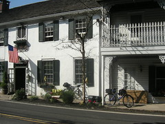
Wednesday, May 31. Near Middletown, NY, to Hyde Park, NY. This morning we headed out on a course I crafted late last night, one that would get us back to the ACA route without backtracking along the narrow, busy roads we traversed last night. The morning was cool and overcast, a nice change from the last couple days of open sun; and maybe there was a tailwind, or maybe the coolness made the effort easier, or maybe we were climbing less, but we were pedaling strong today. Sweating, yes, because it was so humid, but feeling strong.

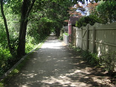
One of the roads we took is Petticoate Road, and near where it rejoins the route, it crosses the Shawangunk Kill on a bridge built in 1884. It is a beautiful crossing, green and quiet, with just a little turbulence in the water to give you the babbling brook sound. We took lots of pictures.

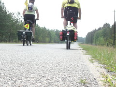
The climbing was less severe today, more rollers where we could get up some momentum and power up the other side (remember, momentum is a terrible thing to waste). Ever since Nancy mentioned the Cher song she was using for tempo, I can't get it out of my head either. I tried many, many other songs and rhythms, too: Cool Jerk, Canary in a Coalmine, Message in a Bottle, even an old Jeff Beck song, The Pump. Nothing could permanently banish those damn lyrics. I'm afraid I don't know very many lyrics from Disturbed. Maybe 11 can fill us in?

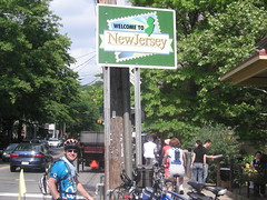
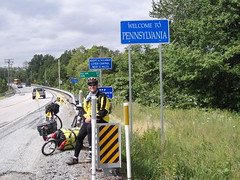
Just beyond Ulsterville, we met a small dog, Mary Jane, and her person (whose name we somehow neglected to get). She (the person) said she was getting a road bike this weekend so she and her boyfriend could go riding; Mary Jane was interested in us for a little while (what dog isn't?), but got bored after deciding we didn't have any food, weren't an imminent threat, and seemed to be friendly to her person. In any event, we got some good info about the road ahead, including bridge work that might mean a detour. Of course, we've run in to closed roads before; "Road Closed" signs mean nothing to us. We went around one in Pennsylvania, and another maybe a week ago in the St. Peter township. Today was no different; we came to the sign and rode right by. To us it just means there will be less traffic to contend with. The gravel was not too bad, and the construction guys were a little amused but OK with us passing through. Walked a bit, but we've done that on functional bridges. Over the Delaware. Several times.

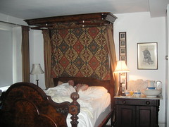
We were halfway between Shawangunk and New Paltz when we met Fred; he had to pull over and talk with us because he had done a cross-country bike trip back in 1976 with his wife, Pam. His excitement about our trip was infectious; his stories about the people he met, and the friends he still has, were delightful. He even gave us the name of a friend in Hyde Park, where we intended to stop for the night, who would let us camp in heer yard. But, we had already seen the weather report and knew rain was coming (I think it is raining right now), and had decided to stay in a motel near the FDR home so we could go see it in the morning. We appreciated the offer and would have taken it if we hadn't already made that decision. Fred, if you are reading this, thank you for your kind efforts; we share your excitement about this journey and hope you will find some entertainment in our blog.

On a slightly technical note, we passed a significant mile-mark for me today, 1750 miles, which represents more than 25% of the trip. It seems like a good time to evaluate where we are relative to the plan and what we have accomplished.

Where did we expect to be? At this point, I thought we would be near the border between Connecticut and Massachusetts; actually, we are in Hyde Park and will not even be in Connecticut until Friday, probably. In terms of days, that is about four days behind where my ambitious plan had us, and as we look ahead to the mountains of New England we are expecting to fall several more days behind the intended schedule. This is OK. Our only real time constraint is to get across the Rockies before it snows, and our new projected time for that is mid- to late August.

What about the budget? I'll be honest; we've missed the target $60 per day on average by about a third. There's still a lot of road ahead of us though, and many more opportunities to camp.

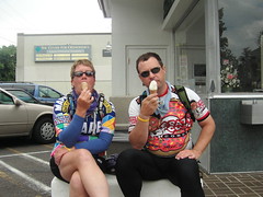
How do we feel? In a word, strong. Nancy is conquering hills she never dreamed she could, and now that I have a full range of gears available I am availing myself of the Granny Gear more often so I don't ruin my knees. And, we've only been in one hot tub. We are still grinning from ear to ear.

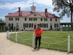
Tomorrow we are going to do the touristy thing and visit the FDR house, and maybe the Vanderbilt mansion too. We will take a short day and stop short of Connecticut unless we feel extraordinarily strong or something weird like that. Cheers!

Walpack Center, NJ to Middletown, NY!

Tuesday, May 30. As I write this, it's Wednesday night, and we've already spent a full day in New York. We came across the New York State line on Tuesday around noon, having spent the night at a less-than-full-service-but-under-new-management private campground. We started the day by walking our bikes back up to the campground's entrance at the top of the hill. I had seen the start of today's route when we pulled off into the campground, and It looked like we'd start the day climbing hard.

Fortunately for me, it was a short climb, followed by a couple hours of rolling hills--and a few steep climbs just for fun. I hadn't gotten the new music suggestions, so my brain was on it's own (and oxygen deprived, as well). Songs like "The Old Gray Mare (Ain't What She Used To Be)" and "Mr. Postman" got me up the hills on this day.

We rolled through Montague and crossed into NY at the town of Deer Park. We stopped for lunch at the Port Jervis Subway, and continued on through the townships, boroughs and villages of Huguenot, Godeffroy, and Cuddebackville before we hit a really long, steep climb right before Mount Hope. Just beyond Mount Hope and THE HILL was Otisville (remember Otisburg from the original Superman movie?), and a mail stop for us.

The replacement Airmat and a care package (thanks, MB) were waiting for us at the Otisville PO. Right next door was the Otisville Ice Cream shop, and it was a blazingly hot day--so we pulled a table to the shade and enjoyed some of Hershey's Premium Ice Cream.

While we were sitting there, minding our own business, Lorene stopped by. She is just getting back into cycling after knee surgery, and was interested to hear what our plans were. She's also just organized a citizens' committee to stop the installation of new electric lines through Otisville. So she wasn't able to throw in the towel and join our ride--but if you're reading this, Lorene, you can catch up with us any time!

By the time we were ready to leave Otisville it was 4:00pm, but hey, we only had about 8 miles to go and Lorene had assured us that "there was nothing up ahead to break your hearts" before we got to Middletown. There's always something, and today it would be Middletown.

We arrived in Middletown with our hearts still intact, only to find that Middletown is a town split in two. And the two parts have yet to meet each other. We stopped at a large city park, replete with commemorative statues and plaques, at the junction of two major county roads. From there our plan was to find the closest reasonable hotel and head for it. The three that we called didn't know where the park was, nor could they direct us from the county road intersections. Our last shot was the Middletown Motel, which had an address on county road 211, so we set off in the direction of their address.

In just a couple of blocks, the addresses reversed order. We were looking for a quiet place to call them for directions. At the corner we stopped there was a Domino's Pizza shop (loud music inside), a neighborhood ice cream truck, and the hubbub surrounding a recent fender-bender in the parking lot of the Domino's.

Matthew hunkered down to call them from the back of the building, and I approached the cop who was finishing up citing the parking lot accident. He told me he wouldn't stay at the Middletown Motel, but he did give me directions to the other half of Middletown--where they keep the nicer hotels.

Turns out this was about another 3 miles away, but there was the promise of a bed and food, so off we went. Now, I'm sure he was just giving me visual cues, but the directions were "right at the Wendy's, left at El Bandito. Then you'll start to see all the chain restaurants and the hotels will be right there." Lunch was long gone, and the Reese's cookies (new!) I had at the c-store as we came into Middletown were just an appetizer. I was hungry.

After a final, short but crushing uphill climb, we did find the hotels and restaurants in Middletown(part 2). It takes us some time to get our bikes and trailers unhooked and ferried in the elevator to our 2nd floor room. After that it's showers, a weather-channel fix and some laundry before we can grab dinner.

The weather channel shows that we have about 7 minutes to our choice of the area's restaurants, so we chased over to the Red Robin. It's a chain, but not one that we know--change is good, right?

The sky was darkening and the sun we'd seen all day disappeared behind gray and darker gray clouds. We noticed a huge cloud forming a circular pattern right above the Red Robin--we still had minutes to spare before the oncoming rain and 80mph winds arrived.

Sure enough, the rain started within minutes, terrifying the hostess and knocking out the satellite TV. The storm didn't last very long (80mph winds blew through in almost no time), and by the time we finished with dessert the storm had passed. We walked back to the hotel, and spent a cozy night not worrying about staking down the tent for a rainstorm. Maybe some other time.

Tomorrow--we continue on to Hyde Park, NY. I'm loving our pace and feeling good (and trying not to worry about the mountains yet to come). Brian, thanks for the "NY Welcome". 11, 5, Jim--thanks for the hill-climbing music suggestions. I think that 5 is right. I'm pretty sure that the reason I'm channeling Cher is from listening to too much Disturbed.

Tuesday, May 30, 2006

Oops . . . Forgot the Mural


Oops . . . Forgot the Mural
Originally uploaded by nstovall8.
Sorry! Forgot to put up the full view of the mural on the Manayunk

Towpath. Here 'tis.

Cooling off


Cooling off
Originally uploaded by nstovall8.
We'd been riding next to it and crossing back and forth over it for the last

3 days . . . finally gave up and waded in to cool off!

Portland, PA


Portland, PA
Originally uploaded by nstovall8.
Mary Beth was kind enough to take our pix outside the Mercantile in

Portland, PA. Next shot, Portland, ME.

Memorial Day in Belvidere, NJ


Memorial Day in Belvidere, NJ
Originally uploaded by nstovall8.
Back on the NJ side, we enjoyed a night at the newly renovated Hotel

Belvidere.

The Delaware River - PA side


The Delaware River - PA side
Originally uploaded by nstovall8.
We crossed back into PA to spend the night in the Grover Cleveland room at

the Black Bass Hotel.

The Delaware River - PA side


The Delaware River - PA side
Originally uploaded by nstovall8.
We crossed back into PA to spend the night in the Grover Cleveland room at

the Black Bass Hotel.

The Delaware River - NJ side


The Delaware River - NJ side
Originally uploaded by nstovall8.
We crossed into NJ, took a hard left, and found ourselves on the D&R Canal

Towpath.

The Delaware River - NJ side


The Delaware River - NJ side
Originally uploaded by nstovall8.
We crossed into NJ, took a hard left, and found ourselves on the D&R Canal

Towpath.

Philly Phavorites


Philly Phavorites
Originally uploaded by nstovall8.
The Liberty Bell, Friendship Gate, and of course, the Ben Franklin

Exchange.

Philly Phavorites


Philly Phavorites
Originally uploaded by nstovall8.
The Liberty Bell, Friendship Gate, and of course, the Ben Franklin

Exchange.

Philly Phavorites


Philly Phavorites
Originally uploaded by nstovall8.
The Liberty Bell, Friendship Gate, and of course, the Ben Franklin

Exchange.

Philly Phavorites


Philly Phavorites
Originally uploaded by nstovall8.
The Liberty Bell, Friendship Gate, and of course, the Ben Franklin

Exchange.

Close-up of the Mural


Close-up of the Mural
Originally uploaded by nstovall8.
This is just one of the 50 different animals created in the mosaic

mural near the Manayunk Towpath.

A Memorial Day to Remember

Monday, May 29. Belvidere to Walpack Center, NJ. After coffee and a chat with the Hotel Belvidere's owner, Sidney Deutsch, it was time for Belvidere's Memorial Day parade. We had front-row seats on the front porch, and after the parade, many Belivdere residents stopped by to chat. They seem to be very happy that the hotel has been renovated--apparently, it was nearly ready for the bulldozers. Some of them are lifelong residents, and remember the parties and other goings-on at the hotel back in the day.

Sidney's son, Jeremy, had recently moved to Belvidere from Portland, OR, so we had a great time chatting with him about his experiences there. He has a very high opinion of the Pacific Northwest, and only moved back to the East to help out with the family's new hotel business.

By the time we managed to get on the road, the day was already warm, and somewhat humid. The last few days had been about the same, so we were looking forward to riding by the river again. And for a couple of hours, the ride was great. Shady roads, good pavement, nice breezes, limited traffic. It was fun to watch what seemed like half of NJ out enjoying the Delaware River. We crossed a couple more pedestrian bridges (on foot, of course), and I think that I have now crossed the Delaware more times than did George Washington!

We stopped in Portland, PA, for a picture outside of Longhunters Mercantile, where we met Dennis and Mary Beth. Mary Beth took the picture, and we got to talking about our trip. (Hi guys! Hope you're reading this!) We also stopped for Kelly's ice cream, where we sat next to a family at a picnic table. The talk turned to our trip, and the kids were amazed that anyone would do what we're doing. "You could fly to Oregon--that would only take one day" was Frankie's comment.

As we entered Delaware Water Gap, out route took us down a side street and then onto a ('natch) pedestrian bridge. The bridge paralles I-80 over the Delaware River. There was no pedestrian traffic (and no law enforcement), so I decided to ride across. This is an odd experience: on the left-hand side I'm separated from I-80 traffic by a 4-ft high, solid concrete barrier. On the right-hand side, I'm separated from the Delaware River (and I'm guessing about a 100-foot drop) by a metal pole and rail fence. And this, my friends, is part of the Appalachian Trail!

A little later on, the road turned away from the railway and the freeway, and started up the mountain. We could still see the Delaware, but as we hit some of the steeping ascents, my eyes were fixed on the roadbed in front of me. Matthew's trick is to only look a few feet in front of the bike on a steep climb, and to put a rythm in his head as a beat to spin the pedals. I've been using this trick with some success, but the only rythm I can get in my head is a chorus from "Gypsies, Tramps and Thieves", or the rythm of my lungs gasping for air. I made it up all but one of the hills today, though, using that tactic. The hill I walked just became too steep and too long--I got about halfway up it before the sweat on my hands made them slip on the handlebar grip--and I forgot how the song ends. After that, we still had a couple more hours of ups and (glorious) downs, until we finally reached the campground at Walpack Center.

This campground caters more to RV's--long-term RV'ers--and so we didn't find showers tonight. We did find the pool, though, so we jumped in and cooled off there for a while. The view from the pool is pretty stunning. You can see the mountains (that we just rode through, thank you), and above that is a ridge that is part of the AT. It's pretty amazing to be in close contact with the AT. On this trip, we've met a few folks who have done all or parts of the AT. I keep imagining them walking through these hills and forests.

Without showers or laundry rooms to slow us down, we made camp pretty quickly. Dinner tonight was another pre-packaged meal, one that we picked up at Dick's in Plymouth Meeting. Black Been Tamale Pie is another winner. We also had some buttermilk biscuits. A few days ago, I found some packages of mix that only require water, no eggs. I picked up a couple varieties, and tonight the buttermilk biscuits with honey (purloined from a hotel's breakfast bar) was a great dessert. I think I am finally getting the hang of the Bake Packer.

I want to close tonight by saying thanks to everyone who's posted notes, sent e-mails, called, and sent along care packages. While it's hard for us to respond individually to the posts, we do read every one of them. Thanks for reading along with us--we are glad you're tagging along.

PS - can anyone suggest a different tune for hill-climbing? (other than It's a Small World, of course)

One great place leads to another

Sunday, May 28. Lumberville, PA, to Belvidere, NJ. The Black Bass Hotel and Restaurant was a delightful place to enjoy an evening, and to spend a very comfortable night. Since it was Memorial Day weekend, we were not assured of finding a place to stay up the road, and so we were kind of liking the prospect of having to spend another day here. We made several calls, finding all the campgrounds we knew of full, but finding a room available at the Hotel Belvidere, so we made tracks for there. We thought we might stop for lunch in Phillipsburg, and since the map showed little in the way of attractions to distract us, we thought we'd make good time there just enjoying the scenery. The first ten miles or so from Bulls Island is (or for us at least) a continuation of the D & R towpath, so we had a nice, liesurely ride without worrying about traffic (other than the pedestrians and other bicyclists). Once we got to Frenchtown, where the New Jersey side of the towpath ends, we briefly considered hopping over to the Pennsylvania side until another cyclist told us to skip it. Ever since the flood last year, it has been impassable. So we continued on our mapped path. About two miles beyond town, we found ourselves in terrain where I thought I could use my largest gears, and tried to shift up to my big ring; but the derailleur wouldn't make the chain go up (sort of surprising, since it worked OK until today). To make matters worse, when I shifted down again, the derailleur was rubbing on the big ring. We knew there was a bike shop back in Frenchtown, so we headed back there to see if they could fix it. They couldn't repair it, but they did adjust it so it would get us to Easton, across the river from Phillipsburg, where there was a shop that COULD replace the defective derailleur. Nancy is an angel. I was worried that these delays were going to upset her, or make both of us cranky; but she was great. We did get to Genesis Cycles around 3:15, and they had the right part in stock, so we left my bike there and wandered off in search of lunch. Tomias, the owner of Genesis, was very helpful and friendly; anyone reading this who might need help in the Easton area would do well to stop there first. We had a nice, late lunch at a place called Pearly Baker's, where Nancy picked up the latest copy of Traditional Chinese Medicine World for some lunchtime reading. Fascinating. We made it back to the shop and found my bike with a brand new derailleur, one that works with the crank I have, and it shifts as smooth as silk now. We resumed our route after Nancy called the Hotel Belvidere to apprise them of our revised arrival time, around 7. One of the roads we found ourselves on is called River Road; although some of it was OK, vast swaths of it are in such poor repair that riding on it is borderline dangerous. I would have been truly worried if we were on narrower tires; potholes, uneven asphalt (Nancy spelled it "assfault", and said she could have poured it better. I think she's right.), frequent splits and poor patch jobs. It was a relief to finally come to some ordinary shake-n-bake surfaces. At one point, near the end of the day, a pickup truck with two guys in the cab and one in the bed (presumably guarding the beer) slowed while passing us, and the guy in the bed asked us where we were headed; Nancy called back "Oregon!", and he, now receding down the road, yelled back "REALLY?!". We nodded, and then they were gone down the road. A bit later, we passed by a party taking place along the river, where the guys were apparently headed, because as we passed the whole group gathered there shouted out their approval. That was nice. Nothing prepared us, though, for the pleasure that was in store for us at the newly renovated Hotel Belvidere. For one thing, as we rolled up to the front, there was a group of four on the porch cheering for us, including the owner. The room was absolutely lovely, the shower felt GREAT, and with the late lunch I thought we would skip dinner and just go to sleep. But around 9 we started to get hungry; this could have been a problem, it being Sunday night in a quiet town on Memorial Day weekend; but as we were downstairs inquiring about local places to eat, one of the other guests, Luanne, offered to drive us to the diner where they had had lunch earlier, and then come pick us up when we were finished! Luanne was up from Virginia, having a get-together for her Uncle and all his old friends, and said she was happy to do it, since it was far too far to walk. What a sweetheart! Good karma is still with us, I guess, with all the great people we've met and who've treated us so nicely. They are making this adventure so much more fun than I thought it would be, and I thought it was going to be a blast! Tomorrow, Delaware Water Gap; we'll see where we end up. Cheers!

Friday, May 26, 2006

Philly!

Friday, May 27. Plymouth Meeting to Philadelphia (and back).

We decided to take a day to go into Philadelphia today, only about 15 miles from our hotel in Plymouth Meeting (near Conshohocken), PA. And since the ride would be on the Schuylkill (pronounced "school-kill") River bike path, we went to bed Thursday night looking forward to a day of playing tourist.

Friday morning's weather report warned us of rain from about 3pm on through the evening, so we took along all of our rain gear--just in case--and set off down the bike path.

If you ever get the chance to ride this route, take it! It's flat, with great views of the river. Once we got into the outskirts of Philly, near Manayunk, the bike path changed to a gravel towpath. At one break in the path there is a great mosaic on the side of a building, created by some students as part of an art network project. I snapped a couple of pix of the mural, decided against a stop at the local coffeeshop, and we continued on down the path. A short time later it came to an abrupt end--at the Manayunk Brewery! While this solved the problem of where to get a beer, we were still confused about where to pick up the trail into the city. I was still contemplating riding up to the brewery when I noticed a bike shop right at the corner. The wrenches at Human Zoom bike shop filled in the missing details, and we were off to pick up the trail.

Just as we got into the city, it started to drizzle, and by the time we got to Logan Circle, it was really coming down hard. We ducked under a construction scaffolding over a sidewalk and prepared to wait it out. It was only noon, and if these were the precursor to the predicted 3pm storms, we were going to be in for a wet day. We got out our rain jackets and helmet covers, and waited for a letup.

The squall passed over in about 20 minutes, so we decided to continue on to the Independence Mall. The park rangers told us that we were too late for tickets into Independence Hall, but there were other attractions in the area.

We locked our bikes to the fence outside the Liberty Bell exhibition, and put on the bike cover--just in case.

By the time we were done touring the Liberty Bell exhibit, the skies were clearing up. We left the bikes locked up, and found the Visitor's Center. A tour-bus employee gave us a tip to have lunch at the Reading Terminal Market, so we headed off in that direction.

And what does one have for lunch in historic Philadelphia? An authentic, historic philly cheesesteak, of course. The market reminded me of the farmer's market in Toronto, where you can find cheese, chocolate, wine, fresh vegetables and fruit, bakery items (especially good are the oatmeal cookie sandwiches at the Flying Monkey Patisserie), and ethnic take-out foods of all kinds. You can also find Philly cheesteak. By the time we sat down with our lunch at a table outside the market, I was peeling off my jacket and socks--glad for shorts and a short-sleeve shirts. The sun was out and there wasn't a cloud in the sky!

After lunch we walked over to see the Chinatown Friendship Gate, which proclaims Philadelphia's friendship with sister city Tianjin, China. I love to walk through Chinese markets--there are always barrels and baskets of dried spices and other mysterious dried items. I can't imagine what these things might look like re-hydrated, and even though they're each labelled, the labels are in Chinese characters--so the mystery remains unsolved!

We also visited Ben Franklin's home--or rather, the site where his home used to be. In its place is a metal frame, showing what the frame of his home would have looked like. Quotes from letters between Ben and Deborah, his wife, are etched into the pavement "inside" the house. They corresponded quite a bit about the house, its furnishings, and even fabric for the curtains and the color of the wallpaper! Ben was abroad while the house was being built, and Deborah oversaw much of the initial construction.

Near the house site is a rental property that Ben owned (Franklin Court), as well as the B. Free Franklin Post Office, a working postal center. Back in the day, Ben was the first Postmaster General, and signed his name to cancel stamps sent through the mail. He signed them as "B. Free Franklin", which is thought to have been a reference to America's yearning for freedom. At this post office, stamps are still cancelled with an ink-stamp replica of Ben's signature.

But my favorite part of the whole Ben Franklin complex was the museum. This museum has to date from sometime in the 70's.

The first room has a number of replications of Franklin inventions--the Franklin Stove, the Long Arm, the Armonica, and some artifacts from the Franklin house--a desk, a chair, etc. The second room has a wall that is entirely covered in mirrors--and a sort of flash-dance flashback with neon signs that read "Statesman", "Inventor"and "Diplomat".

But the third room is the best. There are about 50 princess phones, mounted on waist-high poles in rows across the room. At the front of the room are numbers that you can call from these phones--The Franklin Directory.

Each number will call up (!) a voice from the past--not necessarily Franklin's past--who will make a short statement of their feelings about Ben Franklin. I couldn't keep from cracking up when I tried it. The first name I dialed was Franklin's son-in-law. He's probably not real busy right now, but it took 4 rings for him to pick up the phone! And the other numbers I dialed were just the same. You can hear the phone, rotary dialing the number, and then the number rings. After 3 or 4 rings, you can then hear the call being connected! This is an exhibition sadly in need of updating--or better marketing.

That room also had an odd listing of quotes from Ben, sorted into categories such as "Family", "Business", "Health", etc. This display is just not working right, because there's no correlation between the list of quotes and what shows up on the screens below. I think that at one time you could "dial-a-quote", and the one you selected would show up on a microfiche display. But the selectors have been removed, and only 2 of the 4 screens seem to rotate through the sayings. The 3rd screen is stuck on one quote (not even that memorable), and the last one is dark. Ben himself would have something to say about the poor use of this technology, I think. But I was laughing out loud, and some of the other visitors may not have appreciated my reaction. Ben was always thinking of ways to make something better, safer, or more useful. I think he would have laughed along with me.

After a stroll through and sit-down in Washington Square, we headed to the Market East Station to catch a train back to Conshohoken. Bikes are not allowed on the train during peak hours, so we couldn't get on the train until 6:45pm. Worked out ok for us, as it gave us some extra time in the city.

Once the conductors saw us, they opened a car just for us. I can understand why these trains have bike restrictions. There is no kind of accommodation for bicycles at all. We had to find a spot between the seats to park our bikes, and were glad that we didn't have to wrestle them through a car that had actual passengers.

The ride to Conshohoken was about 30 minutes--the trains are smooth and quiet. Once off the train it was only about 3 miles back to our hotel, but we scooted across the road and stopped in at Dick's Sporting Goods. Matthew had inadverdently left his sunglasses on the train, and I wasn't about to let him go on without eye protection. While we were there, I wandered over to the camping section and found a couple of new dehydrated dinners for us to try--Kung Pao Chicken and Black Bean Tamale. We're hoping to be able to camp the next couple of nights as we thread our way in and out of Pennsylvania and New Jersey. This being Memorial Weekend, we're also hoping that there will be a campsite available when we get to the end of the day's ride!

Couldn't have asked for more fun than we had in Philly, though. I'm glad we took the time to take the spur into the city. We didn't get a chance to hook up with Sue's brother Joe and sis-in-law Patty, nor meet Sue's parents, so I guess that will have to wait for the next trip.

Thursday, May 25, 2006

Valley Forge and Sue's old stomping grounds

Thursday, May 25. French Creek State Park to Conshohocken, PA. With the idea of heading to Norristown, PA, just 30 miles away or so, we slept in a bit in our secluded campsite this morning. It felt a little lazy, but it also felt good to relax. We had a site at French Creek State Park, and might have been the only people in the loop (I certainly didn't see anyone else until morning). As anticipated, we had a good, long downhill stretch to rejoin the route, almost 2 and a half miles worth. That was nice. Of course, we are still in Pennsylvania, so there was plenty of climbing still to come. As we approached a turn on the route that would have led us onto miles of back roads (and no services), we opted to stay on a more direct route (which we would later rejoin anyway); and it's a good thing we did, because otherwise we would have missed the ice cream shop. It was a perfect place to stop, at just about 18 miles. The day was warm and we needed a cool treat; and although water ice (pronounced "wooder ice", we were later informed by an ad on a passing bus) was on the menu, we chose the familiar ice cream so we could get our dairy for the day. Yeah, dairy. You'd be surprised how easy it is to have NO dairy servings during a typical day on this trip. We have to make sure we get our minimum RDA, ya know. We reached Valley Forge around 1 and met George and Joan, cyclists who had just ridden on the path we were about to take, and who were getting ready to head back. They gave us some information about Norristown (basicallly, not to expect much), and about Conshohocken (where they thought we should go since the library was easy to find). Even though I knew Conshohocken was more towards Philadelphia than I thought we were going to go, when we got to Norristown it seemed like the right thing to do. Joan is a teacher who is out sick today, although she looks like she's pretty well beaten whatever bug was affecting her this morning (ah, the wonders of cycling). George is a representative for Etxe Ondo, and they were both sporting EO jerseys (very nifty, too). Joan had told us that the path we were about to take was flat, but we perhaps misunderstood that she was talking about the trail on the other side of the river. The trail from Valley Forge was still somewhat rolling, with not a few challenging uphills (made more challenging by the expectation of flat terrain); then, we crossed the river - how to describe this? - on a boardwalk on the side of a bridge, maybe 3 feet wide. We were both struck with the same thought, that scene from "Indiana Jones and the Temple of Doom" with the rickety suspension bridge. For a good while afterwards, I had the Indiana Jones theme song in my head. The path along the Schuylkill River (that's pronounced SKOOL-kil) was smooth and flat and fast. We were overtaken at one point by another cyclist who was interested in our trailers, and we chatted briefly before she had to race off ahead to catch up with her riding partner. We never even got her name. By the way, Sandy, you'll be happy to know that the tire you helped us get at Green Mountain Cycles is working out very well. Nancy is very happy with the smooth way it rides. Thanks so much, again, for your help; we might still be there if not for you. The small shop that George and Joan said we would find in Conshohocken was indeed easy to find, and so was the library. An older couple at the shop didn't really believe us when we told them we had ridden there from Atlanta, and asked several times before they would believe it. The weather seemed to be threatening rain, for the first time in many days, so we looked for a nearby hotel, and found one in Plymouth Meeting, less than two miles away. After two mountaintop campgrounds in the last two days, Nancy promised I would get a hotel and pizza tonight; true to her word, here we are at a Hampton Inn and we walked over to Franzone's for some good Philly pizza. Over dinner, we decided to go into Philadelphia tomorrow, and perhaps to visit Sue Pezely's brother Joe and his wife Patty, or Sue's parents, who live nearby. We will see what develops over the next day; in the meantime, we're staying here an extra night so we can do the Philadelphia thing tomorrow without the trailers. We'll just leave them in the room for the day and take our bikes in to town. Will we be able to hook up with Sue's parents or with Joe and Patty? We'll see tomorrow!

Valley Forge


Valley Forge
Originally uploaded by nstovall8.
We stopped here at Valley Forge, where we picked up a bike trail that goes

all the way to Philadelphia. These cabins are what remains of George

Washington's encampment at Valley Forge. During the winter of 1777, there

were 2,000 of these cabins built in the encampment. The guide brochure

claims that these hills are some of the steepest in Pennsylvania . . .

Starlight View


Starlight View
Originally uploaded by nstovall8.
From our campsite at the very (very) top of a mountain, we could look out

over the valley where we'd be heading in the morning. The town below is

Ephrata--where the BOB trailer tire blew, and Sandy came to our rescue.

Mennonite Horses


Mennonite Horses
Originally uploaded by nstovall8.
This beautiful team of horses is pulling a wagonload of hay bales across the

field. This area of PA is home to a large Mennonite community, and farming

is BIG here.

Susquehana River Looking North


Susquehana River Looking North
Originally uploaded by nstovall8.
We had been climbing and dropping in a forest for the better part of 2

hours, and suddenly the road dropped us out onto the banks of the Susquehana

river.

Welcome to Pennsylvania!


Welcome to Pennsylvania!
Originally uploaded by nstovall8.
We've crossed the state line into Pennsylvania. I can hardly believe how

fast we blew through Maryland and the DC area . . .

Loch Raven Reservoir


Loch Raven Reservoir
Originally uploaded by nstovall8.
The sun is out, but I'm wearing leg warmers and my jacket! There are quite

a few cyclists on this road, and it's a gorgeous ride. Some rolling hills

along a shady, tree-lined route.

Wednesday, May 24, 2006

Hopewell to Geigertown, PA.

We felt like we needed a short day to give our legs a break from all of yesterday's climbing, so we set our sights on French Creek State Park near Geigertown, PA, about 40 miles away. And for the first couple of hours, things were going really well. Then it got even better.

The route sheets took us through Reamstown, but not on the main drag. We needed to stop for some food supplies, so we jumped onto the main road through town. Seeing as it was near lunch, and the Silk City Diner was right in front of us, we decided to stop.

Turns out, the company that made the original dining cars also made the car that we dined in--and the manufacturer named it the Silk City Diner. We sat right underneath the placque!

We headed down the road to pick up groceries at the local Weaver Market, where everyone was interested in our trip and our rigs. Takes longer to check out and get going that way.

I'd been having some problems with my B.O.B. Trailer tire, and as we headed down the hill past the market, it blew out completely. This is the original tire, so I guess I shouldn't be surprised. It's been on the BOB for about 8 years now . . .

Anyway, we pulled off to a side street and were trying to figure out just what to do, when Sandy stopped by. She thought we might be lost, but when she saw that we had bigger problems, she jumped into action.

There are a lot of bike shops in the general area, but a number of them follow the Mennonite tradition of closing on Wednesdays. (yep, today's Wednesday) But with Sandy's yellow pages, we found a shop that was open and had a replacement tire.

Sandy took Matthew, the tire and rim, while I waited with the bikes. I had a great spot under a tree, on a beautiful day in Pennsylvania. How lucky can a girl get?

It didn't take long for Sandy and Matthew to return with a new tire, and we were ready to go in short order. We figured we had about 25 miles to the State Park, so we thanked Sandy (and if you're reading this, thanks again!) and set out on our way.

There were some challenging hills left in the day, the last one being the 2-mile climb to the campsites at the park (I'm pretty sure that none of these tent sites will ever flood). From Lake Hopewell to the campsite entrance, we climbed 400 feet in less than a mile. It's a great park, and encompasses both Hopewell Lake and Scotts Run Lake, as well as the Hopewell Furnace National Historic site.

Dinner in camp tonight was Mexican Chicken and Rice--This one ranks up there with the Turkey Tetrazzini as our favorites. Matthew made a small fire for us tonight--it's not as cold as the last few nights, and we're both ready to hit the mats tonight.

I'm looking forward to starting another day with a long downhill. Tomorrow we head for Norristown, and hope to spend some time at the library uploading more pix. We also are trying to map out our route over the holiday weekend--and cross ouur fingers for an available room or campsite.

Tuesday, May 23, 2006

The View at the Top

Tuesday, May 23. York Furnace to Hopeland, PA.

We have stopped for the night at the Starlight Campground Resort, and have the best site in camp! It took a monumental effort to get here, because the campground sits at the top of a hill. The very top. We crawled our way up here and after catching my breath, the view from the top of the mountain took it away again.

Today's ride started early, and we woke to temps in the low 40's. We made breakfast and then broke camp, beginning our ride with a long, slow crawl out of Otter Creek Campground. We spent the next 2 1/2 hours climbing steep elevations and then losing all the climb on a sweeping descent. Around 11:30, our final climb and descent dumped us out right in front of the Susquehana River! Fortunately for us, a coffee shop was right there too, so we stopped in to warm up and take a break.

Turns out that the folks at the coffeeshop are actually kayakers, and the coffee, ice cream and gift shop is a side venture. The kayak business' motto is "Go Play Outside". Today they were hosting a high-school field trip; an ecological and biological tour of the Susquehana. It felt a bit too cold to me to be out on the water today, but the weather report for the Memorial weekend looks promising.

As both the kayakers and Wayne, our Camp Director had promised, the road evened out past Marietta. For about an hour. Then we were back into the steep climbs from the morning. On one break from all this climbing, I spotted a team of 6 horses pulling a wagon-load of hay. Matthew identified the farmers as Mennonites, not Amish--something about the hat, I think. I did get a couple of pix of the horses, which I'll upload at the next library. Later on we saw a couple of Mennonite women (different hats) at a Quilt Shop. I didn't stop . . . I couldn't have bought anything . . . Nowhere to stash stuff!

Once in the campground, we met Jonathan and Andy, both down in PA from NH. They're on motorcycles, and have taken a 5-day trip to enjoy some of this great weather. We might meet Jonathan again once we get into NH--he runs the bike shop at a well-known resort on Hwy. 26.

We're now freshly showered, laundered, and stuffed full of another fabulous rehyrdrated dinner thanks to Suzi and Jim. Matthew has built a fire, and the view from my picnic bench across the valley is stunning. Fir trees are silhouetted against a dark blue sky, lit up with stars. Across to the horizon, the towns below have lit up as well. This night, this view, is our reward for our efforts today.

30 Days to PA

Towson, MD to York Furnace, PA. Tonight finds our intrepid couple at the Otter Creek Campground near York Furnace, PA, after another long day in the hill country. Less than 50 miles, but Matthew guesses we climbed around 4,000 feet today. What is really amazing is that he did all that climbing today without his granny gear!

The derailleur and new crankset apparently still need some adjustments, with the result today that he wasn't able to shift into his smallest gear. I could not have done all of today's climbs without my granny gear, but Matthew muscles his way through it, somehow. Besides the gearing issue, the master link on his chain popped off, so we had a short break to replace it.

The sun was out today, but the winds were WNW between 10 and 20 mph, so it felt cold all day today. Both of us are wearing jackets, but Matthew seems to feel the cold more. Just outside of Towson, we crossed the Loch Raven Reservoir. An absolutely gorgeous spot, but Matthew was already so cold that he changed into his heavy tights and even put on gloves! It doesn't really feel like the end of May.

We knew that the campground is on the Susquehanna River, and I was glad that the last half-mile was all downhill. Even though I know we'll be climbing that hill tomorrow, our Camp Director, Wayne, assures us that after we reach Marietta(!), the terrain evens out. I'm clinging to that like gospel for the time being.

Dinner tonight was sponsored by Suzi and Jim Stovall. (Thanks!) After an appetizer of a peanut-butter-smeared tortilla, the package of Pasta Primavera that arrived at our last PO pickup was a great treat. We also attempted to make the Chocolate Decadence Cheesecake, but it turned out more like a milkshake (which is also a dessert, in my book).

We're so worn out tonight that everything is incredibly funny,and we could hardly eat, let alone talk we were laughing so hard over dinner.

The Otter Creek campground features campsites with electricity, so we're able to charge up some of our electronics. In the unexpected category, the showers here are coin-op. 50 cents will get you 7 minutes. Laundry facilities are also available, so we're able to throw everything together for one load. While I'm on the subject, we found a laundry product ot one KOA kampground that works perfectly for us. A disposable sheet is impregnated with the soap and softener, so you just throw one in with the load and throw it away when you're done. Plus, they're incredibly packable.

As I write this, playoff hockey is on the XM radio in our tent. I'm a little surprised that we can get a signal here, because I don't have phone service. I have a feeling that I won't be awake to hear the end of the game, though.

Tomorrow's ride will be another 50 miles or so--depending on how well we face the hills. Hard to believe that we're already in Pennsylvania, and have logged over 1400 miles. After just a month on the road, I totally understand why people want to travel around this country. It really is such a beautiful country, and there's so much variety to see. Today we could look out at the top of a hill and see a setting fit for a Wyeth painting. Farm fields planted with variious crops, forming a quilt-like pattern on the land. In the middle of each quilt square is the farmhouse and barns. We're still seeing a lot of horse farms (we're just one day's ride from the home of the Preakness), and we've entered Amish country. While we were stopped for a break this afternoon, a horse-drawn buggy filled with 6 Amish women drove by. They were all dressed in long, dark dresses, and each one had a dark bonnet. We were on the opposite side of the street, and when we waved, all six of them waved back. That was a fun moment for me--I guess as a cyclist, I can really understand alternative lifestyle choices. I hope that I'll have the opportunity to meet and talk with some Amish folks sometime soon.

Matthew's comment: despite the cold, the wind, and the hills, I'm still having the time of my life.

Sunday, May 21, 2006

Rockville to Towson, MD (Part 2)

The library at Ellicott City has disabled their USB ports, but the librarian there helped out by putting me in touch with the Enoch Pratt Free Library in downtown Baltimore. They did have USB access, and since the would close at 5pm, we decided to head there and try to upload pix.

It was only about a dozen miles, but the hill-factor combined with the sketchy downtown map conspired to eat up more time than we would have liked. One particularly long downhill took us to (and through) historic Ellicott City. The shopping district that we cycled through was awash with hippie-ness. Somebody was creeating huge soap bubbles and releasing them on the street for us to ride through. And I swear I could smell patchouli wafting through the entire area. Then we crossed the Patapsco River, and headed up another loong, slooow hill.

For the last few blocks of the day's trip, we were going the wrong way on a one-way street. (To compound the error, we rode on the sidewalk) But we were finally in Baltimore, at the library--all we had to do was find an available computer.

I was able to upload the pix I'd been hording, and by about 4:30pm we were set to ride the remaining 10 miles to Towson.

The hills were waiting for us, and so it took another hour before we ended our ride for the day. While I wouldn't have complained if the last 10 miles had been downhill--or even level--I still feel pretty good. I haven't yet had "shaky-leg syndrome", which I'm taking as a good sign. Both of us are feeling pretty good--and we're in good spirits and still enjoy each other's company. I'm taking this as a good sign, too. Tomorrow marks Day 30 on the road. We're hoping to end up in York Furnace tomorrow. A distance of about 50 miles--and a crossing into Pennsylvania!

Quote for day: "Adversity becomes adventure after a shower and a couple of beers".

Sunday, May 21

Rockville to Towson, MD. Note to self: just because the map doesn't show any elevation changes, doesn't mean the ride won't be hilly. And today's ride was exactly that. We started out early, and in my mind that translates to an easy ride, finishing early and feeling refreshed. Since we were a little off route today, we thought that today's mileage might be around 50 or so. It took us about 5 hours to ride 56 (did I mention hilly?) miles today. Just for comparison, the "boys" riding the Giro d'Italia today will cover about 125 miles in about the same time. But they have media coverage, team chase cars, and matching uniforms--none of which we have. On the other hand, we will never be caught by the peloton. The weather today was (and is) georgous. Mid-60's, sunny, and warm with NW winds. Just about perfect riding weather. We made a stop around 11am and met a family who has biked a lot on the C&O Canal Bike Path. We met a cyclist in DC who had done that path and really enjoyed it, too. We got to talking about our route, and when we mentioned going to New Hampshire, the woman supplied us with her sister and mother's phone numbers. "My sister had 5 kids, so she might be busy (ya think?), but call my parents. They are always taking in strays." The goofy thing is that we forgot to ask her name . . . guess the conversation with her sister will be really interesting. We stopped for lunch on the outskirts of Ellicott City--we had some time to kill before their library opened at 1:00pm. Back on our bikes, we followed a family of 5 on their bikes to the library. We had a nice chat with them; they are just introducing their kids to cycling. Their oldest daughter is riding her first 2-wheeler; one of the boys rides a tag-along which is attached to the seat post of another bike. The other boy is still young enough to ride in a bike-seat behind his dad's bike. They were very enthusiastic about our trip, and checked our route into Baltimore for us. More later.

Welcome, Spring!


Welcome, Spring!
Originally uploaded by nstovall8.
I don't know how Matthew missed seeing this, but I had to stop and capture

this for the record. This is yard art in Maryland . . . I wonder what they

do for the other seasons!

Reagan National Airport


Reagan National Airport
Originally uploaded by nstovall8.
The Rock Creek Bike Path took us right through the flight path of one of the

runways at Reagan National! Here's a big one just taking off now.

The Big House


The Big House
Originally uploaded by nstovall8.
This is George Washington's place on the Potomac. There are some stunning

river views from the back side of the house and lawn.

George's Garden


George's Garden
Originally uploaded by nstovall8.
This is in the "Upper Garden" at Mount Vernon. Now this is the way to

garden--try it all, and have a large staff to manage it. Around this garden

are the shoemaker's shop, the smokehouse, and a special fire-house where the

heat from the fireplace is directed to the floor of the greenhouse. This

made it possible for GW to grow tropical plants.

Saturday, May 20, 2006

DC, Rockville, and Michele's FABULOUS parents

Friday, May 19, 2006. Springfield, VA, to Rockville, MD via Washington, DC. Today was "Bike-to-Work" day in the DC area, so for once we looked like we fit right in. We were admittedly behind rush hour by the time we got started, and my flat tire and subsequent puncturing of the first replacement tube set us back even further. We also decided to do the touristy thing and take a minor detour to go see Mount Vernon, George Washington's home.

There is a bike trail, appropriately called the Mount Vernon Bicycle Trail, that leads directly to the attraction. It was just four miles out of our way, and even though we were running late, we opted to go because we were so close. We had each had a bagel and some granola cereal for breakfast; to Mount Vernon, it was 16 miles. We wandered around, taking in the upper garden, the bowling green, the various outbuildings, and the view out over the Potomac (which was spectacular, even in the gathering clouds of early afternoon). We decided against the tour of the mansion itself, since the wait was about 30 minutes.

We got back on the trail around 1:30, and stopped when we got back to where we had originally found the trail to have a snack (Paydays, the best energy bar out there). We tooled along on the trail for quite a while, until we ran into some unexpected construction; the small detour was pretty well signed, but at one point we found ourselves dumped out onto Union Street with no real indication that the trail continued anywhere. A serendipitous turn down a side street plopped us right in front of a bike shop, where we got directions and a couple of new spare tubes. My mirror had broken at the same swivel point as the previous one, but was still relatively intact; there were no suitable replacements at this shop, though.So I stuck with the broken one, even though it wobbled and would not stay in one position for long, especially on the bumpy Mount Vernon trail.

Interestingly, the trail goes right by the Washington National Airport, where we stopped briefly to get a few pictures with airplanes taking off in the background. One interesting thing about this airport that you might not know if you are not around on the ground when planes take off is that the sounds of fireworks and/or gunfire are played frequently near the watery areas, presumably to keep birds away (so they don't get sucked in to aircraft engines). People keep looking up to see the fireworks, but there aren't any.

After a brief moment of confusion about how to get to the Arlington Memorial Bridge (which, BTW, locals just call "the Memorial Bridge" - if you call it by it's actual name, you just get puzzled looks), we made it to the Lincoln Memorial around 3:15pm. Nancy had been there before but I had not; I had been anticipating this visit for some time, and it was all I hoped for. On one side of the memorial, the entire Gettysburg Address is carved into the stone wall; on the other, his second inaugural address. The statue of Lincoln himself is a commanding and, to me, real presence. You could almost believe he was looking out across the mall.

Which we did, too; got a picture of the two of us with the Washington Memorial in the background. Nancy will be posting that soon.

It was a little difficult to find the Rock Creek Trail; and by the way, Dad, the maps you have are different from the ones we are using, hence the confusion when we spoke with Michele while traversing the area. The Rock Creek Trail suffers from a distinct lack of signage; it can be quite challenging to find the right route. I expected the kind of wide, smooth, painted asphalt multi-use trail we experienced in Georgia. Unfortunately, it was not very wide (just a couple feet in some places), not very smooth (frequent root intrusions causing bumps were the worst, but also many places of cracked and deteriorating asphalt), and made frequent unmarked branches which made us stop just to figure out which way to go. We must have talked to 20 people that way.

We called our friend Michele, one of our former neighbors in Georgia, who grew up in the area, for help. She was a tremendous help; she even went so far as to reserve a room for us at a hotel in Rockville, and at a pretty decent rate, too. AND, as if that weren't enough, it was RIGHT NEXT DOOR to the Rockville REI, our de facto sponsor. We were hoping to make it into town early enough to meet Michele's parents for dinner, since they live nearby; in order to make a little faster time, we abandoned the Rock Creek Trail and just rode up Beach, the street it parallels (which is MUCH smoother going), until we reached a street Michele told us we could take to get to the street the hotel was on. We got to the hotel OK, but it was far too late to join Michele's parents for dinner; so, we decided to take a rest day on Saturday, so we could spend some time with them, Gil and Claudette Amyot. They assured us that they would take us to the post office in Brookville so we could retrieve our general delivery packages in the morning.

Gil and Claudette are simply wonderful people; not only did they ferry us to the post office, they gave us a nice tour of the area in the process. After we got our packages, we headed to Panera for a nice, leisurely lunch, and then to their place. We had a wonderful time talking with them; Gil and Claudette got married in PARIS, in APRIL, while he was stationed there as an interpreter for the Army. They regaled us with their amazing stories; Gil was an extreme sports enthusiast before they were even called that - he parachuted from airplanes, went SCUBA diving, took an ice climbing seminar on Mount Hood from Tenzig Norgay; they've been to Egypt and all over Europe together, he to New Zealand and Australia; he has a Master's in Theater and was a professional actor in New York, before he was an interpreter in the Army, before he was a teacher while going to Law School at night, was a lawyer for the Civial Aeronautics Board before joining Western Airlines; they still speak fluent French and think that we'd all be better off if we all did, too (and I have to concur). In one of their many adventures, they traveled on Pakistani International Airlines and camels in Egypt, and there was an assassination in the very hotel they were staying in.

It was enough to make the rest of the day fade into irrelevance, but I should mention that Michele made sure we were very close to an REI (RIGHT next door, it turned out), and we had a little maintenance work done on Nancy's bike (it wasn't shifting right) and bought some more necessary supplies. One thing we bought was a headband for me called a Halo, which has a little flexible band that fits right above the brows to prevent sweat from dripping down into my eyes. We also got me a replacement mirror, a better one that folds in so it can't get damaged the way my other two have.

For dinner we went to a nearby restaurant, a charrascuria like the one we went to in Manaus a couple years ago, and found ourselves seated next to a nice pair of Marines (one current, one retired). Jim (the retired one) and Rachel were fun to talk with, and we shared some of our adventures with them and they shared some of theirs with us. She has already been deployed once to Iraq, and although she's working now here in Bethesda, she may have to go again. Rachel, here's wishing you all the protection you need to stay safe!

It was nice to take a day off; it felt good to just relax a little (and finally get to watch some PLAYOFF HOCKEY!). Tomorrow, since we will be off route some, it is hard to determine exactly how far we'll go, but a fair estimate is about 50 miles; for now, we expect to either camp about 10 miles this side of Baltimore and run the gauntlet of rush hour Monday morning, or stay somewhere in Baltimore. If the wind is with us or the mileage is less, we may push on past Baltimore. We'll see.

Haiku moment
A night in Rockville
Michele made it possible
What great friends we have!

Thanks again, Michele; we'd have been lost without your help, and Gil and Claudette were an absolute delight to spend the afternoon with.

Thursday, May 18

Fredericksburg to Springfield, VA.

For the first time since we put our wheels on the road, we were up and ready to roll by 8:00am. Good thing, too, because we needed an entire day to pack everything in!

Remember that long, sweeping descent I nto the hotel yesterday afternoon? This morning the same ride is a long crawl back up a traffic-laden route on legs that haven't warmed up yet. Back through historic F'burg, and past Carl's Custard Shop, lonely and dark at this early hour. Then we're back into the rollercoaster rural ride that we've come to know and gear down for. Once we got to the perimeter of Quantico, though, the roads evened out and even had a shoulder for safety. There isn't much traffic on the road, but I did see a sign that said "Dangerous Entrance". Not even one Marine to be seen, though.

We stopped for lunch in Independent Hill, at what looked like the only business in town. A combination Citgo/grocery/grill/ice cream shop, but no bathroom--so before I can enjoy my cheeseburger, I have to traipse off into the woods.

Back on the road, our road began to see some heavier traffic, and we were happy to have a smooth, fast shoulder to ride. The triptik directed us to take a left turn off the road, and of course that turn came at the bottom of a hill across 3 lanes of traffic. Imagine my surprise when that turn dumped us out into historic (everything here is historic) Ocoquan, VA. Such a charming little town, and such a change from what we'd seen for the last few hours. We knew we were looking for a pedestrian bridge, but the street signs didn't match our triptik directions. Time for a beverage break, and luckily, we were right at the Ocoquan Coffee Shop.

The proprietor pointed us in the direction of the pedestrian bridge, although she commented that she wasn't sure it connected to anything . . . we decide to press on, anyway.

The bridge crossing is narrow, and short, and at the far end of the bridge we can hear and see the Ocoquan Falls. Very picturesque, and I'm sure, historic.

The road continues on in the direction that we think it should, so off we go. In short order, we find ourselves back at a highway--which is under construction. Traffic is stopped for a construction vehicle to enter the road in front of us, and we follow him onto the road, avoiding the hazard of dodging traffic.

We're heading into Lorton, VA, where we think we'll end our day. But once again, road construction makes our triptik a little outdated. As we turn off the highway and head up a steep hill, we're confronted with Road Closed signs. The bridge over the railroad is a short wooden bridge, but it still looks like it will hold for us to cross. The problem now is the concrete blockade, but after a closer check of the situation, we manage to squeeze through on both sides. Once on the other side, it's obvious that construction has altered our route again. We head back to the highway, and find a patrol car with some friendly troopers--and a current map. Their suggestion is to continue to Springfield, where there are a lot of hotel--and it's less than 10 miles away!

We decide to take their advice, and we're back into the rollercoaster hills. We ended up on a highway with 3 lanes of traffic again. It's now the beginning of rush hour, but fortunately we're heading in the opposite direction of most of it. The road is a service road that runs right next to the interstate, and after a few miles of this ride, I feel like I could just as easily ride on it. (With rush-hour traffic, we'd probably be going faster than the cars, anyway)

At the end of the ride, we pull into a Comfort Inn to find that there are no rooms available within 15 miles of Springfield. While we're digesting this fact, and calling places in the next town, Matthew decides he needs to look at a more detailed road map--especially since we're off our triptik route at this point. He goes back into the hotel, and as he's looking at their road map, a cancellation comes in! We have a room for the night (and it's better if you don't ask how much it cost). Today's mileage: 68.89. Tomorrow's (planned) route: Springfield, VA to Rockville, MD by way of Washington DC.

Thursday, May 18, 2006

Improvisation on the Route


Improvisation on the Route
Originally uploaded by nstovall8.
When the bridge that we were supposed to cross was closed, we should have

known we were in trouble. But we decided we could squeak through, and

shortly after that, some friendly local policemen added almost 10 miles

to our already 60 mile day.

Ocoquan Falls


Ocoquan Falls
Originally uploaded by nstovall8.
At the far end of the pedestrian bridge, you can look down on the Ocoquan

Falls. So I did.

Walkways for Bicycles


Walkways for Bicycles
Originally uploaded by nstovall8.
Part of today's route landed us in Historic Ocoquan, VA, a really quaint

little town that time seems to have forgotten. Our map had us take this

pedestrian bridge across the Ocoquan Falls, which was a nice diversion from

the road construction and traffic that we'd been in for the last few miles.

I'm on Break!


I'm on Break!
Originally uploaded by nstovall8.
We stopped here for a few minutes today. This is pretty typical of the

rural spots we've been riding through. In a switch from the usual, pictures

are posted before the shorts today. But stay tuned--today's story is pretty

good.

The Elusive Carl's


The Elusive Carl's
Originally uploaded by nstovall8.
Here's the spot! I read a story in the laundry room at the KOA that they

use a 1940's Electro-Freeze to make their custard. We got here just in

time--around 3pm--the line was in full swing by the time we had fnished our

cones.

Become One with the Custard . . .

On second thought, get your own cone! My first taste of custard is at

Carl's in Fredericksburg--great stuff! Tim, thanks for the tip on Ted's in

St. Louis. I'm sure we'll have to find our way there.

Pop Quiz #2


Pop Quiz #2
Originally uploaded by nstovall8.
Y'all did so well with the first mystery picture, we have another one for

you. This bug flew in past my shoulder and landed on the ground while we

were stopped in Lee's Park. It is the weirdest bug I've ever seen (and I've

been to the Amazon rainforest), but I have no idea what it is. I put a tube

of Chapstick next to it for scale. Your guess?

No Extra Charge


No Extra Charge
Originally uploaded by nstovall8.
for the welcome ducks at the KOA kampground! This one stood toe-to-toe with

Matthew while he took this picture.

William Clark


William Clark
Originally uploaded by nstovall8.
We may have ridden past the actual home of Wm Clark, but didn't pass any

other markers. It is pretty fun to be riding around in such an historic

area, stumbling over founding fathers, battlefields and shrines without even

trying!

Stonewall Jackson Shrine


Stonewall Jackson Shrine
Originally uploaded by nstovall8.
This Park Ranger told the tale of Stonewall Jackson's death at Fairfield

Plantation outside of Fredericksburg. His great grandfather was one of 12

survivors of Jackson's regiment. Two of his grandfather's brothers were

captured and died in prison. Like many Southerners, he's a great

story-teller.

Wednesday, May 17, 2006

Dre' and Carl Save The Day

Wednesday, May 17. Brookside KOA (near Stonewall Jackson's Shrine) to Fredericksburg, VA.

It's much later, and you may be able to tell that we have not made it out of Fredericksburg. Less than 20 miles, but we've called it a successful day (hey, it's our musical).

We were about 5 miles from F'burg and my tire gave out again. We tried to patch it, but in the end we had to gamble that our our last tube would get us to Bike Works. (drum roll, please)

We rolled in to F'burg on six inflated tires, and Dre' took a look at the damaged tube and my tire. It didn't take him long to find 2 tiny shards of glass that were imbedded inbetween the tire treads. Dre' also suggested that we change the rim tape to plastic or cloth (we're using rubber rim tape), and we opted to put in tire liners on both of our rear bicycle tires. I feel like I'm riding on steel-belted radials now.

While we were there, we also picked up chain cleaner, more spar tubes and packets of GU (edible gel--sounds yummy, right?). And, as long as we were burning plastic, I talked Matthew into replacing his Camelbak hydration system.

Camelbaks are just one brand of hydration system, but they're probably one of the most popular among cyclists. These days, hydration systems hold not only water, but have zippered pockets, loops, and a sort of bungee-cord restraint system--my guess is that REAL touring cyclists carry everything they need in just their Camelbak.

Matthew's model is about 8 years old, while mine is brand new. I've been watching him struggle with the way the shoulder straps distribute the pack's weight, as well as a small-ish fill spout on the bladder and a lock mechanism for the bite valve. The bite valve is what makes the Camelbak easy to use while keeping both hands on the handlebar. The lock keeps the valve from opening when pressure is applied accidentally--say, if you happen to set the pack down on top of the valve This is just a waste of water, and the carpet in the Richmond library will get really damp if it takes a while for you to notice . . .

So, while Bike Works has relieved us of a nice chunk of change, we're ready to roll. We lock the bikes to the rack outside the shop, and begin the hunt for the elusive Carl.

We stopped a couple of men in shirts and ties--they knew where to find Carl. Turns out that we were heading in the wrong direction, so we decided that lunch was in order. We'd skipped breakfast and hoped to get to F'burg in time for a mid-morning breakfast, but it was now 1:30pm, and the peanut butter crackers we'd had in kamp were a distant memory. Several folks recommended Old Town Grill, and we stumbled on it without really trying. Staying the night in F'burg was at this point, a foregone conclusion, so now we just needed to find a hotel--and Carl.

The Visitor's Center staff confirmed Carl's location, so after lunch (around 3pm) we set off. Carl--really, Carl's place--is a landmark custard ice cream shop in F'burg. They use a 1940's Electro-Freeze to make 120 gallons a day of vanilla, chocolate and strawberry custard.

I've never had custard before this, but I know folks who RAVE about it. We rolled up to Carl's stand, and while there was a little bit of a line, we had our cones in almost no time. I now understand the karma that is custard. It's what soft-serve wants to be! Carl's is softer than soft-serve-wanna-be's, and because they use eggs to make custard, it's very creamy. I sort of expected it to be heavy, but it was really very light and tasty. Go Carl!

I took a couple of pix at Carl's; next time I get to a library I'll upload them.

We rode another few miles to find a hotel, and get our weather-channel fix. The weather around here looks fine for the next couuple of days, but we're looking at the state of the roads in New England. We'll be there in a couple of weeks, and we may have to find an alternate route if some of the raods are washed out.

But for tonight, I feel better knowing that there was a reason for all of my flat tires. I'm ready to tackle the hills again tomorrow.

Chance Meeting

Tuesday, May 16. Brookside KOA. Once we got our tent set up this afternoon, the plan was to plop our laundry in a washer and plop ourselves in the KOA's heated, outdoor pool. The water in the pool was just a little too cold, and the afternoon had cooled off too, so we chickened out and headed back to the laundry to watch our clothes spin. And that's where we met Carol.

Carol and her husband John are full-time RV'ers, having sold their home in San Clemente, CA in 2005. They haul a 5th-wheel trailer behind an SUV, and are out to see America. We got to chatting, and Carol invited us back to their trailer to meet John. This was pretty heroic on her part, since not only didn't she know us from Adam, but we were sitting around the laundry room in our bathing suits. And neither of us had taken showers yet!

Well, if she's up for it, so are we. We knocked on their door around 8pm, and spent a couple of hours talking with John and Carol about their trips and our trip. It was a real pleasure to meet them, and before we left for the night they were gracious enough to pose for a picture. I hope they'll keep up with our blog--and hopefully John will get his pictures uploaded to his Flickr account soon. Carol and John, If you're reading this, it was lots of fun meeting and visiting with you!

Our kampsite appears to be a favorite with the local (read tame) ducks. One of them came over and stood toe-to-toe with Matthew while he took it's picture. Wish I'd had a camera.

History Trail

Tuesday, May 16. Ashland to near Fredericksburg, VA.

After leaving the wam, civilized, and caffeinated confines of the Ashland Coffee and Tea Company, our ride changed almost immediately to rural roads, georgous forest, and the first real topographical changes we've seen in a while. This is beautiful country--Matthew commented that he could understand why settlers arrived here and never left. We free-wheeled down long, winding descents, and then crawled our way back up the other side. At the bottom of the first descents, the climb up began so abruptly and so steeply that I couldn't downshift fast enough, ran out of momentum, and had to walk up the hill! As I pushed my biike and trailer up the hill, I felt as though it would slide back down the hill if I didn't put all of my weight into the climb. I glanced at my cyclo-computer and noticed that I was going too slow to even register any speed!

Our lunch stop came just a bit sooner than we had planned--my rear tire had a flat. This is the second one in 2 days, and we can't find anything in the tire that might be causing the puuncture. Now we know we'll have to stop at the next bikeshop to pick up more tubes and have them check out the tire for us.

Shortly after our lunch break, Matthew spotted an historical marker for the birthplacee of William Clark (of Lewis and Clark). This is an exciting moment for both of us--the L&C expedition has fascinated us both for some time. The Adventure Cycling organization has created a bicycle route that traces their route, and we'll be riding part of that trail once we get into the Pacific Northwest.

When we got to within about 7 miles of the KOA Kampground where we'll stop, we saw a marker for "Stonewall Jackson's Shrine"--who could resist? It was a great stop, too. The "shrine" is at the plantation where Jackson actually died (he was buried in Lexington, VA). The plantation office is the only building left from the plantation, but it is the actual place where Jackson expired. The room, bed, and blanket that were in the room during those last days are still there. The park ranger who gave the commentary did a wonderful job of telling the tale. We discovered after the tour that his great grandfather was one of 12 survivors (of over 1100 troops) of the regiment that fought with Jackson. So he has a direct connection to the place and time that he narrates.

We got back on the road, and were within a mile of the kampground when I had another flat. Same tire, same place on the tube. This time we fixed it with Second Skin and duct tape, and I made it to kamp. Fredericksburg is about 14 miles into tomorrow's ride--let's hope the patch holds that long.

More later.

Monday, May 15, 2006

What's Working, What's Not

2-Wheeler asked how our hardware was holding up, so since I have some time before dinner arrives, maybe I can shed some light on the subject.

Since I know that 2-Wheeler is a techie and a former cyclist, he might be interested in either our bikes or our geek-gear. For tonight, let's stick with the cycling gear. If there's time after dessert, we'll move on to other hardware.

We're both riding Cannondales, which we bought new in 1994. They were billed as "comfort" bikes, before hybrids arrived on the cycling scene. The frame geometry and the straight handlebars help us to sit more upright, which I prefer since I don't want to miss any ice cream shops along the route. Mine's purple, his is black.

We put on new tires for this trip-- Continenal Top Touring 2000's, to be exact. (Sounds like something out of Harry Potter, doesn't it) These tires had been recommended by other touring cyclists. At 1.75 inches, they're wider than the 1.0 inch tires we normally ride, and we've already noticed that they take some of the "shake" out of "shake-n-bake" roads.

We also put new wheels on the bikes, 36-spoke versions versus the original 32-spoke wheels. The extra spokes give the tires more stability and strength, better for carrying the extra (touring) weight.

Btw, our tires are 26-inch, not the 700cm diameter that you'd see on a road bike. The trade-off is speed versus availability. Frankly, I'm not going fast enough to notice any loss of speed, but if I need a tube, I'll be able to find a 26-inch tube more easily than a 700cm. Btw, we both have lightweight, plastic fenders on both front and rear wheels. Saves us from getting "racing stripes" when we have to ride through puddles.

The bikes have 27 speeds--a triple chainring--and so far I've used every single one of them. My "big ring" gets me moving faster on downhills, and the momentum helps me get back up the hill on the other side. Sometimes, though, the laws of gravity take over and I have to resort to my lowest (granny) gear. I'm guessing that in the Rockies, I'll be looking for a "granny-er" gear than the one I've got.

Other stuff we carry on the bikes include our trunks (where we carry the rain gear), locks, under-seat bags (mine carries the laundry kit; Matthew's has small spare bike items), and mirrors. Matthew's mirror broke on the 3rd day, so we had to go for a couple of days with just one set of eyes in the back of our heads--mine. That's another story, but in Wilmington, I gave him mine and got a new one. The shape of the old one works better for him, and frankly, I like the new one much better, anyway.

I know that a lot of riders don't use a mirror, and the reasons vary from "too much weight" to "not cool" to "not safe". I've been riding with one for years, and now when I'm just walking somewhere I really miss being able to see behind me.

Matthew also has a map holder and a handlebar bag for some small items, and the basket on the front of my handlebars holds our snacks. We each have a cyclo-computer to record time, distance, average and max speeds, and a trip odometer. These are wireless (CatEye brand), and so far have worked pretty well. We each have high-powered lights, in case we're out after dark. This has already worked for us. At a couple of places, we've unhooked the trailers and flew into town for dinner and back. (I am going to be SO FAST when I'm done with this trip!) I also have a (pink) bell.

We haven't had much in the way of mechanical troubles. Matthew's new crankset needed some tweaking, and we've each now had a flat tire. And there was that incident the other day when I rode through newly laid, quicksand-soft asphalt, but nothing that hasn't been fixed. We do have listings of bicycle shops that are on or near our routes, so if we need a "wrench", we should be able to find one.

Ah . . . Dinner has arrived. Anthony's Pizza in Ashland, VA, also serves up a variety of Italian specialities, and if you'll excuse me, there's an eggplant parm with my name on it. Cheers!

Ashland, VA


Ashland, VA
Originally uploaded by nstovall8.
Just as we entered Ashland, VA, we stopped for this picture on Elvis Presley

Blvd. No id was found on the scarecrow, but who else could it be?

Battlefield Cannons


Battlefield Cannons
Originally uploaded by nstovall8.
Behind Matthew you can see the cannons that were lined up to defend the

hill. At the Battle of Malvern Hill, 30 cannons were deployed on this

hillside. This site is very hands-on and interactive. We walked the line

of cannons and saw the engravings on them of their manufacture dates.